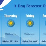
Enjoy one more warm day today with highs reaching into the 60s. Temperatures will turn much cooler Monday through Wednesday. #nywx
After an unseasonably warm day across the region, high clouds will increase overnight. Temperatures are expected to fall into the 40s.
Fair weather will continue across western and north central New York this weekend with above normal temperatures. #nywx
9
2,899
5:15 PM November 20th - Enjoy the warm weather this weekend while it lasts! Colder weather is expected headed into next week. #NYwx
2
16
2,690
The 3 day outlook for western and north central New York will continue to feature fair weather with above normal temperatures through the weekend. #nywx
Mostly clear conditions with a light southwest wind are expected across western and north-central New York tonight. Temperatures will fall into the 40s, with upper 30s expected across portions of the western Southern Tier and southern Tug Hill region.
19
2,583
The dry and warm weather will continue today and Friday. Today will be warmer, with highs in the upper 50s to low 60s. Friday will feature highs in the mid to upper 50s.
Dry weather, sunshine, and well above average temperatures will continue through the rest of the week. High temperatures will run 10 to 15 degrees above average each day through the weekend before colder air arrives next week. #nywx
Mainly dry weather and clear skies will prevail today! Highs will climb into the 50s with lows tumbling down into the upper 20s to low 30s across the higher terrain and the upper 30s to low 40s across the lower elevations.
High pressure over the region will provide dry weather. Lows will be found in the upper 20s to low 30s across the Southern Tier. A range of 30s to low 40s near the lakes.
14
2,914
Dry today with temperatures this afternoon rising back into the 50s. Clouds this morning will begin to thin, allowing for increasing amounts of sunshine this afternoon.
A large area of high pressure will remain anchored over the Great Lakes region, spelling dry weather through the week and above normal temperatures beginning tomorrow. A good week to finish autumn clean-up. Enjoy!
An increasing number of cities across the United States have reached the freezing mark this winter, including portions of the Southeast. However, Buffalo NY has yet to record a 32°F reading this winter which currently ties with 2005 for the latest first freeze on record.
A cool start, but a fine week is ahead for us as a large area of high pressure anchors over the Great Lakes region, spelling dry weather through the week and above normal temperatures by Tuesday. Enjoy!
The last SKYWARN Winter Class of 2026, hosted by NWS Buffalo will be held Monday, November 16. The class is virtual and there is still time to register. We hope to see you there!
1
12
2,963
Upslope light rain and a few snow showers will end through the morning and early afternoon hours. Temperatures return back above normal by Tuesday, with several days of partly to mostly sunny conditions expected. Several locations in WNY will reach 60°F by mid - to - late week.
17
3,169
Here is our forecast for the rest of the weekend. #NYwx
17
3,160
One of the downsides to the recent stretch of nice weather is that moderate drought conditions have expanded across WNY. The precipitation through the weekend will likely remain light with little influence on the developing moderate drought conditions.
2:57 AM EST 11/14/26: Here is our forecast for this weekend through Monday. #NYwx
Periods of light rain and/or snow continue through most of this weekend. Snow will be the predominant precipitation type in the higher terrain, while lower elevations will experience rain that will mix with or change to wet snow at times. #NYwx