
I make maps and wrangle data (professionally), take photos and ride my bike (that's all for fun)
The Netherlands
Joined January 2010
- Tweets11.6K
- Following560
- Followers1.9K
- Likes7.5K






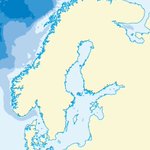


Minimal map for the #30daymapchallenge today, can't get much less than this I guess 😉 Of course inspired by the NASA Pale Blue Dot image.

Rather than using a map we've made before I decided to make a new one for today's #30daymapchallenge: Antarctica.
Marie Byrd Land is one of the very few places on Earth that are truly "Terra Nullius", as in owned or claimed by nobody.
Map made in @Avenza MAPublisher #lovemaps

3D for the #30DayMapChallenge today, here’s a little 3D model of Mount St Helens I had a friend print for me a while ago.

Voordeel van cartograaf zijn: die grote stembiljetten weer netjes opvouwen is een makkie. #verkiezingen2023
North isn't always up, at least in today's #30DayMapChallenge. We do a lot of maps of the Arctic and Antarctic so quite often we have maps where north isn't up. Well... it is actually up here, but also down and sideways. #map #cartography #lovemaps

Turns out making a map in 5 minutes is hard 😅 This took me 6: Natural Earth 10m bathymetry. I think I can shave off some seconds here and there though. #30DayMapChallenge #cartography

A long time ago I made maps of islands around the world, including Oceania, for an atlas. Here's my map of Samoa, American Samoa and Wallis & Futuna #30daymapchallenge #cartography

There's elegance in contour lines, even in a supposedly flat-as-a-pancake country. This map features one of the most iconic Dutch cycling climbs & the location where I saw my friend @GoFahr race in the cyclocross world championships a few years back #30DayMapChallenge #lovemaps


I’m at the Peak Of Data Integration in Bonn this week. Come talk FME with me 😄 #peakofdataintegration #peak23 #podi23 #fmepartners
