

The Washington Map Society supports and promotes map collecting, cartography, and the study of cartographic history.
Washington, D.C.
Joined September 2017
- Tweets2.5K
- Following200
- Followers1.1K
- Likes1.9K




Pinned Tweet
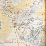
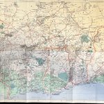
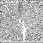
It's a great day in @washingtondc... Spring weather, the cherry blossoms are out and the new issue of The Portolan arrives in the mail. @NationalMallNPS @CherryBlossFest

Upcoming WMS meeting: Prof. Kory Olson from Stockton University will present on “Motoring Africa: Michelin’s Road Maps for an Exotic Continent.”
Register below and tune in on 12 November at 7:00 PM ET.
washmapsociety.org/event-674…
@Stockton_edu @ISHMAP1


Washington Map Society retweeted

i guess you can ask me things? i'll warn you though i'm not interesting. as anyone who knows me will attest
Washington Map Society retweeted

🌎 Looking for new ways to make learning meaningful and relevant for your students? Join "Inspiring Geographic Thinking: From Ideas to Classroom Practice," a workshop for educators, future teachers, and faculty to bring geographic thinking into classrooms. buff.ly/84n4yIu

Washington Map Society retweeted

This striking 1895 geologic map of the region around Great Smoky Mountains National Park includes six geologic cross-sections to provide rich details of the landscape.
Take a closer look here: loc.gov/item/99446177/?loclr…

ALT Geologic map with six cross-section diagrams of geologic layers and legend information on the left and right sides of the page.
Washington Map Society retweeted

#MapoftheWeek: On Sept. 15, 1835, HMS Beagle arrived in the Galápagos Islands, where Charles Darwin spent weeks observing the archipelago’s volcanic landscapes & wildlife. The observations gathered there became important evidence for his theory of evolution by natural selection.

Washington Map Society retweeted

At this week’s @OSCE event, Jack Dangermond joined policymakers and technology leaders to discuss how GIS brings clarity to complex information, enabling better decisions and stronger co-operative security.

“Here’s where we’re disagreeing. And here’s where we’re not.”
🗺️ @Esri Founder and President Jack Dangermond on why maps can be a common language, and what that could mean for cooperative security.
A timely reminder for the upcoming WMS meeting on "Mapping Philadelphia"
washmapsociety.org/event-674…

#OnThisDay in 1787, the Constitution was signed in Philadelphia.
HSP has a remarkable assemblage of Constitutions, including the first draft. The phrase "freedom of speech" appears in the margins, suggesting that the drafters were considering this right early in their process.


Washington Map Society retweeted

#OnThisDay in 1787, the Constitution was signed in Philadelphia.
HSP has a remarkable assemblage of Constitutions, including the first draft. The phrase "freedom of speech" appears in the margins, suggesting that the drafters were considering this right early in their process.
The next WMS meeting is October 8, where we will hear from Christopher W. Lane, from the Philadelphia Print Shop, on the topic of "Mapping Philadelphia." More information and registration link below. #philly
washmapsociety.org/event-674…

Check out the PLPS lecture next week at the LOC from Dr. Sen Roy: “Tracing the Transformation: Cartographic Evolution of the Sundarban Delta (1654–1945)”
washmapsociety.org/event-680…

Register now for the WMS meeting on 10 September featuring Andrew Kapochunas: "How to Find an Image of Ancestral Eastern- or Central-European Towns on Antique Topographic Maps”
washmapsociety.org/event-674…

Washington Map Society retweeted

"The land of Moses" This map (1938) of New York City and Long Island by the legendary cartographer Richard Ernest Harrison is beautiful, shows an interesting perspective, and is labelled with a tongue in cheek reference to the (in)famous Robert Moses.
Map source: buff.ly/3Zl9dWS
Must read biography of Moses: link.amazon/B0eW0tFZs

Washington Map Society retweeted
Explore the peculiar geopolitics of condominiums (territories of shared sovereignty) through history in our latest blog post.
The full post is available here: blogs.loc.gov/maps/2026/06/c…

ALT A map view of the Fellesdistriktet border area condominium between Norway and Russia, with forested areas pictorially shown.
Washington Map Society retweeted
A big round of applause for our @EsriUC Map Gallery winners! 🏆
Your creativity, storytelling, and cartographic skills continue to inspire us. Explore the winning maps and all the incredible entries for this year's Map Gallery. 🗺️ bit.ly/4wkUkUg
#EsriUC2026


WMS returns from summer vacation on 15 September with a presentation by Gareth Fuller: "Walking the Streets of Washington, DC to Create a Unique Map of Place." 3-6PM on the campus of @GWtweets. A display of maps from the Albert H. Small collection and happy hour will follow.


Washington Map Society retweeted

🌊 Europe’s heatwave also heated the seas.
🌡️ @CMEMS_EU data from 29 June show sea surface temp anomalies reaching up to 6°C above avg in parts of the W Mediterranean, with warming also visible in the North & Baltic Seas.
🔗 link.europa.eu/9TxXPq
#ImageOfTheDay #CopernicusEU
