

The Earth Observation component of the EU Space Programme
Brussels
Joined November 2012
- Tweets80.6K
- Following2.1K
- Followers139K
- Likes83K




Low water levels are affecting the River Rhine 🇩🇪 after a dry spring & hot summer.
🛰️ #CopernicusEU Sentinel-2 reveals exposed sandbanks near Kaub, where the gauge read just 0.55 m on 26 October, limiting shipping capacity.
🔗 eu-space.europa.eu/explore-e…
#ImageOfTheDay

❄️ Winter arrives in the Alps! 🏔️🇦🇹🇮🇹🇨🇭
🛰️ #CopernicusEU Sentinel-2 captures the season’s first snowfall across the central Alps, with bright white peaks contrasting against the valleys below.
🔗 link.europa.eu/krtWhj
#ImageOfTheDay

🏔️ 🇵🇪 Cordillera Blanca is home to the world’s largest concentration of tropical glaciers.
🛰️ #CopernicusEU Sentinel-2 captures its dazzling ice, rugged peaks & turquoise lakes - vital to monitoring water resources and glacial hazards.
🔗 eu-space.europa.eu/explore-e…
#ImageOfTheDay

☄️ A cosmic impact in the Namib Desert! 🇳🇦
🛰️ #CopernicusEU Sentinel-2 reveals the 2.5 km-wide Roter Kamm Crater, where a meteorite struck millions of years ago, leaving a striking circular mark in the desert.
🔗 eu-space.europa.eu/explore-e…
#ImageOfTheDay

🌧️ Storm Adam brought severe flooding to E Spain 🇪🇸, with 663.8 mm of rain recorded in Pego in just 37 hours.
🛰️ #CopernicusEU Sentinel-2 captures sediment plumes along the coast, while emergency mapping supports response efforts.
🔗 link.europa.eu/XvcYDk
#ImageOfTheDay

Copernicus EU retweeted

🛰️ More satellites mean greater collision risks in space.
For 10 years, @EU_SST has helped protect space operations, monitoring risks and warning of potential hazards.
🇪🇺 With 19 Member States, it helps safeguard space assets worldwide.
👉 link.europa.eu/PyNVrJ

🌀 Super Typhoon Champi (Rosal) reached Cat 5 strength east of the 🇵🇭 Philippines, with winds of 296 km/h - the strongest sustained winds recorded globally (2026).
🛰️ @CMEMS_EU data show waves reaching 10 m near the storm’s centre.
🔗 link.europa.eu/KKQhFc
#ImageOfTheDay

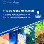
💧 What happens when #CopernicusEU services combine their insights?
🧩 Explore The Odyssey of Water, revealing how #EUSpace data help us understand the Mediterranean.
🔗 link.europa.eu/HHkGC8
With @CopernicusLand @CMEMS_EU @CopernicusECMWF @CopernicusEMS & @defis_eu.

❄️ Autumn across Scandinavia! 🇳🇴🇸🇪
🛰️ This #CopernicusEU Sentinel-3 image captures fog filling lowland valleys and early snow covering Norway’s higher elevations, as colder days arrive in northern Europe.
🔗 link.europa.eu/PPVQbm
#ImageOfTheDay

🛰️ Thank you, @EU_SST, for helping protect #CopernicusEU satellites! Happy anniversary! 🥳

1/4 🎉 Happy 10th anniversary, EU Space Surveillance and Tracking - @EU_SST !
More than 300 experts & network members from the civil & military #EUSpace sectors gathered to celebrate a decade of EU cooperation for safer, more sustainable space.
🔗 link.europa.eu/vrXWw8


🇪🇺 @EU_Commission has unveiled its new Strategy for the Arctic, focusing on security, resilience, climate and prosperity for Arctic communities.
🛰️ This #CopernicusEU Sentinel-2 image shows sea ice drifting off 🇬🇱 illustrate Arctic dynamics.
🔗 link.europa.eu/pNjvgr
#EUSpace

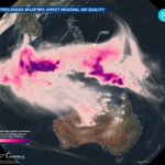
🔥 Wildfires in 🇮🇩 Indonesia are sending vast smoke plumes across Southeast Asia, affecting air quality in Malaysia & Singapore.
🛰️ #CopernicusEU CAMS data show 2026 fire emissions among the highest in 24 years.
🔗 link.europa.eu/FfyFxX
#ImageOfTheDay

🧊 Two giant icebergs drift north through the South Atlantic. 🇦🇶
🛰️ #CopernicusEU Sentinel-1, -2 & -3 track A81 (1,340 km²) & D32 (106 km²), from calving in Antarctica to their journey across the Southern Ocean.
🔗 link.europa.eu/HHtW6g
#ImageOfTheDay

🏙️ Delhi 🇮🇳 from space! 🛰️ This false-colour #CopernicusEU Sentinel-2 image reveals the city in purple & magenta, with vegetation in bright green and the Yamuna River winding through the urban landscape.
🔗 eu-space.europa.eu/explore-e…
#ImageOfTheDay

Copernicus EU retweeted

🌍 When every minute counts, concerted action can deliver effective Disaster Risk Management.
Great conversation w @hadjalahbib at the “From Space to Grassroots” event.
Working in a Compass of more space, better data&readiness help save lives. Tangible value of #EUSpace🇪🇺
1/4


Copernicus EU retweeted
Better preparedness saves lives.
🛰️ #EUSpace techs - from @CopernicusEU & Galileo to GOVSATCOM & future IRIS² - help monitor risks & coordinate responses.
At “From Space to Grassroots”, we discussed the Compass that draw a path for more space in support of disaster management.
🏞️ The Itaipu Reservoir 🇧🇷🇵🇾 is bordered by a green belt of protected forest, helping prevent soil erosion, conserve water & connect habitats.
🛰️ #CopernicusEU Sentinel-2 reveals this striking contrast with surrounding farmland.
🔗 eu-space.europa.eu/explore-e…
#ImageOfTheDay

🌾 Today is #WorldFoodDay by @FAO.
🛰️ #CopernicusEU maps crop types & growing durations across Flevoland 🇳🇱, helping monitor agriculture, manage land sustainably & support food security.
🔗 link.europa.eu/rp7ccd
#ImageOfTheDay

🌊Warming & extreme climate events are transforming our oceans, affecting all from marine ecosystems to coastal communities.
Discover the findings of the 10th #CopernicusEU Ocean State Report & how 🛰️ data can help us prepare for change: link.europa.eu/xwJXqq
#EUSpace

🚣 Lake Constance 🇩🇪🇨🇭🇦🇹 is running low!
🌊 Water levels in the Untersee were ~90 cm below avg in early Oct, suspending passenger boat services.
🛰️ #CopernicusEU Sentinel-2 reveals shallow waters & exposed lakebed.
🔗 link.europa.eu/CGNCVn
#ImageOfTheDay
