

The #1 Lowcountry weather team keeps you up-to-date with an accurate forecast with @BILLWALSHTV @JoeySovine @ChrisHoltzmanWx @stephaniesinewx and @MinorWX
Charleston, SC
Joined February 2009
- Tweets26.6K
- Following110
- Followers9.5K
- Likes404

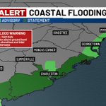


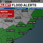
MARINE WARNING has been issued for parts of Waters from South Santee River SC to Savannah GA out 20 NM until 11/21 7:00PM.
1
232
Live 5 First Alert Weather retweeted

TROPICS: A low pressure center associated with the Southeast's rainfall risk is becoming less likely to become tropical or subtropical, per @NHC_Atlantic!
There's now a "low" chance of further development through Sunday as its eastern branch moves over the Gulf Stream. #Tropics

Live 5 First Alert Weather retweeted
FIRST ALERT WEATHER DAY: Periods of heavy rainfall and gusty winds are expected across the Lowcountry on Saturday! Rainfall rates (occasionally over 1"/hour) will be highest for areas east of I-95 starting around midday. @Live5Weather #SCWX #CHSWX
Live 5 First Alert Weather retweeted
⚠️ NEW: The @Live5Weather team has declared Saturday as a "First Alert Weather Day" as a strong coastal low begins to impact the Lowcountry, with heavy rainfall and localized flooding serving as the primary risk.
Here's what you can expect throughout the day: #SCWX #CHSWX

Live 5 First Alert Weather retweeted

Nearby coastal low will bring scattered, occasional showers on Saturday -- mainly light to moderate but some pockets of heavier rain are not out of the question. Expect gusty winds, marine impacts, and minor coastal flooding with morning high tide. #scwx

Live 5 First Alert Weather retweeted
FIRST ALERT: Dangerous beach and boating conditions will develop within the Lowcountry's nearshore waters as a coastal low draws closer! A "Small Craft Advisory" is in effect through Sunday, which takes into account strong winds, high surf and dangerous rip currents. #SCWX

Live 5 First Alert Weather retweeted
FIRST ALERT: Impacts from a developing coastal low remain likely this weekend, especially on Saturday! Periods of light/moderate rainfall could occur beginning Saturday morning, and should persist alongside gusty winds (30+ MPH) through early Sunday. #SCWX
Live 5 First Alert Weather retweeted
That coastal system we've been talking about? NHC is still watching it. They're giving it a medium chance of development within the next 7 days. Data indicates the bulk of the storm stays offshore. Still a risk for at least scattered showers this weekend, mainly east of I-95. #scwx

Live 5 First Alert Weather retweeted
FIRST ALERT: There remains some uncertainly on the track of our next coastal disturbance this weekend! In general, the greatest risk of showers and storms across the Lowcountry should be confined to areas east of I-95 on Saturday - a trend also agreed upon by the @NWSWPC. #SCWX

Live 5 First Alert Weather retweeted
TROPICS: As of Wednesday evening, forecast models are in better agreement on the formation of low pressure near the #Bahamas by late week! This future disturbance now carries a "medium" chance of tropical/subtropical development as it generally lifts northward. #Tropics #SCWX

Live 5 First Alert Weather retweeted
FIRST ALERT: The @Live5Weather team is continuing to monitor a developing coastal low, which could bring rain to the Lowcountry this weekend! Isolated showers cannot be ruled out ahead of this feature on Thursday and Friday, especially south of I-26. #SCWX
Live 5 First Alert Weather retweeted
Last-minute low in mid-November. NHC is highlighting the yellow area for a LOW chance of development this week. Could this system develop some sub-tropical characteristics? We will see. Local impacts, if any, will be dependent on the system's eventual track. #scwx

Live 5 First Alert Weather retweeted
Watching the weekend. 👀 Signs are pointing to a coastal storm, which could bring needed-rain to the Lowcountry. Questions remain regarding the track. Farther west = more rain, more impacts for us. Farther east and offshore = less rain. Stay tuned!
#scwx

Live 5 First Alert Weather retweeted
COASTAL HAZARDS: The @Live5Weather team is monitoring trends as low pressure develops offshore this weekend!
Regardless of rainfall totals, hazardous conditions remain likely for Lowcountry beaches in the form of gusty winds, high surf and dangerous rip currents. #SCWX #CHSWX

Live 5 First Alert Weather retweeted
FIRST ALERT: Ahead of our next coastal disturbance is a comfortable, milder stretch of weather! Although morning lows will remain chilly (30s and 40s inland), Wednesday features high temperatures close to 70°. @Live5News @Live5Weather #SCWX #CHSWX
Live 5 First Alert Weather retweeted
Now that's a pretty shot of our bridge and harbor with the Schooner Pride setting sail. Have a great evening!

Live 5 First Alert Weather retweeted
LOOKING AHEAD: #Thanksgiving Day is officially 10 days away!
Early forecast indications, however, are now favoring a higher coverage of rain in the days leading up to the holiday, especially on Saturday and Sunday (November 21 and 22) as a coastal low develops. #SCWX #CHSWX

Live 5 First Alert Weather retweeted
FIRST ALERT: There's only one more frosty night in the forecast ahead of a noticeable warmup! High pressure eventually moves offshore around midweek, which will help to usher in warmer temperatures and higher rain chances. @Live5Weather #SCWX #CHSWX
Live 5 First Alert Weather retweeted
Live 5 First Alert Weather retweeted
FIRST ALERT: The growing season has officially ended for the Lowcountry! A nearby area of high pressure will allow for warmer temperatures to develop later this week; no significant rain chances are expected through at least Friday. @Live5News #SCWX #CHSWX