Weather team providing live weather coverage with degreed meteorologists & storm chasers focused in Kentucky. Business inquiries:[email protected]
Joined April 2025
- Tweets7.7K
- Following235
- Followers1.3K
- Likes2.3K




Zero Meter Chasers retweeted

Widespread rain will return to Kentucky late on Tuesday night and last through Wednesday!
Latest model data has storms approaching western Kentucky late Tuesday night and advancing throughout the state on Wednesday!
Data has 1-3" of rainfall from this wave in general with localized higher amounts. Severe weather is NOT expected with this round!
Much needed rainfall for many! #KYwx
Zero Meter Chasers retweeted

For the older generation, do YOU remember this one? An early season snowstorm ❄️*thumped much of KY with over a Half-Foot for many. Even an Isolated one Foot portions measured around E’Town/Hardin Co area. Image via @spann

Widespread rain will return to Kentucky late on Tuesday night and last through Wednesday!
Latest model data has storms approaching western Kentucky late Tuesday night and advancing throughout the state on Wednesday!
Data has 1-3" of rainfall from this wave in general with localized higher amounts. Severe weather is NOT expected with this round!
Much needed rainfall for many! #KYwx
-Chris
A nice improvement for parts of South-Central and Lake Cumberland parts of KY as clouds have eroded for some late-day Sunshine. Temps have rebounded nicely in mid-70s

Zero Meter Chasers retweeted
The Storm Prediction Center has upgraded today's severe risk to an enhanced risk (level 3/5) in portions of Oklahoma and Kansas. This includes a 10% cig-1 tornado risk!
Latest model data is showing more discrete cells along the dry line! StormNet also has very high tornado probabilities from 6-9 PM.
Active day ahead! #OKwx #KSwx


Gusty Wind Potential
(Overnight Tues/Early Wed)
Earlier, we mentioned of a Gusty Wind potential a couple nights from now. A synoptic setup from low level wind energy about 5000' up could approach the region. If data continues the trend, winds at the surface could mix down with gusts up to 50mph during the overnight hours. Luckily, instability/ storm juice looks to be very low so the Severe Threat looks very low at the moment. We'll keep you posted next couple days if data changes.

A WET PATTERN ahead:
After two weeks of non-stop Sun and few clouds, an active flow slides in. Waves of energy rolls in with rounds of showers and storms. Severe storms looks low at the time, but main concern will be a little gusty winds come into late Tues/Early Wednesday. Some decent rainfall amounts are possible. Ensemble data shows ~ 1.5" and the NBM (NWS Blend of Models) show about 2" in some spots through Thursday Night. This will help Drought conditions. More scattered showers tonight through Monday morning. Lets see how we trend on the rainfall amounts.

The rain is here! Scattered showers have rolled in since pre-dawn hours allowing a good slow soaking rain. We’ll keep the showers off and on through the day.
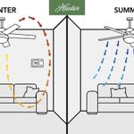
ANOTHER great tip to use during this time change is your switch on your ceiling fan. Flip the switch *up* so air can circulate up and clockwise allowing air to creep along walls so there won’t be a cooler draft.

In case if you didn’t know… we *fall back* one hour tonight.
It’s a good time to check your smoke / CO2 detectors batteries as well.

HAPPY HALLOWEEN!
A very balmy and Dry Afternoon is still the trend as we also roll into the Evening for all the Trick or Treaters. Mild conditions as we keep the blanket of clouds w/ us as they'll act as a thermal insulator. Rain chances likely for Western KY this Evening though as that moisture increases. North/South Central KY will see the rain chances increase as we roll into the late Evening hours toward Midnight.

Zero Meter Chasers retweeted
“Early Look” 👀 next Week:
It appears that our shot of some strong, (maybe Severe) ⛈️ chcs look to come on TUESDAY PM. A classic “High Shear/Low CAPE” event is poss. Mid-Low level winds will be cranking with little ⛈️ 🧃 to work with. Gusty 💨 look like Main Hazard ⚠️ for now.


We still look DRY for Trick or Treating tomorrow evening. Hires Future radar does show some green but that could be Virga since our airmass is quite dry. Best rain chances should come after 8/9PM.
Zero Meter Chasers retweeted
Data is starting to come in agreement with a strong storm early next week and severe weather is looking more likely in the central US on next Monday, November 2nd.
SPC issued a Day 4 15% risk for this threat targeting Oklahoma and Kansas. Latest from SPC:
"The main severe threat should develop during the afternoon along the cold front. Effective deep-layer shear will be near 50 kt, with sufficient low-level turning with height to support both supercells and linear structures late."
Watching this VERY closely next couple of days! #OKwx #KSwx


"EARLY LOOK" for Friday & HALLOWEEN
A very weak/dry front to our North passes to the East overnight, but that won't affect us at all into the morning and rest of the day. Once again, we stay DRY and Warm as some could flirt near 80 for parts of South Central and Western KY. This'll be the last *nice* day despite a few passing high clouds.
As for all the Trick or Treaters, we remain DRY. Latest data shows increasing clouds through the day, but dry and warm near 80 on Saturday. Kids will enjoy a balmy and festive evening going from house to house. Any rain chance will increase late into the Evening closer toward Midnight as moisture increases out of the south and west spreading into our Region, especially into the Overnight hours.
We'll keep ya posted on Friday if the forecast changes, but we are DRY for time being during Trick or Treating.


The *Updated* weekly US DROUGHT MONITOR was released earlier today. It has been a while since we’ve last seen rainfall; especially for Western 1/2 and Southern 1/3 of the state as parts along the State line are in a Severe Drought… GOOD NEWS… rain returns late Saturday Night!

Weekend forecast is looking much more promising compared to earlier this week!
Halloween now looks DRY and even Sunday will have dry time! We will introduce some rain showers on Sunday but some might remain dry all weekend!
Best rain chance will come middle of next week! More to come on that later today! #KYwx

Zero Meter Chasers retweeted
Good news:✅
The weekend is trending drier! Halloween now looks overcast and DRY for most in Kentucky.
Sunday does have a small rain chance but data has trended significantly less in the last 48 hours.
Our next rain chance will be middle of next week with the cutoff low moving across the US. I still think model data is struggling with this setup… It will be a pattern changer!
Forecast video on all of this tomorrow morning! 🫡#KYwx

1PM CDT-
Super-see-duper conditions out there early this Afternoon across the Commonwealth via @kymesonet
High Pressure is doing its job. Perfect fall day.