

Official channel of the Alberta Emergency Alert system. Download the AEA app now to receive alerts when there is a life-threating situation in your area.
Alberta
Joined May 2011
- Tweets4.4K
- Following14
- Followers154K
- Likes120





This is an Alberta Emergency Alert. Valleyview RCMP have canceled the Amber Alert.
This alert is no longer in effect.
Valleyview RCMP is updating the public that the Amber Alert issued for the 7 year old girl has been canceled. The child has been safely located by police. The suspect has been arrested and in police custody.
This is an Alberta Emergency Alert. Valleyview RCMP have issued an Amber Alert.
This alert is in effect for the entire province of Alberta.
An Amber Alert has been issued for 7-year-old female Aspen Wilson abducted from her residence in Valleyview. Aspen is 4 feet tall, slim, curly shoulder blond hair, blue eyes. Aspen was taken by her stepfather Alexander Stone, 28 years old, 6 foot 5 inches, 185 lbs, brown hair, hazel eyes. Alexander Stone is believed to be driving a grey 2004 Chevrolet Venture van, with Alberta license plate CWY 3459 possibly driving to Slave Lake or Red Deer.
If located, do not approach the vehicle or suspect. Call 9-1-1 immediately or contact RCMP at 310-RCMP. Visit alberta.ca/emergencyalert or stay tuned to local media for updates.


This is an Alberta Emergency Alert. Environment Canada has Tornado Advisory.
This alert is in effect for east-central Alberta, between approximately Cold Lake, Lloydminster, Vegreville and Smoky Lake/Whitefish Lake (see attached map).
Conditions are favourable for the development of severe thunderstorms which may produce a tornado.
Funnel clouds in this area have been reported to be very close to the ground. It is possible that funnel clouds may touch the ground and become a brief landspout tornado.
The risk of landspout tornadoes will last until early this evening.
In the event of a tornado, or if a tornado warning is issued for your area:
Go indoors to a room on the lowest floor, away from outside walls and windows, such as a basement, bathroom, stairwell or interior closet.
Leave mobile homes, vehicles, tents, trailers and other temporary or free-standing shelter, and move to a strong building if you can.
As a last resort, lie in a low spot and protect your head from flying debris.
#ABStorm alberta.ca/aea/cap/2026/08/1…

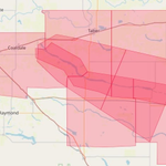
This is an Alberta Emergency Alert. Environment Canada has issued a red warning for a severe thunderstorm.
This alert is in effect for Lethbridge County near Coaldale (see map.)
At 7:26 p.m. MDT, an extremely dangerous thunderstorm is located near Barnwell. This extremely dangerous thunderstorm is moving east at 45 km/h. Damaging wind gusts, baseball size or greater hail and heavy rain are possible. Locations and nearby areas that could be impacted include: Barnwell, Wrentham, Skiff.
Driving conditions will be difficult. Buildings and/or many trees will be destroyed. Large hail will cause significant damage and injury. Severe thunderstorm warnings are issued when imminent or occurring thunderstorms are expected to produce damaging hail, wind or rain. Severe thunderstorms can produce tornadoes.
Take cover immediately if threatening weather approaches.
Red warning - severe thunderstorm - in effect | Alberta.ca

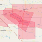
This is an Alberta Emergency Alert. Environment Canada has issued a red warning for a severe thunderstorm.
This alert is in effect for Lethbridge County near Coaldale (see map).
At 7:08 p.m. MDT, an extremely dangerous thunderstorm is located over Coaldale. This extremely dangerous thunderstorm is moving southeast at 40 km/h. Damaging wind gusts, baseball size or greater hail and heavy rain are possible. Locations and nearby areas that could be impacted include: Chin, Barnwell, Wrentham
Driving conditions will be difficult. Buildings and/or many trees will be destroyed. Large hail will cause significant damage and injury. Severe thunderstorm warnings are issued when imminent or occurring thunderstorms are expected to produce damaging hail, wind or rain. Severe thunderstorms can produce tornadoes.
Take cover immediately if threatening weather approaches.
alberta.ca/aea/cap/2026/08/1…

This is an Alberta Emergency Alert. Environment Canada has issued a thunderstorm alert.
This alert is in effect for the municipal district of Willow Creek near Claresholm and Stavely (see map).
At 5:02 p.m. MDT, an extremely dangerous thunderstorm is located over Claresholm. This extremely dangerous thunderstorm is moving southeast at 50 km/h. Damaging wind gusts, baseball size or greater hail and heavy rain are possible. Locations and nearby areas that could be impacted include: Claresholm, Nobleford, Monarch.
Driving conditions will be difficult. Buildings and/or many trees will be destroyed. Large hail will cause significant damage and injury. Severe thunderstorm warnings are issued when imminent or occurring thunderstorms are expected to produce damaging hail, wind or rain.
Take cover immediately if threatening weather approaches.
Red warning - severe thunderstorm - in effect | Alberta.ca

This is an Alberta Emergency Alert. Environment Canada has issued a thunderstorm alert.
This alert is in effect for the municipal district of Willow Creek near Claresholm and Stavely (see map).
At 4:56 p.m. MDT, an extremely dangerous thunderstorm is located over Willow Creek Provincial Park. This extremely dangerous thunderstorm is moving east at 30 km/h. Damaging wind gusts, baseball size or greater hail and heavy rain are possible. Locations and nearby areas that could be impacted include: Willow Creek Provincial Park, Stavely, Claresholm, Granum
Driving conditions will be difficult. Buildings and/or many trees will be destroyed. Large hail will cause significant damage and injury. Severe thunderstorm warnings are issued when imminent or occurring thunderstorms are expected to produce damaging hail, wind or rain.
Take cover immediately if threatening weather approaches.
Red warning - severe thunderstorm - in effect | Alberta.ca

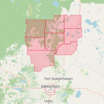
This is an Alberta Emergency Alert. Environment Canada has updated a Tornado Watch.
This alert is in effect for a large part of central Alberta, in the Municipal District of Lesser Slave River near Chisholm and Cross Lake (see attached map).
Severe thunderstorms capable of producing tornadoes may develop today. The greatest risk for tornadoes will be between 4 and 8 PM local time.
Any thunderstorm capable of producing tornadoes will be accompanied by hail up to the size of baseballs and torrential rain.
To report severe weather, send an email to [email protected], call 1-800-239-0484 or post reports on social media using #ABStorm.
alberta.ca/aea/cap/2026/07/2… #ABemerg #ABtornado

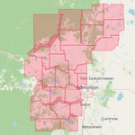
This is an Alberta Emergency Alert. Environment Canada has updated a Tornado Watch.
This alert is in effect for a very large part of central Alberta, in between Edson and Edmonton and a few hundred kms to the north and south of these places. The map has been updated to exclude some counties that are no longer affected by this alert (see attached map).
Severe thunderstorms capable of producing tornadoes may develop today. The greatest risk for tornadoes will be between 4 and 8 PM local time.
Any thunderstorm capable of producing tornadoes will be accompanied by hail up to the size of baseballs and torrential rain.
To report severe weather, send an email to [email protected], call 1-800-239-0484 or post reports on social media using #ABStorm.
alberta.ca/.../2026-07-28T18…...
#ABemerg #ABtornado

This is an Alberta Emergency Alert. Environment Canada has issued a Tornado Watch.
This alert is in effect for a very large part of central Alberta, in between Edson and Edmonton and a few hundred kms to the north and south of these places (see attached map).
Severe thunderstorms capable of producing tornadoes may develop today. The greatest risk for tornadoes will be between 4 and 8 PM local time.
Any thunderstorm capable of producing tornadoes will be accompanied by hail up to the size of baseballs and torrential rain.
To report severe weather, send an email to [email protected], call 1-800-239-0484 or post reports on social media using #ABStorm.
alberta.ca/aea/cap/2026/07/2… #ABemerg #ABtornado

This is an Alberta Emergency Alert. Environment Canada has issued a Tornado Watch.
This alert is in effect for Brazeau County near Cynthia and Lodgepole.
Severe thunderstorms capable of producing tornadoes may develop today. The greatest risk for tornadoes will be between 4 and 8 PM local time. Any thunderstorm capable of producing tornadoes will be accompanied by hail up to the size of baseballs and torrential rain.
Significant damage or destruction to infrastructure, homes and the natural environment is possible. Tornado watches are issued when conditions are favourable for the development of severe thunderstorms capable of producing tornadoes. Please continue to monitor alerts and forecasts issued by Environment Canada. To report severe weather, send an email to [email protected], call 1-800-239-0484 or post reports on social media using #ABStorm.
In the event of a tornado, or if a tornado warning is issued for your area: go indoors to a room on the lowest floor, away from outside walls and windows, such as a basement, bathroom, stairwell or interior closet. Leave mobile homes, vehicles, tents, trailers and other temporary or free-standing shelter, and move to a strong building if you can. As a last resort, lie in a low spot and protect your head from flying debris. Be prepared for severe weather. If you hear a roaring sound or see a funnel cloud, swirling debris near the ground, flying debris, or any threatening weather approaching, take cover immediately. When out on the water, be prepared for severe weather. If threatening weather approaches make for shore and take shelter immediately.
It is particularly dangerous to be on a small craft on the open water when lightning is occurring
alberta.ca/aea/cap/2026/07/2… #ABemerg #ABtornado
