

Where Al turns climate data into evidence, and we turn evidence into decisions.
Islamabad, Pakistan
Joined July 2025
- Tweets972
- Following83
- Followers215
- Likes203



As part of GIS Week 2026 celebrations, AI Geo Navigators, in collaboration with the Department of Agricultural Engineering at Khwaja Fareed University of Engineering and Information Technology (KFUEIT), Rahim Yar Khan, organized a seminar titled “Beyond Mapping: Statistical Rigor, Machine Learning, and the Dawn of the GeoAI Era” on 19 November 2026.
The seminar brought together students, faculty members, and professionals to explore how GIS, statistical analysis, machine learning, and Artificial Intelligence (AI) are shaping the future of geospatial technology and supporting data-driven decision-making.
Through practical demonstrations, the AI Geo Navigators team introduced participants to the applications of GeoAI, including a demonstration of SAIR, featuring weather stations, interactive GIS mapping, and localized forecasting.
At AI Geo Navigators, we believe in connecting academic knowledge with industry experience to encourage innovation and develop the next generation of geospatial professionals.
We extend our appreciation to Engr. Prof. Dr. Adnan Aslam Noon, Dean, Faculty of Mechanical and Agricultural Engineering, KFUEIT, the Green Youth Movement Club, and the Department of Agricultural Engineering for their support and collaboration in making this event possible.
@kfueit_official @Esri @EsriTraining
#GISWeek2026 #GISDay2026 #AIGeoNavigators #GeoAI #GeospatialIntelligence #GIS #ArtificialIntelligence #MachineLearning #KFUEIT #RahimYarKhan #AcademiaIndustryCollaboration #ClimateTech


On the third day of GIS Week 2026, AI Geo Navigators, in collaboration with the Department of Statistics at Bahauddin Zakariya University (BZU), Multan, organized a seminar titled “Beyond Mapping: Statistical Rigor, Machine Learning, and the Dawn of the GeoAI Era.”
Aligned with this year's GIS Day theme, “GIS: Powering Purpose and Innovation,” the seminar explored how GIS, statistical analysis, machine learning, and artificial intelligence are coming together to address real-world challenges, strengthen climate resilience, and drive geospatial innovation.
The event also reinforced the value of academia-industry collaboration, bringing research and practical applications closer together through knowledge exchange, innovative thinking, and opportunities for the next generation of geospatial professionals.
At AI Geo Navigators, we believe in the power of location intelligence to transform data into insights and insights into meaningful action.
We extend our sincere appreciation to Prof. Dr. Javed Ahmed, Dean of Sciences; Prof. Dr. Muhammad Amanullah, Chair/Head of the Department of Statistics; and Dr. Saima Afzal for their support and contributions. Special thanks to Dr. Atif and the entire organizing team at BZU for their collaboration, coordination, and efforts in making this seminar possible.
@BZUniversity @Esri @EsriTraining
#GISDay2026 #GISWeek2026 #PoweringPurposeAndInnovation #AIGeoNavigators #GeoAI #GeospatialIntelligence #AcademiaIndustryCollaboration #GIS #BZU #Multan #ClimateTech #Innovation


Pakistan gets heavy rain in one season and faces water shortages in the next. So why are we still struggling for water, when the rain is falling right on our rooftops?
This week on the AI Geo Navigators Podcast, we’re joined by Mr. Zaheer Gardezi, a civil and environmental engineer with 30+ years of experience in water, sanitation, and climate resilience. He led Pakistan’s first large-scale public rainwater harvesting program, with over 40,000 rooftop systems installed.
Here’s a quick rapid fire round with him. Short answers, straight from the field!
Stay tuned for the full episode, dropping this Saturday, on our YouTube channel.
#AIGeoNavigators #Podcast #RainwaterHarvesting #WaterSecurity #ClimateResilience #Pakistan #Sustainability #ClimateAction #WaterConservation #RapidFire
Explore NIGRAAN, Pakistan’s GeoAI-powered climate intelligence platform developed by AI Geo Navigators. From live hyperlocal weather intelligence and climate change modelling to hazard modelling, simulation and scenario-based hazard impact assessments, NIGRAAN brings advanced capabilities together to help understand climate risks and support informed decision-making.
Want to learn more about what NIGRAAN can do?
Scan the QR code to explore the platform and discover its capabilities.
Play Store: play.google.com/store/apps/d…
App Store: apps.apple.com/sa/app/nigraa…
#AIGeoNavigators #NIGRAAN #ClimateIntelligence #GeoAI #ClimateResilience #GeospatialTechnology

31
What would our world look like without GIS?
From finding our way around to planning cities, monitoring environmental changes, and preparing for natural disasters, GIS plays a role in more aspects of our lives than we often realize.
At AI Geo Navigators, we believe in the power of GIS and Artificial Intelligence to make geographical data more meaningful and support better decisions.
This World GIS Day, let's recognize the technology, ideas, and people helping us understand our world a little better.
How do you see GIS making a difference in your everyday life? Share your thoughts in the comments!
#WorldGISDay2026 #GISDay2026 #AIGeoNavigators #GIS #GeoAI #GeospatialTechnology #ArtificialIntelligence
41
Every place has a story, and GIS helps us understand it better.
From mapping our surroundings and monitoring environmental changes to identifying risks and supporting informed decisions, Geographic Information Systems (GIS) are changing how we understand and respond to the world around us.
This World GIS Day, we recognise how the integration of Artificial Intelligence (AI), GIS, and Remote Sensing is opening new possibilities in geospatial technology. Together, these technologies help turn complex data into meaningful insights, improve climate risk assessment, strengthen early warning systems, and support better decision-making.
At AI Geo Navigators, we use AI-driven geospatial intelligence to transform data into actionable insights, helping communities and organisations better understand risks, prepare for challenges, and build a more climate-resilient future.
Happy World GIS Day!
@gisday @Esri @EsriTraining
#WorldGISDay #AIGeoNavigators #GIS #ArtificialIntelligence #RemoteSensing #GeospatialIntelligence #ClimateResilience

36
During COP31, our CEO, Mr. Asim Javid, met with @HamzaFarrukh, Chairperson of the Pakistan Climate Change Authority (PCCA).
The meeting provided an opportunity for a fruitful discussion on climate change, the role of technology and innovation, and the importance of strengthening climate resilience through informed decision-making.
Such engagements at global platforms like COP31 help foster meaningful conversations, strengthen connections, and encourage collaboration towards a more climate-resilient future.
#AIGeoNavigators #COP31 #ClimateChange #ClimateResilience #PakistanClimateChangeAuthority

27
AI Geo Navigators, in collaboration with Bahria University’s Department of Earth Sciences, successfully hosted Geospatial Innovation for Flood Resilience, Early Warning and Sustainable Tourism on 16 November 2026 at Bahria University, Islamabad.
The event marked three important milestones for AI Geo Navigators, featuring two product launches and the announcement of a strategic partnership.
1. SAILAB Product Launch: SAILAB introduces a flood simulation and analytics solution designed to support flood risk assessment, impact analysis and informed decision-making.
2. SAIR Product Launch: SAIR introduces a sustainable tourism solution that supports safer travel planning through route intelligence, accessibility and hazard information.
3. Strategic Partnership Announcement: AI Geo Navigators announced its strategic collaboration with Beijing Foresea Technology, opening new opportunities for cooperation in monitoring, early warning and geospatial intelligence.
The event also marked the beginning of AI Geo Navigators' World GIS Day event series. Through this series, we aim to bring together academia, industry professionals, researchers and students to explore how geospatial technology can help address real-world challenges.
The programme opened with remarks by Dr. Ansa Ruqiy, Head of the Centre of Research Excellence: Earth, Climate and Environment (CORE ECE).
One of the key sessions was a panel discussion on Integration of GeoAI in Earth, Climate and Environment, moderated by Mr. Owais Ali, COO, AI Geo Navigators. The discussion brought together experts from academia and industry:
•Mr. Asim Javid, CEO, AI Geo Navigators
•Dr. Hammad Gilani, Associate Professor, SINES, NUST
•Dr. M. Fahad Mahmood, Senior Assistant Professor, Bahria University
•Dr. Akif Rahim, Hydro-Climatologist and Climate Change Expert
•Dr. Tehmina Bibi, Assistant Professor, University of Azad Jammu and Kashmir
The event was graced by H.E. Dr. Oumer Hussein Oba, Ambassador of the Federal Democratic Republic of Ethiopia to Pakistan, as Chief Guest. Other distinguished guests included Commodore (Retd) Noman Usmani, SI(M), Director Campus, Bahria University, and Saira Faisal Syed, Head, GSMA Pakistan.
The programme also featured a 3MT E-Poster Student Competition, giving students an opportunity to present their ideas and geospatial research. Participants included Emaan Saeed, Usman Talpur, Abdullah Kamran and Tyyaba Khattak from Bahria University, and Eman Abid, Laiba Rafi and Rameen Naeem from PMAS-Arid Agriculture University.
The event brought together students, academics, researchers and industry professionals for meaningful discussions and knowledge exchange on the role of GeoAI in climate resilience, environmental management, flood risk assessment and sustainable development.
We extend our appreciation to Bahria University, Beijing Foresea Technology, our distinguished guests, panellists, faculty members and participating students for being part of this event.
This is just the beginning of our World GIS Day series. More conversations, collaborations and innovations are ahead!
@BahriaOfficial
#AIGeoNavigators #BahriaUniversity #WorldGISDay #GeoAI #GeospatialTechnology #ClimateResilience #SAILAB #SAIR #SustainableTourism #EarlyWarningSystems #ClimateIntelligence


104
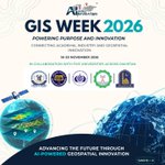
AI GEO NAVIGATORS PRESENTS: GIS WEEK 2026
A Week of Geospatial Innovation, Learning & Collaboration!
What happens when academic knowledge meets real-world geospatial innovation?
This November, AI Geo Navigators is celebrating GIS Week 2026 through a series of collaborative seminars across five universities in Pakistan, bringing academia and industry together to explore the power of GIS, geospatial data and Artificial Intelligence.
Celebrating GIS Day 2026 throughout the week, our events are aligned with this year's theme:
“GIS: Powering Purpose and Innovation.”
📍 GIS WEEK 2026: EVENT SCHEDULE
1. Bahria University, Islamabad
* Department/Unit: Earth & Environmental Sciences / CORE ECE
* Theme: Bahria Geospatial Connect 2026, in Collaboration with AI Geo Navigators
* 📅 16 November 2026
* ⏰ 10:30 AM - 01:45 PM
* 📍 Auditorium, H-11 Campus, Islamabad
2. University of Sargodha
* Department: Earth Sciences
* Theme: From Maps to Meaningful Action: GIS-Powered Weather Intelligence for Resilient Communities
* 📅 17 November 2026
* ⏰ 10:00 AM
* 📍 Auditorium, University of Sargodha
3. Bahauddin Zakariya University, Multan
* Department: Statistics
* Theme: Beyond Mapping: Statistical Rigor, Machine Learning, and the Dawn of the GeoAI Era
* ⏰ 10:00 AM
* 📍 Auditorium, BZU, Multan
4. Khwaja Fareed University, Rahim Yar Khan
* Department: Agricultural Engineering
* Theme: Beyond Mapping: Statistical Rigor, Machine Learning, and the Dawn of the GeoAI Era
* 📅 19 November 2026
* ⏰ 10:00 AM
* 📍 Auditorium, KFUEIT, Rahim Yar Khan
5. Islamia University of Bahawalpur
* Department: Statistics
* Theme: Beyond Mapping: Statistical Rigor, Machine Learning, and the Dawn of the GeoAI Era
* 📅 20 November 2026
* ⏰ 10:00 AM
* 📍 Auditorium, Islamia University of Bahawalpur
At AI Geo Navigators, we believe in turning geospatial knowledge into meaningful action through collaboration, innovation and practical learning.
Let's connect, explore and empower the next generation of geospatial professionals!
Celebrating GIS Week 2026, Powering Purpose and Innovation!
@BahriaOfficial @Official_UOS @BZUniversity @kfueit_official @IUB_BWP @Esri @EsriTraining
#GISWeek2026 #GISDay2026 #PoweringPurposeAndInnovation #AIGeoNavigators #GIS #GeoAI


We often hear about the ozone layer protecting us from the Sun’s harmful UV rays, but ground-level ozone is a different story.
Formed through chemical reactions involving sunlight, heat and air pollutants, ground-level ozone can affect the air we breathe and our health.
But what makes it harmful, and why is it important to understand?
Watch the video to learn more about ozone and its impact on air quality, our health and the environment.
#AIGeoNavigators #Ozone #AirQuality #AirPollution #AQI #ClimateAwareness
Three milestones, one mission!
AI Geo Navigators is marking an important step forward with two product launches and a new industry collaboration.
We are introducing SAILAB (Simulation & Analytics for Inundation, Loss, Assets & Built Environment) and SAIR (Sustainable Access, Itineraries and Routes), alongside a collaboration with Beijing Foresea Technology to further explore opportunities in geospatial innovation.
Join us at Bahria University as we bring these three milestones together and take another step towards advancing geospatial technology and practical solutions.
📅 16 November 2026 (Monday)
⏰ 10:30 AM - 01:45 PM
📍 Bahria University, H-11 Campus, Islamabad
#AIGeoNavigators #SAILAB #SAIR #GeospatialTechnology #GeoAI #Innovation #StrategicCollaboration #BahriaUniversity
@BahriaOfficial

AI Geo Navigators Officially Launches NIGRAAN at COP31, Türkiye!
At the Pakistan Pavilion during COP31 in Antalya, Türkiye, AI Geo Navigators officially launched NIGRAAN (National Integrated Geo Risk Alert and Atmospheric Network) under the title “From Climate Data to Early Action: Launching NIGRAAN - Pakistan’s GeoAI Platform for Climate Risk and Early Warning.”
NIGRAAN is Pakistan’s operational GeoAI-powered climate intelligence platform, combining real-time weather observations, geospatial data, satellite information, and AI-based hazard assessments to support climate risk monitoring, early warning, and informed decision-making.
The panel discussion was moderated by Laiba Tanvir, GIS Analyst at AI Geo Navigators, and featured:
•Magdalena Mirwald; Germanwatch
•Lincoln TeO ; Managing Director, ZERO13
•Dr. Shakeel Hayat; Regional Climate Change and WASH Advisor, WaterAid
•Zainab Naeem; Associate Research Fellow, SDPI Pakistan
•Asim Javid; CEO, AI Geo Navigators
The event also featured an address by Shezra Mansab Ali Khan Kharal, Member of the National Assembly of Pakistan, who highlighted the role of geospatial data, AI, and local knowledge in strengthening climate resilience and early warning.
Representatives from international organisations, research institutions, and climate networks also joined the event, contributing diverse perspectives on climate action, technology, and collaboration.
Through NIGRAAN, AI Geo Navigators aims to connect climate intelligence with practical action and support a safer, more climate-resilient future.
@ZainabNaeem7 @SDPIPakistan @wateraid @ClimateChangePK @turkiyecop31 @DrShezraKharral
#AIGeoNavigators #COP31 #NIGRAAN #GeoAI #ClimateAction #ClimateResilience


We launched Nigran at the COP31 Pakistan Pavilion, with Minister of State for Climate Change Dr. Mansab Khan Kharal ( @DrShezraKharral ) addressing the ceremony. Nigran turns hyperlocal weather data into location-specific climate risk forecasts and early warnings for Pakistan.
Sabah News covered the launch. Read more: sabahnews.net/archives/38645…
@ClimateChangePK @SDPIPakistan @turkiyecop31
#COP31 #Nigran #GeoAI #ClimateRisk #Pakistan

We’re on the ground at COP31 Türkiye!
Our team is here in Antalya, getting ready for an important session at the Pakistan Pavilion as part of the COP31 Side Events.
Today, AI Geo Navigators will introduce NIGRAAN, Pakistan’s operational climate intelligence platform, bringing together real-time weather observations, AI-based hazard assessments, and geospatial intelligence to support better climate preparedness and early action.
Join us for the session:
From Climate Data to Early Action: Launching NIGRAAN - Pakistan’s GeoAI Platform for Climate Risk and Early Warning
📅 12 November 2026
🕞 3:30 PM – 4:30 PM (Türkiye time)
📍 Pakistan Pavilion, COP31, Antalya, Türkiye
Our team looks forward to sharing this work, exchanging ideas, and connecting with people working towards a more climate-resilient future.
See you at the Pakistan Pavilion!
@turkiyecop31
#AIGeoNavigators #COP31 #NIGRAAN #ClimateIntelligence #GeoAI #ClimateResilience #PakistanPavilion #ClimateAction


From local climate action to global collaboration, meaningful conversations are an important part of building climate resilience.
At COP31 in Antalya, Türkiye, Asim Javid, CEO of AI Geo Navigators, participated as a Key Presenter at a side event titled “Fostering Local Climate Actions and Solutions Through Innovative and Inclusive Traditional Knowledge.”
During his presentation, “Adapting Affordable Technologies and AI in Accelerating Local Climate Actions,” he shared perspectives on how accessible technologies and Artificial Intelligence can support locally driven climate action, strengthen community resilience, and improve disaster risk management.
Alongside the session, Asim Javid also had the opportunity to meet and interact with Mohsin Ranjha, Shezra Mansab Ali Khan Kharal, and Syed Naveed Qamar, Members of the National Assembly of Pakistan, and Dr. Abid Qaiyum Suleri, Executive Director of the Sustainable Development Policy Institute (SDPI) and M. Naeem Qureshi, President of the National Forum for Environment and Health (NFEH) and Managing Editor of Energy Update.
These interactions provided an opportunity to exchange perspectives on climate challenges, sustainable development, and the importance of bringing technology, policy, and local knowledge together.
At AI Geo Navigators, we believe that effective climate action starts with understanding local challenges and connecting the right knowledge, technology, and people to address them.
@turkiyecop31 @SDPIPakistan @ClimateChangePK @Abidsuleri
#AIGeoNavigators #COP31 #ClimateAction #ClimateResilience #ArtificialIntelligence #GeoAI #DisasterRiskReduction #SustainableDevelopment #Pakistan


Meet AI Geo Navigators at COP31!
How can climate data help communities prepare for climate risks and make better decisions?
At COP31 in Antalya, Türkiye, AI Geo Navigators will introduce NIGRAAN, Pakistan’s GeoAI-powered climate intelligence platform, at the Pakistan Pavilion on 12 November.
Designed to support climate risk assessment, localized weather forecasting and early warning, NIGRAAN brings together geospatial intelligence and AI to turn climate information into actionable insights.
As part of the session, Laiba Tanvir will moderate an engaging discussion on how GeoAI can strengthen climate resilience and connect climate information with practical decision-making.
Joining the discussion will be:
- Magdalena Mirwald: Policy Advisor for Adaptation and Loss and Damage, Germanwatch
- Lincoln TeO: CEO, iWise Group; Managing Director, ZERO13; UN ESCAP partner and developer of frontier technologies; COP28 Tech Sprint Award winner
- Dr. Shakeel Hayat: Regional Climate Change and WASH Advisor, South Asia, WaterAid
- Zainab Naeem: Associate Research Fellow, SDPI Pakistan
- Asim Javid: CEO and Founder, AI Geo Navigators
📅 Date: Thursday, 12 November 2026
🕒 Time: 3:30 - 4:30 p.m. (Türkiye time, UTC+3)
📍 Venue: Pakistan Pavilion, Blue Zone, COP31, Antalya, Türkiye
Join us for a conversation on the role of GeoAI, climate intelligence and early warning systems in building a more climate-resilient future.
We look forward to connecting with you at COP31!
@turkiyecop31 @COP31Agenda @ClimateChangePK @SDPIPakistan
#COP31 #AIGeoNavigators #NIGRAAN #GeoAI #ClimateIntelligence #ClimateResilience #EarlyWarningSystems #ClimateAction #PakistanPavilion

Lahore is once again facing a serious smog crisis.
On 9 November 2026, Lahore ranked as the world's most polluted major city, with its Air Quality Index (AQI) reaching 590. An hourly reading also recorded a peak of 647, placing the city's air quality in the hazardous category.
Poor air quality is more than an environmental concern. It directly affects public health, daily life and the well-being of millions of people.
Addressing this challenge requires consistent air quality monitoring, stronger enforcement, reliable environmental data and long-term solutions.
At AI Geo Navigators, we believe that climate intelligence and geospatial technology can help us better understand environmental challenges and support informed action.
Because cleaner air begins with understanding the problem.
@ClimateActionPk @ClimateChangePK @UNFCCC
#LahoreSmog #AirPollution #AirQuality #AQI #ClimateIntelligence #GeospatialTechnology #EnvironmentalMonitoring #ClimateAction #AIGeoNavigators

63
Pakistan’s May 2026 Heatwave | Geospatial Visualization
At AI Geo Navigators, we created a geospatial visualization of Pakistan’s May 2026 heatwave.
This animation illustrates how extreme temperatures evolved across Pakistan, highlighting regional temperature variations and the value of geospatial data in understanding climate extremes.
Credits: Milos Popovic, PhD
#AIGeoNavigators #MilosPopovic #Heatwave #Pakistan #GeospatialVisualization #ClimateIntelligence
1
58