

Remote Sensing Computer Vision scientist @une_aarsc. PhD candidate @RSRC_UQ. Destresses through climbing rocks. Views expressed here are are my own opinions.
Brisbane, Queensland
Joined June 2019
- Tweets26
- Following155
- Followers46
- Likes213


Andy Clark retweeted

New year, new job?!
We're hiring a Spatial Analyst based in Brisbane!
For all the details and how to apply see here: lnkd.in/giPuM_Bz (Reference Number 222005)

Andy Clark retweeted

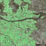
Detecting Banana Plantations in the Wet Tropics, Australia, Using Aerial Photography and U-Net
Full-text is available at:
mdpi.com/2076-3417/10/6/2017
#convolutionalneuralnetwork #segmentation #deeplearning #aerialphotography
#openaccess #mdpiapplsci

This quoted post is unavailable.
Andy Clark retweeted

How extreme conditions drove Australia’s record bushfire disaster abc.net.au/news/2020-02-19/a…

Andy Clark retweeted

To help manage the sunny state's diverse geography, @QldEnvironment introduced the Queensland Land Use Mapping Program #QLUMP to map, assess & preserve this complex landscape.
Read the blog to learn more about this winning formula: bit.ly/372I2TV
#GIS #ComputerVision

Andy Clark retweeted
. @qldscience @QldEnvironment leverage machine learning to update Queensland Land Use Mapping Program (QLUMP). Here's how:
bit.ly/30zaOds

Andy Clark retweeted

New map shows fire impacts on Aussie banana, avo, maca, citrus, olive and mango orchards @WeeklyTimesNews @CitrusAustralia @OliveNetwork @DeptAgNews @UniNewEngland @une_aarsc #RRD4P @hortidaily is.gd/B1Mx8t

Andy Clark retweeted

Want to know how land is used in #Australia? The Queensland Land Use Mapping Program used emojis to create a thematic map of how land is used in the Brisbane region. 🌳😃 See this wonderful map here: p.ctx.ly/r/9ixl #PoweredByEsri @QldGov

Andy Clark retweeted

From the Plenary to the Map Gallery to the Thursday Night Party to the Closing Session– #EsriUC 2019 was absolutely unforgettable. Thanks to all who joined us in San Diego. Those who didn't: see you next year?

The Queensland Land Use and Mapping program has taken our first place in the thematic map category @EsriUC. @esriaustralia @qldscience.


Legends in map making and beer drinking!
This Post is from an account that no longer exists. Learn more
Andy Clark retweeted
Jack Dangermond discusses how GIS and geospatial infrastructure are powering smarter organisations, so everyone can effect positive change in our world #EsriUC #SeeWhatOthersCant bit.ly/2xFpf1N
Queensland land use on display @EsriUC map gallery! You can vote for the maps here:
bit.ly/2XXqb08
bit.ly/2zmU13b
bit.ly/2XVC32S
#qlump @esriaustralia

Andy Clark retweeted
A once in a lifetime moment! Jack Dangermond welcomes 2 of the greatest minds in conservation & biodiversity – #JaneGoodall & #EOWilson to share what they’ve learned over their legendary careers to help future generations protect our Earth. @JaneGoodallInst @EOWilsonFndtn #EsriUC

How do you capture 18,000+ people in the same room? Some awesome geo-intelligent projects being demonstrated @EsriUC plenary. @Esri @esriaustralia

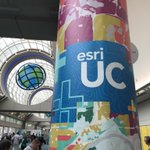
Day 1. The @EsriUC has started. The scale of this conference is unbelievable! @esriaustralia #EsriUC

Andy Clark retweeted

To attain a better understanding of the cosmos, researchers successfully developed the first deep learning-based 3D simulation of the universe.
Andy Clark retweeted
#AI and #GIS are intersecting, opening up massive opportunities that were never possible in the past. Here's how: p.ctx.ly/r/9h7x #DeepLearning
