

Arch Aerial LLC is a commercial UAS operator providing enterprise drone services to oil and gas and construction companies in the United States.
Houston, Texas
Joined July 2013
- Tweets2.4K
- Following1.2K
- Followers1K
- Likes379





Wrapping the week with some of the most satisfying work we do.
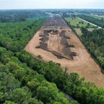
Full 3D facility documentation on a Texas oil and gas site. One flight, complete capture, delivered before end of week.
Foundation to facade.
Different phases of the same build, captured from the same angle.
This is what a project record looks like when you start documenting on day one and don't stop.
Proud of the crew that built this and the GC that let us document every step.


Every active site tells a different story from above.
Crews, equipment, structure going up in real time. A single pass gives the GC, the owner, and the project team a current picture nobody has to walk the site to get.
This is what we do.
Back at the The Pipeliners Association of Houston Clay Shoot 2026.
Competitive enough to keep it interesting. Enough laughs to make it one of the better days of the year. This year didn't disappoint!
One of our favorites on the calendar. See you next year.
The average commercial development moves between 50,000 and 200,000 cubic yards of earth before the concrete guys get there.
And on major mixed-use projects, up to 40 different subcontractors can be active on the same site in a single week.


Give your projects what they deserve.
Progress aerials give the GC, the owner, and management a current picture of the site without anyone going through an old text thread looking for outdated photos.
This is what consistent documentation looks like mid-build.


A 2D map tells you where everything is. A progress video can tell a story of how it got there.
For GCs managing active builds, both deliverables come from a single visit. Current site conditions, documented and delivered before the subs packs up.
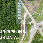
Your pipeline. Your data.
Every flight we run delivers a organized, geo-referenced file set directly to you. Video, imagery, detection reports, all indexed and ready the moment your team needs them.

Increase your odds of winning a project by presenting the media your bid deserves.
Drones are for documenting progress, marketing a finished product, and presenting a proposal.
One site capture can change the heart of the owners, the board, district, the developer...
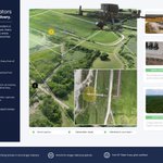
An aerial program built for midstream operators who need data they can actually use.
See how encroachments and full pipeline coverage works: ow.ly/Ou8h50ZPjRl

The Permian Basin produces 40% of U.S. oil and gas output.
That much infrastructure needs eyes on it constantly.
This is why we have an office out there. Right in the heart of the action.
This year, pick your priorities.
Point at which asset you need captured. We'll fly it, document properly, and hand it back in one organized package.

Every now and then, you get a true feel on what construction is about.
It's a feeling that revolves around the people impacted by this industry.
The developers, the contractors, the communities...


When our clients have a site out in east Texas - a new facility or built-up construction project, we are there.
You owe it to your teams to display the hard work of each build, shown through progress photo/video or marketing.

Fall work season is going to look similar to the summer work season.
Permian Basin. Gulf Coast. East Texas. DFW construction.
Grateful for the operators and GCs who keep the schedule full.


Most operators don't know what the right-of-way looked like two years ago.
Imagine if you had a filed record of the data:
- A 2D map of the full system.
- Aerial video you can pull back up and scrub.
- Detailed imagery.
Three formats, all geo-referenced.

A 32.7 mile pipeline needing drone-based methane detection a state away.
We're there to conduct the operation safe and efficiently. Same-day data delivery.
This is a system created for operators and regulators. If you aren't using it, you're competitors will.


Change detection can be captured through multiple deliverables.
High-resolution top-down shows you what the facility and pipeline looks like right now. Layer a point cloud over it and you get an elevation platform. Detailed and measurable.

Reliable detection isn't the first hit. It's the second look.
Once we detect something in the facility or the line, we'll perform a second flight to confirm the hit. A way tighter pattern.
After confirmation, we immediately send the formal report out to the operator.

