The AZ Emergency Information Network 📢 We’re the State of Arizona's official source for emergency updates, preparedness & hazard info. https://xitter.cf/t.co/T68wnyyMVz

Arizona
Joined November 2008
👉 ein.az.gov 👈
1
8
1
33
Select Inner Canyon Trails Reopen in Grand Canyon National Park GRAND CANYON, Ariz. – Hikers can once again explore several inner-canyon trails. These trails have reopened following repairs after trail damage caused by recent flooding. The South Kaibab Trail below The Tipoff and the entire River Trail, connecting the South Kaibab to the Bright Angel Trail, has reopened to hikers. The Bright Angel Trail between Mile-and-a-Half Resthouse and Havasupai Gardens has reopened to hikers only. This section will remain closed to stock use as crews continue to repair additional trail damage. Trail crews will continue technical repairs along the Bright Angel Trail. Hikers should expect intermittent closures and delays and should follow crew instructions and posted signs. Be aware that closure times may change with little notice. Hikers should allow extra time and be prepared for slower travel. Water will remain off at Mile-and-a-Half and Three-Mile Resthouses, as well as at Havasupai Gardens for the remainder of the winter season. Hikers must bring all their own water, along with appropriate filtration or water treatment equipment. Hikers are reminded to plan carefully for their trips, carry adequate supplies and be prepared for changes in conditions. Emergency response times may be delayed in the inner canyon, and rescue is not guaranteed. Hikers should assess their abilities, prepare for changing conditions and understand the risks before beginning their trip. The Black Bridge, Silver Bridge, Phantom Ranch and the entire North Kaibab Trail remain closed. These closures are in place to protect public safety while recovery and assessment efforts continue. Visitors who enter closed areas in violation of the park closure order may be cited. Before visiting, hikers should check the park’s Key Hiking Messages webpage for current trail conditions, water availability, closures and other important safety information. go.nps.gov/gc-hkm (16134) NPS Photo - South Kaibab Trail below Cedar Ridge.
19
110
2,848
Mission-critical and always connected. 📡⚡ Behind every coordinated emergency response is reliable communication. DEMA’s Communications Section manages the vital voice and data networks that power the State Emergency Operations Center and its mobile command units.
1
2
114
🌳 Wildfire risk doesn’t end with summer! 🔥 Dry conditions continue into fall—clear debris around your home and create defensible space to protect your property. #WildfireSafety #FallPrep #StaySafe ein.az.gov/hazards/wildfire
1
2
196
Several pile burns planned Monday on Coconino NF dlvr.​it/TW2T7r
243
AzEIN 📢 retweeted
Several pile burn projects planned for Monday around Flagstaff and Clints Well. More info at fs.usda.gov/r03/coconino/new…
6
1
15
995
🚨 Emergency alerts can save lives! 📱 Make sure your wireless emergency alerts are activated on your phone. Stay informed about local emergencies, weather alerts, and more. #EmergencyAlerts #BeInformed #StaySafe ein.az.gov/resources
3
6
792
An active weather period continues today across the County w/all modes of Severe ⛈️ possible. Storm activity will gradually shift east of the region into this PM but for now please stay Weather Aware 💪 #azwx Full forecast details here: maricopa.gov/878/Weather-Out…
4
7
945
Unlicensed Contractors are out! 📷Avoid contracting scams 📷Always check a license a roc.az.gov 📷get several estimates 📷fully understand the scope of work 📷don't get talked into any immediate decisions 📷never pay in cash 📷take your time
1
1
86
Apache-Sitgreaves National Forests prepares for prescribed fire pile burns on Black Mesa Ranger District dlvr.​it/TW1jdZ
215
AzEIN 📢 retweeted
Storms continue across the state today. If you have plans to drive, remember: 💡Turn on your headlights 🌊Avoid flooded roads & washes 🚗Slow down!
A tornado watch has been issued for parts of Arizona and New Mexico until 9 PM MDT
5
12
3,601
My thoughts are with the Heber-Overgaard community after a reported tornado. My administration is actively coordinating with Navajo County Emergency Management on sheltering and support. I am grateful for the first responders on site who are assisting the impacted area.  We stand ready to deploy resources to assess damage, and I’ve directed DEMA, DPS and ADOT to work hand-in-hand with county officials on recovery efforts.
44
27
3
193
11,342
⚠️ SEVERE THUNDERSTORM WATCH – GILA COUNTY ⚠️ Thursday, October 22, 2026 | Until 11:00 AM MST The National Weather Service has issued Severe Thunderstorm Watch for Gila County.
A severe thunderstorm watch has been issued for parts of Arizona until 11 AM MST
1
109
🚨SHELTER OPEN🚨 📍Desert West Community Center 6501 W Virginia Ave, Phoenix, AZ 85035 If you or anyone you know has been affected by the recent storms please come to our shelter for a safe place to stay, a warm meal, or a little comfort. For assistance call 1-800-RED-CROSS.
2
3
332
🧯 Be ready for the unexpected! 🔥 Fire extinguishers should be in every home. Do you know how to use one? Learn how to use a fire extinguisher properly—it could save lives. #FireSafety #BePrepared #StaySafe ein.az.gov/hazards/wildfire
247
BLM and USWFS Plan Prescribed Fire Treatments in the Hualapai Mountains dlvr.​it/TW0HJ8
1
276
BLM and USWFS Plan Prescribed Fire Treatments near Parker dlvr.​it/TW0HFv
1
261
AzEIN 📢 retweeted
Ignitions completed on the Williams Ranger District at the green waste pit on Forest Road 900 in the Pittman Valley today. Smoke will remain light in the area until it's either done burning or rainfall extinguishes it.
1
5
346
All ignitions on the #WolfeTillmanRX are finished. Resources will monitor the project area over the next few days.
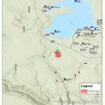
Ignitions underway on 50-acre Wolfe-Tillman prescribed fire project north of Forest Lakes. Project area is 180 debris piles consisting primarily of ponderosa pine & leftover from prior fuels work on @azgfd land, 8 mi. N of Forest Lakes, along Forest Road 169. Ignitions could take a few hours to complete w/smoke drifting north away from Forest Lakes. Project info: bit.ly/4yIrMVj
2
8
984
Pile Burning Planned Near Potato Patch Campground dlvr.​it/TW0DjB
237
Ignitions underway on 50-acre Wolfe-Tillman prescribed fire project north of Forest Lakes. Project area is 180 debris piles consisting primarily of ponderosa pine & leftover from prior fuels work on @azgfd land, 8 mi. N of Forest Lakes, along Forest Road 169. Ignitions could take a few hours to complete w/smoke drifting north away from Forest Lakes. Project info: bit.ly/4yIrMVj
2
1
9
1,579