

The Butler County Sheriff's Office, led by Sheriff Richard K. Jones, is a law enforcement agency serving Butler County, Ohio. 911 Emergency, 5137851300 Non-Emrg
Hamilton, Ohio
Joined May 2009
- Tweets1.8K
- Following81
- Followers8.2K
- Likes180




🕵️ PUT YOUR DETECTIVE CAPS ON! 🕵️
Our detectives need your help identifying these two individuals. They are wanted for questioning in connection with a shoplifting incident that occurred on October 25th.
If you can identify them, please contact Detective Steele at 513-759-7347.


DENSE FOG ADVISORY 🌫️
In effect for Butler, Clermont, Hamilton & Preble Counties until 11 AM.
Visibility may drop to ¼ mile or less, creating hazardous driving conditions.
🚗 Slow down, use headlights, and leave extra distance between vehicles.

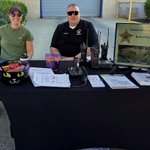
Stop by and say "hey"to Dispatch Supervisors Steph Corhn and David Taylor at our 9Comm
booth at Operation Pumpkin and don't forget our fur pal Ralph passing out candy!!


Kyzer was soooo excited to meet out Bike Patrol Deputies!! This is what it's all about!! Having a great time at Operation Pumpkin!! Kyzer, we loved meeting you too!

Good morning this is meteorologist Natalie Fitzpatrick with the Butler County Sheriff's Office. Today we are back with another weekly weather outlook provided by data from the national weather service.
Good morning this is meteorologist Natalie Fitzpatrick with the Butler County Sheriff's Office. Today we are back with another weekly weather outlook provided by data from the national weather service.
⚠️ FLOOD WATCH until NOON today for Butler County and surrounding areas.
Additional storms and heavy rain may cause flash flooding due to already saturated ground. Avoid low-lying areas and never drive through flooded roadways.
Turn Around, Don’t Drown!

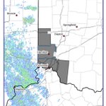
FLOOD ADVISORY until 10:45 PM
Northeastern Butler County and surrounding areas. Heavy rain may cause minor flooding, including Middletown, Monroe, Trenton, Franklin, Carlisle & South Middletown.
⚠️ Turn Around, Don’t Drown! Use extra caution after dark.

🌧️ FLOOD ADVISORY until 10:15 PM
Northwestern Butler County and surrounding areas. Heavy rain may cause minor flooding in low-lying and poor drainage areas.
⚠️ Turn Around, Don’t Drown! Never drive through flooded roads. Use extra caution after dark.

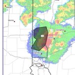
🚨 TORNADO WARNING UNTIL 8:30 PM 🚨
East-central Butler & central Warren Counties.
Radar indicates rotation near South Middletown, moving southeast at 35 mph.
Middletown, Monroe, Trenton, Franklin, Mason, Lebanon & surrounding areas: TAKE COVER NOW!

🚨 TORNADO WARNING — TAKE COVER NOW! 🚨
Until 8:30 PM for northeastern Butler, northwestern Warren & southwestern Montgomery Counties.
Radar indicates rotation near Gratis, moving southeast at 20 mph.
Middletown, Monroe, Franklin, Carlisle & Springboro: Seek shelter NOW!!

⚠️ SEVERE THUNDERSTORM WARNING
until 8:00 PM for northwestern Butler County and surrounding areas.
💨 Winds up to 60 mph
🧊 Quarter-size hail possible
Oxford, Reily, Darrtown, Somerville and surrounding areas may be impacted.
Seek shelter indoors, away from windows.

⚠️ FLOOD WATCH ⚠️
A Flood Watch is in effect for Butler County from 7 PM tonight through Monday morning.
Heavy rain and thunderstorms could produce 1–3 inches of rain, with higher amounts possible. Saturated ground may lead to flash flooding.
Turn Around, Don’t Drown!

🚨 FLOOD WATCH 🚨
A Flood Watch is in effect for Butler County from midnight tonight through Friday morning.
Several rounds of thunderstorms could bring 1–3 inches of rain, with locally higher amounts, causing flash flooding.
⚠️ Avoid flooded roads and low-lying areas.

Good morning this is meteorologist Natalie Fitzpatrick with the Butler County Sheriff's Office. Today we are back with another weekly weather outlook provided by data from the national weather service.

Good morning this is meteorologist Natalie Fitzpatrick with the Butler County Sheriff's Office. Today we are back with another weekly weather outlook provided by data from the national weather service.
⚠️ SEVERE THUNDERSTORM WARNING until 5:30 PM for southwestern Butler County.
💨 60 MPH winds
🌨️ Penny-size hail
⚡ Heavy rain & lightning
Ross and surrounding areas: SEEK SHELTER NOW. Stay away from windows and never drive through flooded roads.

