We’re excited to have been unified under the new U.S. Wildland Fire Service! This account will no longer be updated. We invite you to follow the new service at @USWFS, and follow @BLMArizona for local information and updates.
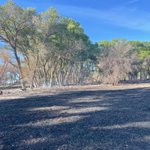
Photo by Clay Stephens.
BLM Arizona Fire Management (Archived) retweeted
Dry lightning is responsible for many wildfires in Arizona, including the Sycamore Fire, now over 9,000 acres. When thunder roars, go indoors! 🌩️ #azwx
BLM Arizona Fire Management (Archived) retweeted
#AntelopeFire Evac reduced to READY!
—-
Per the @YavapaiSheriff and @YavapaiOEM , residents in Zone YCU-2234 who were previously under a GO status due to the Antelope Fire near Mayer may now return safely to their homes. The fire is no longer posing an immediate threat to the area.
While evacuation statuses may change, remember that we are always in READY. Being READY means having a plan, building an emergency kit, staying aware of local conditions, and knowing where to find reliable information before an emergency happens.
Preparedness isn’t just for wildfire season—it’s a year-round habit that helps keep you, your family, and your community safe.
📍 Learn more about being READY: yavapaiready.gov
📲 Sign up for emergency alerts: smart911.com
🗺️ Know Your Zone: protect.genasys.com
#AZFire #AZForestry #YavapaiCounty
BLM Arizona Fire Management (Archived) retweeted
#AntelopeFire Update June 21 @ 10:35am:
Crews continue with mop up this morning with containment increasing to 60%. The public can expect to see smoke as heat remains within the interior and fire consumes heavies located along the river bottom. Crews are working to mitigate hazard trees throughout the burned area.
Resources assigned include 2 hand crews, 3 engines, 1 water tender and miscellaneous overhead.
Evacuations: Per Yavapai County Emergency Management, GO remains in place for the immediate area surrounding the fire in zone YCU-2234. View the current evac status at go.genasys.com/kcvlnp
📍 Approximatley 2 miles southeast of Mayer, AZ
#AZFire #AZForestry #YavapaiCounty
📷 Engine crew and handcrew conducting mop up operations and hazard trees mitigation on the Antelope Fire, Credit AZDFFM Deputy Fire Prevention Officer P. Mungarro
BLM Arizona Fire Management (Archived) retweeted
(Reposted with corrected date)
Rock Canyon Fire Update - 06-21-2026
Location: 17 mi east of Fredonia, AZ
Size: 4,823 ac
Containment: 30%
Fire activity remained minimal across the incident yesterday. Acreage increased on the fire due to more accurate mapping. Increased smoke was visible in the Kanab area yesterday due to fires burning in eastern Nevada. Smoke from the Rock Canyon fire remained minimal. Crews continued to seek out isolated heat sources and extinguish them. A very small, isolated spot fire occurred on the southern edge of the fire, crews responded rapidly and were able to prevent the fire from escaping established containment lines.
Today, firefighters will continue to strengthen containment lines and mopping up the fire’s edge by extinguishing any heat they find to keep the fire from escaping its current footprint. Firefighters will continue working aviation resources as needed.
For updated fire information, visit Inciweb at: inciweb.wildfire.gov/inciden…
#RockCanyonFire #AZFire @KaibabNF @BLMAZFire @AZStateForestry @USWFS
BLM Arizona Fire Management (Archived) retweeted
#RockCanyonFire correction—This is the update for today 06-21-2026
Rock Canyon Fire Update - 06-20-2026
Location: 17 mi east of Fredonia, AZ
Size: 4,823 ac
Containment: 30%
Fire activity remained minimal across the incident yesterday. Acreage increased on the fire due to more accurate mapping. Increased smoke was visible in the Kanab area yesterday due to fires burning in eastern Nevada. Smoke from the Rock Canyon fire remained minimal. Crews continued to seek out isolated heat sources and extinguish them. A very small, isolated spot fire occurred on the southern edge of the fire, crews responded rapidly and were able to prevent the fire from escaping established containment lines.
Today, firefighters will continue to strengthen containment lines and mopping up the fire’s edge by extinguishing any heat they find to keep the fire from escaping its current footprint. Firefighters will continue working aviation resources as needed.
For updated fire information, visit Inciweb at: inciweb.wildfire.gov/inciden….
#RockCanyonFire #AZFire @KaibabNF @BLMAZFire @AZStateForestry @USWFS
RT @azstateforestry: Resources responding to #AntelopeFire currently estimated at 25 acres with structures threatened. DFFM is in command o…
BLM Arizona Fire Management (Archived) retweeted
#RockCanyonFire correction 4,694 acres 20% Contained
Rock Canyon Fire Update - 06-20-2026
Location: 17 mi east of Fredonia, AZ
Size: 4,695 ac
Containment: 10%
Fire activity decreased across the incident yesterday, with crews reporting minimal growth along the main perimeter. Fire behavior was primarily limited to interior pockets of vegetation burning out with isolated torching. Today, firefighters continued strengthening containment lines and mopping up the fire’s edge. Firefighters will continue working in tandem with dozers and helicopters as needed to tie into existing natural and man-made barriers around the entire perimeter of the fire.
For updated fire information, visit Inciweb at: inciweb.wildfire.gov/incid..….
#RockCanyonFire #AZFire @USWFS @BLMAZFire @KaibabNF @azstateforestry
BLM Arizona Fire Management (Archived) retweeted
#DellenbaughFire Update, June 19, 2026
Size: 779 ac.
Containment: 75% contained
Location: Grand Canyon-Parashant National Monument south of Mount Dellenbaugh – Mohave County, AZ
Operations: Crews continued securing the fire's perimeter, increasing containment to 75%. Some resources were released to support other fires. #AZFire
@parashantnps @USWFS
inciweb.wildfire.gov/utpap-d…
BLM Arizona Fire Management (Archived) retweeted
Rock Canyon Fire Update - 06-19-2026
Size: 4,695 ac
Containment: 10%
Firefighters continue to make progress to control the Rock Canyon Fire.
Fire growth was limited to unburned interior islands of vegetation yesterday. Today, winds are forecast to shift from the west to southwest, increasing the importance of reinforcing and maintaining containment lines, particularly along the northern perimeter of the fire. Firefighters are taking advantage of rocky terrain with sparse vegetation to strengthen containment efforts. Strong, gusty winds may also limit the use of aviation resources, requiring close coordination between air and ground crews to support suppression operations.
For updated fire information, visit Inciweb at: inciweb.wildfire.gov/inciden….
@USWFS @kaibabnf @azstateforestry @azein #AZFire #RockCanyonFire
BLM Arizona Fire Management (Archived) retweeted
#DellenbaughFire Update, June 18, 2026
Size: 779 ac.
Containment: 50% contained
Location: Grand Canyon-Parashant National Monument south of Mount Dellenbaugh – Mohave County, AZ
Operations: Thursday saw lighter winds across the Dellenbaugh Fire. Crews have made good progress securing the edge of the fire. Containment is now 50%. The weather forecast for tomorrow calls for red flag conditions with low relative humidity and strong S/SW winds. #AZFire
@parashantnps @USWFS
Inciweb: inciweb.wildfire.gov/utpap-d…
PHD - @USWFS Firefighters are responding to a new fire along U.S. 60 mm 95, about 15 mi. W of Wickenburg. #AZFire
*CLOSURE*
US 60 eastbound is closed at milepost 95 due to a brush fire.
Expect delays. There is no estimated time to reopen.
For real-time traffic info, check az511.gov and the AZ511 app:
📱 Apple: tinyurl.com/AZ511Apple
📱 Android: tinyurl.com/AZ511Android
Update: Engines are on scene. Fire plots on state lands. Crews are securing and mopping up. 0.25 acre. #AZFire @azstateforestry
BLM Arizona Fire Management (Archived) retweeted
#DellenbaughFire Update, June 17, 2026
Size: 766 ac.
Containment : 0% contained
Location: Grand Canyon-Parashant National Monument south of Mount Dellenbaugh – Mojave County, AZ
Operations: A helicopter flew a mapping mission Wednesday, June 17, updating fire acreage to 766 acres. Additional interagency hotshot crews should be arriving on scene soon. Containment is 0%. With these additional crews, securing efforts and containment are expected to increase. There were no significant changes in fire activity overnight.
@USWFS @ParashantNPS
Inciweb: inciweb.wildfire.gov/inciden…
#AZFire
BLM Arizona Fire Management (Archived) retweeted
Evening Fire Update for Rock Canyon Fire and Dellenbaugh Fire - June 16, 2026
Rock Canyon Fire
Size: 3000 ac. Estimated according to heat signatures on EGP
Containment: 5% contained
Location: 9 miles south of HWY 89, 9 miles west of House Rock Valley Rd — Coconino County, AZ
Operations: Firefighting resources have made progress securing containment lines at the heel of the fire. Fire behavior picked up midday and continued to increase throughout the burn period, fueled by strong westerly winds pushing the fire eastward. The head of the fire is approximately 3 miles from House Rock Valley. Fuels in the White Sage scar have not slowed fire progress today.
Plans are in place to evacuate recreators and any public camping in the House Rock Valley, starting as early as this evening. The anticipated winds this evening are expected to contribute to further substantial expansion of the fire into the late night and early morning.
Inciweb: inciweb.wildfire.gov/inciden…
Dellenbaugh Fire
Size: 724 ac.
Containment : 0% contained
Location: portions of Grand Canyon-Parashant National Monument south of Mount Dellenbaugh – Mojave County, AZ
Operations: Minimal growth on the fire perimeter today. A slight increase in fire behavior occurred in the late afternoon/early evening with some torching. A retardant line was completed on the left flank, around the head of the fire, and begun on the right flank before air tankers were diverted to higher priority fires.
Inciweb:inciweb.wildfire.gov/inciden…
BLM Arizona Fire Management (Archived) retweeted
Fire Information -- June 15, 2026
Arizona — Rock Canyon Fire & Dellenbaugh Fire
Wildland firefighters from the @USWFS, USFS, and local area fire departments are working to actively suppress 2 wildland fires in northwest Arizona.
Rock Canyon
36° 54.94’ x 112° 12.19’
Lightning caused
500 acres + estimated
Location: 9 miles south of HWY 89, 9 miles west of House Rock Valley Rd
Fire Behavior: Extreme fire behavior with running, torching and spotting.
Approx. 50 personnel on scene from USWFS, USFS, NPS. Additional resources on order.
Dellenbaugh Fire
36° 04.50' x 113° 32.12'
Lightning caused
400 acres + estimated
Location: NPS [Grand Canyon-Parashant National Monument] south of Mount Dellenbaugh
Structures threatened 2 miles to the north, 2 miles to the northeast
Fire Behavior: Extreme fire behavior with running, torching, and spotting
16 personnel on scene from USWFS. Additional resources on order
BLM Arizona Fire Management (Archived) retweeted
All lanes are open on northbound US 93 at milepost 147.
#WheelFire Update: Fire’s forward progress has been stopped at 4.6 ac. Firefighters continue their work to contain. Traffic remains restricted in that area of Hwy 93 N bound. Follow @ArizonaDOT for updates on road status. #AZFire
#WheelFire Update - Fire has caused closure of N bound lanes of Hwy 93. Follow @ArizonaDOT or monitor the 511 Arizona app for updates to road closures and conditions. #AZFire