

Meteorologist/Consultant @weatheragencyus @minnesotawxnet & ft. on @stormfrontfreak 🎙️ (Ep. 153). Tech Sponsor: @nework_us
Minneapolis, MN
Joined November 2012
- Tweets34.6K
- Following3.3K
- Followers6.7K
- Likes15.8K
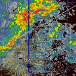

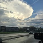


If the core metro gets any storms from this line approaching from the West- it will be in the next 30-60 minutes if we can get any additional development with dewpoints in the low 60s before the cold front moves thru. Slow clap…. 👏🏼

My storm activity so far has consisted of 5 or 6 mini downpours that lasted about 8 seconds each with little cells that keep popping up and quickly moving away as they form right over me.


None of the CAMs seem to have a good handle on this evening tho especially with the current storms SW of the cities.


So what’s the play on all this “have at least 3 days of survival supplies” and others suggesting 90 days for military etc. seems like drumming up fear to get people to spend money. Short term stimulation to the economy and distract people? I have a decent amount of stuff already from a couple years back, but it’s literally all I’m seeing on my feed.
Bo Cole retweeted

Exceptional wind shear near the surface low in Minnesota today if something can stay discrete. Changing winds with height will help storms to rotate, and we can't rule out an isolated significant tornado.

The threat level for today has been raised. Increased storm coverage and also chances for tornadoes have gone up. Main risk timing is between 2-8pm. Expect storms to form pretty quickly if this scenario does verify. There’s still a chance that it busts- but I think that’s the less likely scenario.


