

From Long Island, NY. Meteorology lover. UAlbany Atmospheric Science + Mathematics, Class of 2030🌦️🤓
Joined September 2021
- Tweets3.3K
- Following1.1K
- Followers674
- Likes60K




Pinned Tweet
Super stoked to announce my commitment to studying atmospheric science at the University of Albany! Can’t wait to continue my academic journey and continue to pursue my passion in meteorology and research!
See you in the state capital this fall 🫡

4
18
3,921

This footage is fake. Red sprites are a real phenomenon but last a tiny fraction of a second, not a full second as shown here.

WEIRD ARIAL PHENOMENA SPOTTED
Readers added context they thought people might want to know
This is Ai generated footage of red sprites, a weather phenomenon when plasma discharges high in the atmosphere from strong thunderstorms. As seen with provided footage sprites rapidly flash and are extremely difficult to capture. Not appear for a few seconds and fade out
youtu.be/bwz6g44ZjUI?is…
earthweb.ess.washington.edu/space/AtmosEle…
2
268
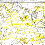
Looks like there’s a closed low near 1-2°S. Some models show this becoming a TC at this latitude. Very rare to see a closed tropical disturbance so close to the equator

2
34
2,488
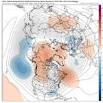
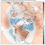
Long-range GEFS looks extremely favorable for cold/snow/storms across the East with perfect Greenland Block placement and ridging near Montana
A strong -NAO is inevitable, but the location and strength of Canada Ridge will make all the difference

Cole Stern retweeted

Some personal news:
Yesterday was my last day at Microsoft.
Today, I started a brand new job at the FAA and things are going pretty well!
Cole Stern retweeted

Happy first official Mesonet snow accumulation (excluding our WF and Lake Placid stations, of course)! What a beautiful winter wonderland our backyard weather stations are capturing on camera. Winter has officially arrived across the network! Check out our WInter Weather page!

Cole Stern retweeted

Snow totals so far have significantly exceeded expectations along a narrow corridor in the Catskills, with localized totals near and even over 12" so far.
These areas were expected to receive some of the higher-end totals of the event, with higher elevation favoring colder temperatures and higher snow:liquid ratios.
But heavy snow rates from a quasi-stationary snow band aided in an even earlier changeover and more accumulation under the band than other high peaks in the region:


Cole Stern retweeted

Bad policy, bad character make bad politics: erratic tariffs, impulsive Iran war, blanket pardons, apparent corruption, weaponized justice, ICE brutality, mountainous deficits, hiding Epstein, abandoning allies and coddling enemies. Hoping for a course correction, for the country and for my party.


Cole Stern retweeted

My CFSv2 Top 5 analog blend for December has gone nuclear!
If this is a true signal, the very warm December forecasts may be in trouble…


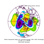
Something to look for this winter will be the location of troughing south and west of Alaska. More favorable winter analogs have troughing further south and west, promoting an Alaskan ridge (see 2009-2010). Less favorable analogs have it closer to the coast (1997/2023).


4
47
2,095
Some long-range models look favorable for cold and/or storminess near Thanksgiving. AIFS shows a big Alaska ridge and positive height anomalies near Greenland, which would support cold across the US in the subsequent days

Pretty insane how quickly things shifted from Nov 2009 to Dec 2010


To be clear, most of the CONUS will torch for at least a week or two after the upcoming storm system (high ensemble + Nino analog agreement). However, once the -NAO becomes more established, I think we could see some form of cold and winter weather (especially into December).
