

Detroit's civic technology and open data vanguard. Book #Detroitin50Maps Projects: @DetroitFoodMap #DetroitGISDay @PropertyPraxis @DetroitData #DetroitAtlas
Detroit, MI
Joined September 2012
- Tweets3.9K
- Following4.5K
- Followers3.9K
- Likes6.4K




DETROITography retweeted

Dan Gilbert's PAC cash gifts to Detroit council emerge as RenCen vote looms detroitnews.com/story/news/l…

Map: Imagining the Riverfront 1970 detroitography.com/2018/02/2…

2
163
Map: Detroit Bus Frequency 2026 detroitography.com/2026/11/0… @RocketCF


Map: Metro Detroit Ancestry 2024 detroitography.com/2026/11/0…

DETROITography retweeted
Map: Detroit Consulates and Most Common Place of Birth of Foreign Born Residents detroitography.com/2026/10/3…

Map: Devil's Night only in Detroit detroitography.com/2016/10/2…

2
185
Map: Detroit Consulates and Most Common Place of Birth of Foreign Born Residents detroitography.com/2026/10/3…
Map: Share of Homes without Air Conditioning in Detroit detroitography.com/2026/10/2… via @TaubmanCollege

1
2
227
Handy Indexed Map of the City of Detroit Showing Complete Street Railways to Date 1895 detroitography.com/2026/10/2…

1
161
Map: Baedeker's Detroit 1904 detroitography.com/2026/10/1…

2
180
Map: Detroit's Zug Island detroitography.com/2026/10/0…

Map: Proposed Detroit People Mover Expansions 2026 detroitography.com/2026/09/2…

Map: Jazz and Blues Clubs in Detroit's Sugar Hill Neighborhood 1930 - 1950 detroitography.com/2026/09/2…

DETROITography retweeted

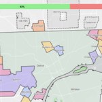
By 1906, Detroit's growth had begun encroaching on villages which had newly incorporated in the surrounding townships. Delray, Woodmere, Fairview, a piece of Hamtramck, St. Clair Heights & Oakwood would be annexed into the city before it reached its current borders in 1926.


DETROITography retweeted

Detroit traffic fatalities and serious injuries dropped again in 2025. Peds rose 9% compared to 2024 while bicyclists dropped 50%. Still much more work to be done.
buff.ly/KL8EBZ4

Map: Detroit Walking Atlas detroitography.com/2026/08/2…

Map: Detroit United Railways 1925 detroitography.com/2026/08/1…
1
1
162