

CPGE Paris and SciencesPo Paris - Geopolitics, Environmental Geography, Science Studies... – and China EGALEMENT : https://teapawt.net/t.co/ijFKscIq0U
Joined March 2017
- Tweets6.2K
- Following913
- Followers509
- Likes6.8K


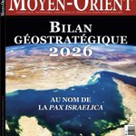


Pinned Tweet
• En préparation pour janvier 2027 (URCA-Reims)
• "Dimensions impériales des Etats-Unis et de la Chine au 21e siècle. Nouvelles perspectives géopolitiques" (URCA, Reims, Laboratoire "Habiter")

René-Eric Dagorn 和宁 retweeted

Un tour de la Russie et de son empire en 101 livres.
Vient de paraître aux éditions de l’EHESS.


René-Eric Dagorn 和宁 retweeted

If you are going to compare the Trump-Xi-Putin trilateral to the 1945 "Yalta Conference", then you need to answer three questions:
1) What war(s) are the powers winning? Unlike Yalta, Russia and the US are in the midst a stalemate.
2) What can be "decided" in a short meeting? Yalta was a week, not 90 minutes
3) Are the three powers actually aligned? Unlike Yalta, when the participants are all unified against a common opponent (Nazi Germany), there is no common opponent here. In fact, quite the opposite, as the US and Russia are essentially fighting against one another and China is enabling Russia.
In short, Yalta was a BIG DEAL in the history of global diplomacy. The Tump-Xi-Putin trilateral meeting, not so much.


René-Eric Dagorn 和宁 retweeted

Trump’s summit in Shenzhen with Putin and Xi was much worse than just a bad photo op. newyorker.com/news/letter-fr…


René-Eric Dagorn 和宁 retweeted
When Trump, Putin and Xi meet - © Chappatte in Le Temps, Geneva 👉 chappatte.com/en/images/when…

René-Eric Dagorn 和宁 retweeted

Pourquoi la rencontre Xi/Poutine/Trump de Shenzhen contient des éléments inquiétants 👇institutmontaigne.org/expres…

René-Eric Dagorn 和宁 retweeted

当中国的“国家精密资本主义”开始收割世界 - 法国报纸摘要 rfi.my/DDq7

René-Eric Dagorn 和宁 retweeted

The purpose of hybrid attacks is psychological, the target is public opinion, and the objective is to generate confusion, fear, and distrust in institutions.
foreignpolicy.com/2026/11/12…

René-Eric Dagorn 和宁 retweeted
Deux parutions aussi formidables que complémentaires pour plonger dans l’univers kojèvien.


René-Eric Dagorn 和宁 retweeted

Un épisode oublié de la Grande Guerre, les travailleurs chinois épaulant les armées françaises et britanniques
lefigaro.fr/vox/societe/un-e…

René-Eric Dagorn 和宁 retweeted

New book #NewBook
Jonathan Karam Skaff. Silk Roads, Steppe Roads: History Unearthed from the Tombs of Medieval China. Princeton University Press, 2026.
press.princeton.edu/books/ha…
#SilkRoads #china #history #tombs #medieval #ChineseHistory #archaeology #medievalChina #Steppe

... peut-être en inversant les codes couleurs pour faciliter le passage au croquis ? Blanche @blambertcarto , si cela ne convient pas je supprime la version bien-sûr !


Pour le programme de khâgne de cette année 2026-2027 "Mobilités et transports urbains dans le monde" (Normale Sup ENS-LSH Lyon) : @ErwanLeGoff1 @laurentcoudrier @EditionsAtlande
... plus particulièrement la partie 2 ("Mobilités et enjeux écologiques")
1
1
167
Pour le programme de khâgne de cette année 2026-2027 "Mobilités et transports urbains dans le monde" (Normale Sup ENS-LSH Lyon) : @ErwanLeGoff1 @laurentcoudrier @EditionsAtlande
... plus particulièrement la partie 2 ("Mobilités et enjeux écologiques")

Jour 11 du #30DayMapChallenge : "Son"
Comment ne pas faire une carte sur la pollution sonore à Brest pour ce thème ?
Données OSM, BD TOPO® (IGN), Brest Métropole
Réalisée avec QGIS et Illustrator en 3h le temps de mon trajet Paris-Morlaix ce matin
#map #bzh

René-Eric Dagorn 和宁 retweeted

Jour 11 du #30DayMapChallenge : "Son"
Comment ne pas faire une carte sur la pollution sonore à Brest pour ce thème ?
Données OSM, BD TOPO® (IGN), Brest Métropole
Réalisée avec QGIS et Illustrator en 3h le temps de mon trajet Paris-Morlaix ce matin
#map #bzh
René-Eric Dagorn 和宁 retweeted

Before steamships, global trade followed the winds rather than the shortest route. This brilliant animation by @BartGonnissen uses 250,000+ historical ship positions (based on logs from 1750–1855) to reveal how winds shaped global shipping routes. Source: buff.ly/j8lVzeC
René-Eric Dagorn 和宁 retweeted

Si Gadi Eisenkot parvient à réunir une majorité, ça ne sera pas une alternance radicale. Mais un Israël sans Netanyahou et l’extrême droite sera différent, même si on ne sait pas encore à quel point. Ma chronique géopolitique du 7/10 @franceinter radiofrance.fr/franceinter/p…


René-Eric Dagorn 和宁 retweeted
The Clearest View of Mars’ North Polar Ice Cap
This is a real, high-resolution mosaic of Mars’ North Pole, built from dozens of orbital images taken by ESA’s Mars Express spacecraft. The bright white region is a permanent cap of water ice roughly 1,000 km across and up to about 2 km thick—equivalent in volume to nearly half the Greenland ice sheet on Earth.
Dark spiral troughs cut through the ice, carved by winds and seasonal sublimation. In winter a thin layer of carbon-dioxide frost blankets the surface; in summer it disappears, revealing the cleaner water ice beneath. The ice is stacked in layers that preserve a climate record stretching back millions of years.
Yes—that white material is water ice.
Image credit: ESA/DLR/FU Berlin

René-Eric Dagorn 和宁 retweeted

NOW AVAILABLE! "Waiting for the Barbarians: A History of Geopolitics in Early Modern China, 1680-1850" is a groundbreaking examination of how Qing China reimagined its imperial identity through territorial expansion, ideological adaptation, and cartographic precision. Between 1680 and 1850, the Qing integrated Central Asia, Tibet, and Mongolia into a vast, multiethnic empire—challenging traditional Confucian distinctions between civilization and “barbarism.”
Bridging political thought, cultural geography, and geodetic science, this book reveals how Qing rulers legitimized territorial claims using symbolic geography—such as surveys of the Yellow River’s headwaters—and advanced tools like triangulation and the theodolite. These efforts fostered a new understanding of spatial order among Qing officials, intellectuals, and administrators. cambriapress.com/Waitingfort…
