

Spatial data. Python. Backpacker. Skier.
San Francisco, CA
Joined January 2020
- Tweets137
- Following639
- Followers307
- Likes1.2K


Pinned Tweet
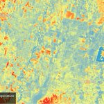
Just completed my Cartography and Data Visualization course for my masters program, here's my favorite map that I created for the class:


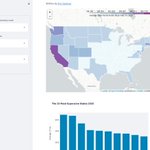
Created my first streamlit app that visualizes Zillow's ZHVI data using folium and geopandas. Can't wait to build more!
You can check out the app live here: https://teapawt.net/t.co/gY1SlhFeIF

4
Eric Samson retweeted

the best vanity URL I have ever published and also possibly the best map? wapo.st/peep-these-leaves
Amazing!
You’re unable to view this Post because this account owner limits who can view their Posts. Learn more
Eric Samson retweeted

#PyConUS2022 @pwang Keynote: Announcing Py-script!!!
It's Python! inside HTML!!! 🤯


Eric Samson retweeted

Introducing a new #Python package named geospatial 🚀Installing commonly used Python package for #geospatial analysis and #dataviz with only one line of code. Let me know your fav package, and I can probably add to it
GitHub: github.com/giswqs/geospatial
Docs: geospatial.gishub.org

Eric Samson retweeted

I'm a little mapping library that was born 11 years ago in Ukraine. 🇺🇦 Yesterday, after enduring 8 years of hybrid warfare that killed 15000+ and displaced millions, Ukrainians listened to a 40-minute hate speech from Russia's insane president on why Ukraine shouldn't exist. 1/4
Eric Samson retweeted

So excited to share a (downsized for twitter) #map I have been working on, with illustration work by @The_Ruizium. A picture of the #Amazon region in crisis. Not only the struggle to deal with #deforestation, but its geography, cultures, and political divisions.

Eric Samson retweeted

#Colorado’s #MarshallFire—the most destructive wildfire in the state’s history—was precipitated by ample vegetation recently under extreme drought conditions.
@GeoScienceSara reports: earthobservatory.nasa.gov/im…

Eric Samson retweeted

District 6 has grown so much with new housing over the last 10 years, relative to other districts, that it is now 30% over its required population.
This means that District 6 will see some big changes & will have to shrink significantly in next year's redistricting process.

Eric Samson retweeted

hello world!
we're launching pandas tutor! it visualizes Python pandas code step-by-step: pandastutor.com/
(developed with my advisor philip guo)
Eric Samson retweeted

#QGIS is a big kid now - over 1.8 million lines of code. It takes a village to make a GIS.

Eric Samson retweeted

Day 16 (Urban) of the #30DayMapChallenge showing the average cost per bedroom & night (USD) of Airbnbs in urban cities by street. Data from @InsideAirbnb. Link has better resolution. Individual maps in the comments.
Full Image: https://teapawt.net/t.co/t30G5UM0lM
#rstats #dataviz #ggplot2

Eric Samson retweeted

#30DayMapChallenge Day 12 - Population
#Joyplot of population and elevation of #Taiwan. Most people live in the coastal cities and you rarely find people living in mountainous areas.
Made with #RStats using #ggridges

Eric Samson retweeted
#30DayMapChallenge (raster). I've talked before about how you can make animations in #Photoshop w/#EarthEngine data. For todays theme, I wanted to show how far you could push it, by also adding #Blender terrain, imagery + admin data over real clouds from GOES data from last year.