
Senior Product Manager at Langan focused on 3D GIS, Digital Twins, Facilities Management, Urban Planning and Design, Asset Management and Utilities.
Joined February 2013
- Tweets924
- Following113
- Followers272
- Likes269
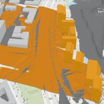

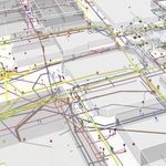


Interested in using GIS to do 2D and 3D analysis to understand the environmental, social, and economic impacts of your design? Langan can help, swing by our booth (401) at IMGIS.

80
Swing by the Langan booth (401) at IMGIS to learn more about taking your campus or facility 3D for asset, space, and emergency management. Here is an example of a K-12 campus we've 3D enabled in ArcGIS Indoors.

86
Excited to be at Esri's IMGIS Conference and to show off some of the work we have been doing with NBC. Come by Langan's booth to learn more.

79
Eric Wittner retweeted

"@CityEngine 2020.1 Release: What’s new and should you download it?" #3D #GIS #ESRI #3DGIS #CityEngine #Planning #Architecture geoplanit.co.uk/?p=5596
Eric Wittner retweeted

A miniature diorama showcasing another small set of the assets we use to build our high-quality 3d buildings.
youtube.com/watch?v=rZThWHmo…
#3d #building #vfx #games #entertainment #architecture #vrbnstvdios
New Blog - CityGML to I3S: Streaming fast 3D city data in ArcGIS - esri.com/arcgis-blog/product…
Extract building footprints with the 3D Basemap... | GeoNet, The Esri Community | GIS and Geospatial Professional Community community.esri.com/people/Gv…
1
What will Charlotte look like? This new tool makes it easier to visualize. #ArcGISUrban disq.us/t/3ludzan
Eric Wittner retweeted

An Argis Lens client success story-- read how a commercial/residential mobile home park in El Jebel, CO is leveraging the #argislens, improving safety, saving time, and refining their #GIS data: argis.com/success-stories/20… #AR #ArcGIS #geospatial #excavation


How "smart" are "Smart Cities?" A pretty tough rating system, but with interesting results. smartcitiesdive.com/news/rep…

"What if?" Even sometimes if the scenario is totally crazy, the process can highlight real concerns, and possible solutions. ow.ly/ksB550wfqRH

Euclidean Zoning constrained the kinds of uses land owners can put on their property. Now we are putting greater restrictions on the kind of uses allowed in a residential building. It this moving forward, or backward? Not sure. ow.ly/Z5el50vxHVm
NACTO updates their standards for the inclusion of micro-mobility solutions. Incentive based permitting is a very cool idea. ow.ly/uLcg50wfl4F
The partnership continues, and integration is ongoing. Now the intersection of Infraworks and ArcGIS Online helping bring BIM and GIS together: ow.ly/uHJ250wslcR
Close encounters with representation of the third (and 3D) kind. Point Clouds, a nice little state of the moment piece: ow.ly/Sir850vzFkK
The Economic Benefits of Geodata in Urban Planning in Sweden: gim-international.com/conten…