

We’re helping farmers pinpoint plant performance with satellite maps and pins for insight. See your farm on https://teapawt.net/t.co/yU8MM3HnxP 🌱📍🌈
Cape Town, South Africa
Joined April 2013
- Tweets79
- Following43
- Followers89
- Likes44








Pinned Tweet
Hello from FarmPin! We’re helping farmers pinpoint plant performance with satellite maps and pins for insight. See your farm at farmpin.com 🌱📍🌈
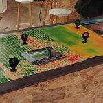
Give your #moisture #probes super powers! ⚡️
Read our latest article to see how you can use moisture maps to track 10's to 100's of pivots: hubs.ly/H0fmpnh0

Give your #moisture #probes super powers! ⚡️
Read our latest article to see how you can use moisture maps to find gradient differences: hubs.ly/H0fmnKy0
Give your #moisture #probes super powers! ⚡️
Read our latest article to see how you can use moisture maps to see how well your probes are representing your field: hubs.ly/H0fmnK30

Bittersweet day saying goodbye from @DroneClouds. We’ve learned a lot. Thanks for being with us on the journey. Watch this “space“...


We are 1 of 6 digital all star startups featured by @Ventureburn! #drone #southafrica
ventureburn.com/2017/07/dron…

"@droneclouds bridges; take something once only accessible to high-tech corporations to small farmers" @davidcampey
itwebafrica.com/enterprise/5…
1
“Over time, precision farming has led to a 40% improvement in yield with both dryland and irrigated crops” farmersweekly.co.za/crops/fi…


As part of our launch, we're giving farmers each 1 FREE satellite image of their farm. Sign up: goo.gl/w9ObHJ
RT to save a crop.


