

Official Twitter account for Rockford's First Warn Weather team. @CandiceKing, @Wxjmar93, @JordanWolfewx, and @OwenWxIllinois.
Rockford, IL
Joined April 2012
- Tweets25.5K
- Following144
- Followers2.3K
- Likes678


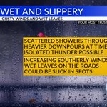


Steady and heavy rain has now moved into northern Illinois and will continue on a steady pace through at least Midnight, with a few showers through 2am. An additional 0.25-0.75 inches can be expected. @MyStateline

Temperatures tonight/early Wednesday will remain in the 60s but fall through the 50s during the day. It'll feel cooler by the afternoon. @MyStateline

Not much showing up on radar as of 6pm locally, but visibility tells a different story. We likely have some steady drizzle/mist, or even a few very light showers occurring this evening. Be careful if you're out and about tonight. @MyStateline


The combo of gusty southerly winds and rain showers may bring down a few more leaves. Be careful while driving as that could create some slick conditions on the roads. @MyStateline


October has been a warm month. Just look at how many days we've had above average temperatures - some days 15-20 degrees! We'll fall some Friday thanks to cloud cover and a northeast breeze, but it looks like at least the 60s take us into next week. @MyStateline

Thunderstorms have developed along a cold front that'll move into N. IL and S. WI later tonight. Widely scattered showers with a rumble or two possible after Midnight. @MyStateline

A little green showing up on radar this evening but not too concerned about it. Skies will clear some after Midnight with sunshine expected Wednesday afternoon. @MyStateline

Clouds will thin out a bit through the evening which will bring temperatures into the 40s overnight. We'll see a little more cloud cover Tuesday with highs in the upper 60s. @MyStateline

Well - that's a pretty sunset over Beloit, WI Sunday evening! @MyStateline

Looks like the warmth will be sticking around for a little while. Longer range outlooks through the beginning of November. @MyStateline


Nice harvest weather into the weekend. A little breezy Saturday with a southwest wind, but temps stay in the 70s. @MyStateline

A little frost/fog again Wednesday morning, but a nice afternoon with temperatures in the upper 60s/low 70s. @MyStateline

Nice harvest weather continues the next few days. The only hiccup may be some early morning frost, but we should continue to see sunny skies and temps near 70. @MyStateline

As we thin out the clouds this evening, temperatures will quickly fall through the 40s and into the 30s. By morning, a widespread frost is likely with freezing temperatures possible. A FREEZE WARNING will go into effect overnight and run through Saturday morning.


It will be a chilly one for the last week of the HS football regular season! Temperatures will quickly fall into the mid-40s through gametime, with breezy North winds and wind chills in the 30s! Be sure to bundle up if you're enjoying Friday night lights this evening!

2PM Stateline Weather: Cool, breezy, and some pockets of light showers. Rain chances will continue through early evening, but we will quickly clear out as temperatures fall into the 30s tonight. A freeze warning will go into effect late tonight.


Light or steady rain has been the trend today and that will continue through 9-10PM. Coverage of rain will wane overnight as the "dry slot" of the system passes overhead. But winds will pick up quickly, with gusts pushing 30 mph overnight as temperatures fall to the low/mid 40s.

Widespread rain will arrive Thursday morning, with some narrow pockets of heavy rain. Additional showers wrap around the low Friday afternoon, accompanied by a blustery and cool North wind. Temperatures drop from the 50s Friday to the 30s Saturday morning; frost will be likely!


Heavy rainfall just east of downtown Rockford, down through New Milford. Heads up Cherry Valley and Belvidere. @MyStateline

Elevated thunderstorms are moving towards SW Wisconsin this evening, with a few isolated storms possible in S. WI around 7pm-8pm. Additional isolated storms may develop to the southwest after 8pm or 9pm. @MyStateline
