

Everything you always wanted to know about Los Angeles freeway history and engineering but were afraid to ask. We cover local state highways too.
LA, Orange & Ventura Counties
Joined April 2018
- Tweets5.2K
- Following19
- Followers10.5K
- Likes3.1K




1958 - Looking NE over Harbor Fwy (then US-6/CA-11, now I-110) during construction of interchange with Olympic Fwy, now known as Santa Monica Fwy (I-10). Washington Blvd crosses at center. SB off-ramp (left center) led to Adams Blvd (ACSC Collection).
1/2

NOTICE:
As is our tradition, on October 31, we will be posting photos of "ghost" freeways, highways, ramps and bridges in the Los Angeles area. 😱☻👻
We define a ghost as a roadway feature that no longer exists or one with surviving remnants or traces.
1/2

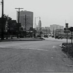
1940-Feb-23 - Facing west on Aliso St approaching Ramona Blvd (US-60-70-99), forerunner to Ramona/San Bernardino Fwy (I-10) - ACSC Collection.
Note transmission towers, light poles, and LA City Hall & Federal Courthouse in background. Mission Rd intersection at center.
1/2


1972 - Looking southerly over newly constructed Foothill Fwy (I-210), now Orange Fwy (CA-57). Note double cable median barrier with chain link glare screen.
At that time I-210 terminated at I-10. Four level interchange with San Bernardino Fwy (I-10) at center (DOH D7 Archives).

2026 - Montebello/Monterey Park between Garfield Ave & Wilcox Ave and Pomona Blvd. Pomona Fwy (CA-60) was constructed in 1967. North is to the right (Google Maps).
Pomona Blvd now a westbound frontage road. Via Campo eastbound frontage road parallels freeway to the south.
2/2

1956 & 2026 - Montebello/Monterey Park before and after Pomona Fwy (CA-60).
1956 - Montebello/Monterey Park between Garfield Ave & Wilcox Ave and Pomona Blvd. Before construction of Pomona Fwy (CA-60). North is to the right. UCSB Collection; Jim Staub annotation.
1/2

1940s & 1958 - San Bernardino Fwy (then US-60-70-99, now I-10) and the dramatic growth of West Covina.
From Ben Hughes of We Grew Up in West Covina:
Even though I was there when it was happening, it's hard to imagine how fast West Covina grew in the 50s. Compare these
1/3

pictures of the same area. 1950 population was fewer than 5,000. By 1960 it was more than 50,000. West Covina was America's fastest growing city from 1950 to 1960. In the 40s it was mostly orange and walnut groves. By the late 50s it was full blown suburbia.
2/3

1956 - Looking SW over newly constructed San Bernardino Fwy (then US-60-70-99, now I-10) at Rosemead Blvd (CA-19) - CH&PW.
Oblong four quadrant cloverleaf interchange with collector-distributor roads to improve mainline freeway operation by separating weaving traffic.

1954-June-07 - Looking NW over NB Santa Ana Fwy (then US-101, now I-5) near Arizona Ave; Telegraph Rd parallels freeway at right. The interchange with Long Beach Fwy (I-710) is now located in background (DOH D7 Archives).

c. 1955 - SB Pasadena Fwy (then US-66/CA-11), now Arroyo Seco Pkwy (CA-110), at arched York Blvd OC. Note US-66 shield on lamp post (Security Pacific Collection).

c. 1940 - Looking NE over Roosevelt Hwy (US-101 Alt, now Pacific Coast Hwy CA-1) near Latigo Canyon in Malibu. Solstice Canyon at left center; Corral Canyon Park at upper left background (Ernest Marquez Collection).


1962-Dec-21 - Looking north over San Diego Fwy (I-405) opening festivities near Mulholland Dr. LA mayor Sam Yorty arrived via helicopter for ribbon cutting ceremony (DOH D7 Archives).
This opened access through Sepulveda Pass; freeway terminated 3 miles to the north, per sign.

1953 - Looking NE over newly constructed Arroyo Seco Pkwy (then US-6-66-99/CA-11, now CA-110) at Sunset Blvd OC. Alpine St OC in background (DOH D7 Archives).
Opening of this segment marked completion of the Arroyo Seco Pkwy, a 13-year construction period interrupted by WWII.

1957-June-13 - Facing NW on newly constructed (and unopened) Long Beach Fwy (initially CA-15, later CA-7, now I-710) near E 61st St. Note distances given in tenths of a mile. Recent freeway widening replaced slope at right with a retaining wall (DOH D7 Archives).
1/2
