

GIS Resources is global platform for geospatial latest news & insights, developments, jobs, webinars, articles, data, conferences and tenders.
USA
Joined March 2014
- Tweets5.6K
- Following0
- Followers2.1K
- Likes443








We are proud partners of Geo Week 2027, a global event bringing together professionals across geospatial technologies, reality capture, lidar, and more.
Register today and our code for an exclusive discount: invt.io/1txbie0udsc

📍🛰️ Togo launches a national CORS network and geodetic reference system to standardize spatial data and improve positioning accuracy. #CORSNetwork #GeodeticReference #GNSS #Togo #Surveying #GIS #GeospatialTech #Togo bit.ly/3P6Ci7G

🛰️🏙️ Mysuru City Corporation to deploy aerial LiDAR mapping for accurate 3D property maps and improved property tax assessment.
#AerialLiDAR #Mysuru #PropertyTaxReform #3DMapping #SmartCities #GIS #GeospatialTech #Mysuru #LiDAR #3D bit.ly/47yH1VR

🚢🛰️ GNSS jamming incidents in the Strait of Hormuz expose major vulnerabilities in maritime navigation systems. bit.ly/4b8UbuY #GNSSJamming #MaritimeNavigation #StraitOfHormuz #PNTSecurity #SatelliteNavigation #GeospatialTech

🛰️🌳 India launches a satellite remote sensing system to monitor green cover along national highways — boosting sustainable infrastructure planning. #HighwayGreenCover #RemoteSensing #SatelliteData #DigitalIndia #GIS #GeospatialTech #infrastructure bit.ly/4rrlMwa

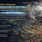
🛰️ Researchers combine optical + radar satellite data to detect conflict-related infrastructure damage in Ukraine with greater accuracy. bit.ly/4cIlVb1 #ConflictDamageDetection #SatelliteImagery #EarthObservation #Ukraine #RemoteSensing #GIS #SAR

🌾🤖 Bihar Agricultural University leads a ₹37 crore AI-driven soil mapping project across 38 districts to boost precision agriculture and soil health.
bit.ly/4rmnCyF
#AISoilMapping #PrecisionAgriculture #Bihar #AgriTech #GIS #GeospatialTech

🔍🛰️ Genesys launches India’s first advanced GPR system for 3D underground utility mapping, improving infrastructure safety and planning. bit.ly/47wo2er #UndergroundUtilityMapping #GPRTechnology #Genesys #GeospatialTech #SmartInfrastructure #GIS

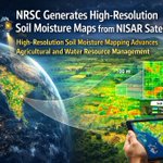
🛰️💧 NISAR satellite data is enabling high-resolution soil moisture mapping, improving insights for agriculture, hydrology, and climate monitoring. bit.ly/4llDfok #NISAR #SoilMoistureMapping #EarthObservation #RemoteSensing #GIS #SoilMoisture #ClimateScience

🛰️ UK launches a cross-government effort to strengthen Satellite PNT Resilience, protecting critical sectors from navigation and timing disruptions. #SatellitePNTResilience #PNTSecurity #UKSpace #GNSS #SpaceTech #CriticalInfrastructure bit.ly/4pUAc7W

🛰️✨Taiwan launches FORMOSAT-8, delivering sharper satellite imaging for disaster response, environmental monitoring, and planning.
#FORMOSAT8 #SatelliteImaging #EarthObservation #TaiwanSpace #RemoteSensing #GIS #Taiwan bit.ly/48HzgwO

📡 🌍Tamil Nadu adopts high-resolution mapping to modernise land records, boost transparency, and enhance accuracy across the state.
#TamilNadu #HighResolutionMapping #LandRecords #GIS #GeospatialTech #DigitalIndia bit.ly/4arPJHD

🤖📐 @RICSnews releases the first global Responsible AI standard for surveying, setting clear rules for ethics, transparency, and safe AI adoption across the industry. #RICS #ResponsibleAI #Surveying #AIEthics #GeospatialTech #BuiltEnvironment bit.ly/4oinChj

🛰️ New global satellite dataset released! Designed to support humanitarian routing and #infrastructure tracking, it’s set to improve crisis response and field logistics worldwide. 🌍 #HumanitarianAid #SatelliteData #CrisisMapping #GIS @GIScienceHD bit.ly/3K86zR6

📊 #WHOAfrica launches a new #Health #Geodatabase — a big leap for data-driven health planning, outbreak monitoring, and resource mapping across the continent. Smart data = stronger health systems. 🌍 #GeospatialHealth #PublicHealth #GIS bit.ly/3JUWrLD

🌊🛰️ Learn how Coastal Mapping & Laser Altimetry can support shoreline monitoring, bathymetry, and climate resilience. A valuable opportunity for geospatial and coastal professionals. #NASAAreset #CoastalMapping #LaserAltimetry #EarthObservation 🔗 bit.ly/3X1jXtk

🌾Small farmers, big data! ICRISAT & SBI are using smart data farming to bring geospatial insights and digital finance to India’s smallholders — driving smarter, climate-resilient agriculture. #SmartDataFarming #ICRISAT #SBI #AgriTech #DigitalFarming bit.ly/3JHDFXX

🛰️ ISRO builds Kerala’s first Chemical Emergency Response System (CERS) — powered by GIS and satellite tech. A big leap for disaster preparedness and rapid chemical hazard management! ⚠️ #ISRO #CERS #Kerala #EmergencyResponse #GeospatialTechnology bit.ly/4hGiOAO

🔥 #Jharia’s #coalfield fires meet their match — satellite fire mapping! #Geospatial tech is now spotting and tracking underground fires in real time, giving new hope to one of India’s toughest environmental challenges. 🌍 bit.ly/47nGqqt
#SatelliteFireMapping #ISRO

🌍✨ Learn how plants reveal stress from space!
Join #NASA ARSET free training on Solar-Induced Fluorescence Monitoring (SIF) to track droughts, floods & fires. 📅 Oct 15, 22 & 29, 2025 | 12–2 PM EDT
#SIF #EarthObservation #ClimateAction #RemoteSensing bit.ly/3W6hdu1
