

Aerial Photography based in North Wales
United Kingdom
Joined January 2009
- Tweets638
- Following412
- Followers463
- Likes1.1K



🌼 Llandudno in the Springtime, North Wales 🏴
#llandudno #wales #dronephotography #aerialphotography #drone

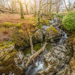
Pont Allen & Afon Colwyn, Beddgelert, North Wales 🏴
#beddgelert #afoncolwyn #dronephotography #aerialphotography #drone

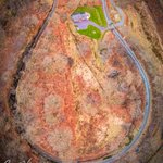
🚂 Beddgelert Loop, Welsh Highland Railway, North Wales 🏴
#beddgelert #welshhighlandrailway #drone #aerialphotography #dronephotography

🌊 Llanfairfechan, North Wales 🏴
#llanfairfechan #wales #drone #dronephotography #aerialphotography

🌉 Three Bridges of Conwy, North Wales 🏴
#conwy #bridges #aerialphotography #dronephotography #wales


🏘️ Llanfairfechan, North Wales 🏴
#llanfairfechan #wales #drone #dronephotography #aerialphotography

🏰 Conwy Castle, North Wales 🏴
#conwycastle #castle #dronephotography #aerialphotography #wales

🏰 Rhuddlan Castle, North Wales 🏴
#aerialphotography #dronephotography #wales #rhuddlancastle #castle

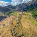
🌿 Afon Hendre & Cwm Glas Crafnant, Parc Cenedlaethol Eryri / Snowdonia National Park 🏴
#llyncrafnant #dronephotography #aerialphotography #drone #cwmglascrafnant


🏰 Rhuddlan Castle, North Wales 🏴
#aerialphotography #dronephotography #wales #rhuddlancastle #castle


🏰 Conwy Castle, North Wales 🏴
#conwycastle #castle #dronephotography #aerialphotography #wales

⚽️ New 3G sports pitch nearing completion, Penrhyn Bay, North Wales 🏴
#construction #3Gpitch #dronephotography #aerialphotography #sport

🎣 Llyn Crafnant, Parc Cenedlaethol Eryri / Snowdonia National Park 🏴
#llyncrafnant #dronephotography #aerialphotography #drone #snowdonia

🌼 Dydd Gŵyl Dewi Hapus! Happy St David’s Day! 🏴
📸 Whitesands Bay / Porth-mawr, Ramsey Island and St David’s Head / Penmaen Dewi, Pembrokeshire, Wales 🏴
#pembrokeshire #dronephotography #aerialphotography #stdavidsday #drone

🏘️ Construction of Parc Bodafon, Llandudno 🏴
⏳ 2023 -2026 🗓️
#timelapse #aerialphotography #dronephotography #drone #construction
🔍 Another roof condition survey complete! ✅
#droneservices #aerialinspection #dronesurvey #aerialphotography #drone


⏳It’s approaching 4 years since our involvement with the North Wales Wildlife Trust to provide aerial mapping services for the Cors-y-Sarnau Nature Reserve and the Interreg Care-Peat initiative… 🌱
🧵 1/3


🗺️ Our high resolution orthomosaic map of the site provided rapid and cost-efficient identification of ground features, and photogrammetric Digital Surface Model closely approximated the ground surface in areas where vegetation had been cleared…
2/3
proving critical for understanding the hydrology of the site, and the cross-cutting relationship between ditches and subtle variations in their elevation. This directly informed the restoration plan for the site ✅
👀 Read the project report here: vb.nweurope.eu/media/21503/c…
3/3