Geospatial Developer • GISP • PhD Researcher 🌎🛰️🗺️Research: Urban Climate Modeling w/ Spatially Aware ML Married 🗣️ DE/EN/ES/FR/IT
North Carolina
Joined April 2022
- Tweets2.8K
- Following335
- Followers1.6K
- Likes3.3K


Geography with Justin retweeted

#CopernicusSanta 🇪🇺🛰️ gifts are coming❗️
Punta del este🇺🇾 as seen by #Sentinel2
Special #HolidaySeason present 🎁 for @GeoWithJustin

Geography with Justin retweeted

It's #FreeMapMonday! Re-tweet and follow us for a chance to win the map Arches National Park, UT #USGSStore (U.S. residents only)

Geography with Justin retweeted

Thank you for sharing, @GeoWithJustin .
And here is a real administrative anomaly inside the River Plate. ⬇️
xitter.cf/Pillandia/status/15494…

Martín García Island, in the Río de la Plata, is in Uruguayan waters but in 1973 Uruguay and Argentina reached an agreement establishing Martín García as Argentine territory and a nature reserve.
Accessible by air only.
Location: 34°10′57″S 58°15′00″W.
pillandia.blogspot.com/searc…


Geography with Justin retweeted

It's map o'clock! 🗺️📍 #CartoMOOC opening day is here. Get ready to create #maps and have fun along the way. 🔁 #Retweet if you're joining the course. esri.social/Tc3n50MYP4U
Geography with Justin retweeted
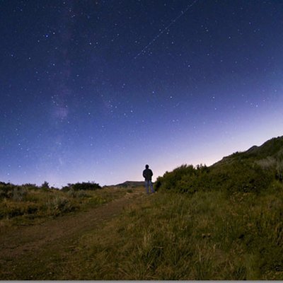
This requires you to be a nerd, but yet...
[source: buff.ly/3HetHb9]
#SaturdayFun

Geography with Justin retweeted

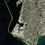
The capital of Uruguay from space - Montevideo 🛰️
Montevideo is the southernmost capital city in the Americas and is known for its beaches – visible east of the city. The Rambla of Montevideo, the city’s famous promenade, stretches for 27 km along the coast 🌊

ALT Montevideo from space. The coastal city is visible in white, surrounded by green spaces to the north. The long promenade is in bright white on the right side of the image.


Geography with Justin retweeted

En este antiguo mapa conocido extarido del "Islario General de todas las islas del mundo", creado por el cosmógrafo Alonso de Santa Cruz en siglo XVI, se ve gran parte de la cuenca del Plata que incluye a todo el actual territorio de la actual República Oriental del #Uruguay 🇺🇾.

Geography with Justin retweeted

When will fall foliage peak in your area this year? Check out this animated map and explanation from @NPR to see how autumn color will likely vary across time and space: ow.ly/eclJ50KN3gf

Geography with Justin retweeted
Esta semana está dedicada a #Uruguay. 🇺🇾
¿Sabías qué el nombre oficial de esta nación República Oriental del Uruguay? 💬
En esta ficha te presentamos otros datos importantes de este país, uno de los Estados Miembros del #IPGH.
“La #CienciaAlServicio de la Paz”. 🌐

Geography with Justin retweeted

The USGS Landsat Program is 50! The National Land Imaging Program provides satellite imagery and remotely sensed and geospatial data (with @NASA). Landsat Fact Sheets were developed for all 50 states. The North Carolina fact sheet is available at: ow.ly/XXns50KLYAb.

Geography with Justin retweeted

California has remarkable geographic diversity. Mount Whitney, the highest peak in the conterminous US, stands at 14,494 feet above sea level. Death Valley’s Badwater Basin boasts the lowest point: 282 feet below sea level.
Download it here🌐ow.ly/8uxZ50Ky1z2

Geography with Justin retweeted
It's #FreeMapMonday! Re-tweet and follow us for a chance to win the Satellite map of Great Salt Lake and Vicinity!
#USGSStore (U.S. residents only)


Geography with Justin retweeted
It's #FreeMapMonday! Re-tweet and follow us for a chance to win the map of earthquakes in Utah from 1884-1989!
#USGSStore (U.S. residents only)

Geography with Justin retweeted
It's #FreeMapMonday! Re-tweet and follow us for a chance to win A World Seismicity Poster, 1979-1988 map!
#USGSStore (U.S. residents only)