

https://teapawt.net/t.co/VIgmCwLi0Z 3D laser Scanning, 3D Modelling, Reverse Engineering, Virtual Reality & Drone Services. Consulting Happy Customers Since 2010
Dubai - UAE
Joined January 2014
- Tweets75
- Following32
- Followers25
- Likes1
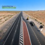






GEOTECH 3D supported a 104 km railway corridor with advanced geospatial surveying and mapping solutions.
#GEOTECH3D #Geospatial #UAV #Surveying #UAENA
🤖 Made with AI


From reality to immersive experiences.
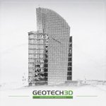
GEOTECH3D delivered the precise digital foundation for Facade Projection Mapping using 3D Laser Scanning and Drone Photogrammetry.
#GEOTECH3D #ProjectionMapping #3DScanning #PointCloud #RealityCapture #DroneSurvey #Engineering
🤖 Made with AI


GEOTECH3D uses advanced 3D laser scanning to detect deviations, improve accuracy, reduce risks, and support smarter engineering decisions.
#3DScanning #LaserScanning #Engineering #DigitalTwin #PointCloud #GEOTECH3D #IndustrialInspection
🤖 Made with AI


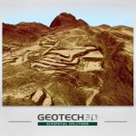
Turning geospatial data into smarter decisions. GEOTECH 3D combines Drone Surveys, Satellite Imagery, DTM, DSM, and GIS analysis to reveal what lies beyond the surface and support better planning from day one.
#GEOTECH3D #GIS #DroneSurvey #SatelliteImagery #DTM #DSM #Geospatial
🤖 Made with AI

Every building tells a hidden story.
GEOTECH 3D uses advanced 3D Laser Scanning to create accurate Point Clouds and intelligent BIM Models, helping clients make smarter decisions for renovation, asset management, and future planning.
#Geotech3D #3DScanning #BIM #PointCloud
🤖 Made with AI


create any number of end products: point clouds, 3D models, line drawings, fly through visualizations – really, the possibilities are endless.
👉🏻Visit our website with just a click below!
🌐geotech3d.com/
#geospatial #3dmodeling #datacollection #UAE #geotech3d

Throughout the AEC industry, point clouds are very commonplace as a fast and accurate way to collect data about present site requirements. Here is a look at point clouds that are altering the way we design projects.
#CAD #pointCloud #mesh #geotech3d #AEC
geotech3d.com/post/a-closer-…
When your data determines a project's success, you need to use your hardware and simple software to match the most reliable, precise, and accurate measurements.
geotech3d.com/post/why-and-w…
#laserscanning #geospatial #3D #UAE #geotech3d
Smart cities still feel like a futuristic concept, yet the puzzle is coming together. Today we'll look at how #3D modeling #technologies and 3D maps play an increasingly important role in harnessing smart city potentials
geotech3d.com/post/mobile-ma…
#SmartCity #mapping #3dmodeling
In this article, we're discussing the difference and advantages of True Ortho Photo and the traditional Orthophoto surveys, read more on geospatial magazine
#geotech3d #surveys #drones #photogrammetry #UAE #Engineering
geotech3d.com/post/introduct…
A brief introduction to the Normalized Difference Vegetation Index (NDVI), its uses and calculations in agriculture and biomass measurements, learn more on Geospatial Magazine ->
geotech3d.com/post/precision…
#ndvi #agritech #geospatial #surveying #dronephotogrammetry
Impressive engineering and technology solutions allow more space for creativity & business, stay tuned with the latest trends & updates
Subscribe to Geospatial Magazine on geotech3d.com/blog
#engineering #innovation #business #geospatial #newsletter #trends
In this article, we discuss the applications of Digital Twinning and how Digital twins let experts work on projects even when they are not through direct contact with a physical twin to assure the safety of well-being without the risk of a tragedy.
geotech3d.com/post/introduct…

Below we review the BIM concept, how it works, and the Future of #bimmodeling in the #AEC Industry.
Tips for ensuring highly efficient and collaborative #planning, #design, and #construction of buildings.
#BIM #GeoSpatial #Dubai #UAE
geotech3d.com/post/intro-to-…
A DECADE OF ENGINEERING EXCELLENCE - #anniversary
Big thanks to our clients and partners around the world, special thanks to our dedicated team, and a huge appreciation to our management efforts lead by our lead engineer and founder @walidelhajj9 💙
#Engineering #MENA #UAE

ALT A decade of engineering excellence - GEOTECH3D - Geospatial engineering - UAE & MENA
Back to office , taking maximum safety procedures is our aim ,
Today we installed the shieldme sterilization station , 1 step for us and our client when accessing office to measure temperature and sanitize hands . Because we care ...
Well done shieldme…lnkd.in/dUkX4wc

Thermal Inspection is our thing, however, using Drones and Flir for buildings and oil fields.
This latest installation in our offices is part of our continuous efforts for a safe work environment for our precious team. Shout out to @SHIELDme_
#stay_safe #thermal_inspection
