

Official Twitter account of the Grayson County Office of Emergency Management serving the people of Grayson County and its sixteen cities
- Tweets10.3K
- Following652
- Followers4K
- Likes1.2K


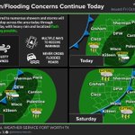

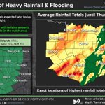
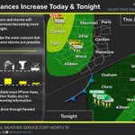
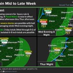


ALT A Wind Advisory has been issued for all of North and Central Texas for Friday. Following the passage of a strong cold front tonight and tomorrow, sustained winds will reach 20 to 30 mph, with gusts up to 45 mph during the day Friday. Please take precautions to secure outdoor items such as lawn furniture, decorations, and other lightweight objects, and exercise extra caution when boating on area lakes.


ALT Protect your little one. Time for a car seat check. Visit LoveMyCarSeat.org

ALT Este gráfico muestra la localización en el mapa de un aviso de tormenta severa. El aviso estará en efecto hasta las 11:00 PM CDT. El aviso incluye a Denison TX, Hendrix OK. El aviso incluye el noreste del condado de Grayson en el norte centro de Texas. Las amenazas asociadas a este aviso son: ráfagas de viento de 60 MPH y granizo del tamaño de una moneda de veinticinco centavos. Hay 30,019 personas bajo este aviso incluyendo 13 escuelas y 3 hospitales.

ALT This graphic displays a severe thunderstorm warning plotted on a map. The warning is in effect until 11:00 PM CDT. The warning includes Denison TX and Hendrix OK. This warning is for Northeastern Grayson County in north central Texas. The threats associated with this warning are wind gusts up to 60 MPH and quarter sized hail. There are 30,019 people in the warning along with 13 schools and 3 hospitals.



ALT This graphic displays a special weather statement plotted on a map. The statement is in effect until 10:30 PM CDT. The statement includes Denison TX and Pottsboro TX. A strong thunderstorm will impact portions of northeastern Grayson County through 1030 PM CDT. The threats associated with this storm are wind gusts up to 40 MPH and half inch sized hail. Seek shelter in a sturdy structure until the storm passes.

ALT This graphic displays a special weather statement plotted on a map. The statement is in effect until 8:45 PM CDT. The statement includes Sherwood Shores TX, Gordonville TX and Dexter TX. A strong thunderstorm will impact portions of northeastern Cooke and northwestern Grayson Counties through 845 PM CDT. The threats associated with this storm are wind gusts up to 40 MPH and half inch sized hail. Seek shelter in a sturdy structure until the storm passes.

ALT This graphic displays a special weather statement plotted on a map. The statement is in effect until 6:30 PM CDT. The statement includes Gainesville TX, Celina TX and Pilot Point TX. A strong thunderstorm will impact portions of northeastern Denton, northwestern Collin and southeastern Cooke and southwestern Grayson Counties through 630 PM CDT. The threats associated with this storm are wind gusts up to 50 MPH and penny sized hail. Seek shelter in a sturdy structure until the storm passes.


ALT This graphic displays a special weather statement plotted on a map. The statement is in effect until 8:00 PM CDT. The statement includes Sherman TX, Denison TX and Bonham TX. Strong thunderstorms will impact portions of eastern Grayson and Fannin Counties through 800 PM CDT. The threats associated with this storm are wind gusts up to 40 MPH and pea sized hail. Seek shelter in a sturdy structure until the storm passes.

ALT This graphic displays a severe thunderstorm warning plotted on a map. The warning is in effect until 7:15 PM CDT. The warning includes Sherman TX, Denison TX and Howe TX. This warning is for Southeastern Grayson County in north central Texas and Northwestern Fannin County in north central Texas. The threats associated with this warning are wind gusts up to 60 MPH and quarter sized hail. There are 84,030 people in the warning along with 35 schools and 5 hospitals.

ALT This graphic displays a flash flood warning plotted on a map. The warning is in effect until 8:45 PM CDT. The warning includes Sherman TX, Denison TX and Pottsboro TX. This warning is for Central Grayson County in north central Texas. Avoid walking or driving through flood waters! Move immediately to higher ground! There are 85,292 people in the warning along with 32 schools and 5 hospitals.

ALT This graphic displays a severe thunderstorm warning plotted on a map. The warning is in effect until 6:30 PM CDT. The warning includes Sherman TX, Denison TX and Knollwood TX. This warning is for Northeastern Grayson County in north central Texas. The threats associated with this warning are wind gusts up to 60 MPH and pea sized hail. There are 84,694 people in the warning along with 31 schools and 5 hospitals.

ALT This graphic displays a special weather statement plotted on a map. The statement is in effect until 6:00 PM CDT. The statement includes Sherman TX, Denison TX and Pottsboro TX. A strong thunderstorm will impact portions of northeastern Grayson County through 600 PM CDT. The threats associated with this storm are wind gusts up to 40 MPH and pea sized hail. Seek shelter in a sturdy structure until the storm passes.