

I track and document hurricanes in the Atlantic basin.
Asheville, North Carolina
Joined October 2018
- Tweets7K
- Following1.3K
- Followers2.3K
- Likes28.8K


Pinned Tweet
Scientists at the National Center for Atmospheric Research have confirmed that a dropsonde deployed into Hurricane Melissa, as it was closing in on Jamaica, officially recorded an astonishing 252 mph wind gust, the highest ever recorded in a tropical cyclone.

21 years ago today. The landfall that capped a very impactful, historic season.

October 24, 2005:
Hurricane Wilma struck Florida as a Category 3. The storm was the fifth hurricane to make landfall in the US during 2005 and was the last major hurricane to hit America until 2017's Harvey. $21 billion in damage was produced & 30 people were killed.
#wxhistory


Jason Randolph retweeted

The generational Pacific Hurricane Season continues, as it has now eclipse an incredible 350 units of ACE. This season has shattered the previous record of 318 units.
VANCE also makes 2026 tied with 2015 for the most major hurricanes in a single season (at 11). It might be a very long time before we see a season like this again.


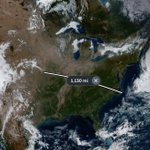
Today, you could travel well over a thousand miles, cross six or more states, and not encounter even one cloud!

Incredible Super Typhoon Champi has winds of 185 mph, 895 mb pressure. This nearing the upper limit of how powerful tropical cyclones can get. Beautiful structure!
Super Typhoon Champi continues to intensify as it pulls away from Guam. Enhanced infrared satellite imagery captures the nearly perfectly circular CDO of the powerful cyclone.
Typhoon Champi appears to miss Guam, with an eyewall pass just to the south of the island. Even in intense hurricanes/typhoons, all of the extreme winds are confined to the eyewall. They lucked out. There was a huge north wobble hours ago which put the island in crosshairs, briefly.
Hurricane Simon. This thing just needs to dissipate soon. I don’t know what it’s doing. NHC doesn’t know what it’s doing. It doesn’t know what it’s doing. And it’s too small! What a weird storm lol.
Isaias was one of the louder hurricanes I've been in. Lots of popping, howling, and [power pole transformer] explosions.

Jason Randolph retweeted

THEORY THREAD | What happened in Pensacola, Florida during Hurricane #Isaias.
The strongest winds in a tropical cyclone is typically seen in the NE Quadrant of the cyclone. However, Isaias strongest winds near landfall occurred in the NW & SW quadrants. So what happened?


The seas are angry tonight as Major Hurricane Isaias draws closer to landfall! This was 30 mins ago at Navarre Beach.
This is not good for the Helene-damaged areas.

A MODERATE risk is in effect in our Day 2 Excessive Rainfall Outlook. More details: wpc.ncep.noaa.gov/qpf/excess…
