

Delivering innovations in remote sensing applications. Our mission - Evolve the science, business and technology of applied geospatial analytics.
Joined July 2019
- Tweets5.4K
- Following0
- Followers118
- Likes3





Pinned Tweet
We have liftoff! OPTICA was successfully launched onboard NG-24 Cygnus XL, the ‘S.S. Steven R. Nagel’, on a SpaceX Falcon 9 rocket from Cape Canaveral on April 11, 2026 at 7:41am EDT. @HySpeedGeo @metaspectral_ @voyagertech_ @ISS_CASIS


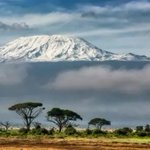
20 years of trend maps reveal a surprising picture of climate change on Kilimanjaro #satellitedata #earthobservation #climatechange #kilimanjaro
port.ac.uk/news-events-and-b…

Clark-led data analysis reveals 70% of U.S. forest loss concentrated in just 11 states @ClarkUniversity #satellitedata #geospatial #deforestation
clarku.edu/news/2026/10/29/c…

EU Space Market Report 2026: planning Europe’s blue economy #satellitedata #earthobservation #oceanscience #aquaculture #blueeconomy
euspa.europa.eu/newsroom-eve…

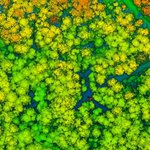
Frames of reference: how LiDAR helps us see both the forest and the trees @TERN_Aus #remotesensing #lidar #forest #vegetation
tern.org.au/news/frames-of-r…

Before and After the Fire: What NEON Data Reveal About Wildfires and Forest Recovery @NEON_sci #remotesensing #opendata #wildfire #lidar #hyperspectral
neonscience.org/impact/obser…

From satellite to soil: space innovation for smarter farming #satellitedata #earthobservation #agriculture #farming
euspa.europa.eu/newsroom-eve…

Beyond tree cover: mapping the world’s forest types @GoogleDeepMind #satellitedata #earthobservation #artificialintelligence #forest
deepmind.google/blog/beyond-…

CubeSat achieves challenging laser link to ground @esa #satellitedata #earthobservation #opticalcommunication
esa.int/Applications/Connect…

A Decade of Carbon Dioxide Data from Space Gets an Upgrade #satellitedata #earthobservation #carbondioxide #carboncycle #climatescience
eos.org/research-spotlights/…

A New Physics-informed AI Tool Aims to Predict Wildfire Spread in Real Time and Assist Wildfire Response #remotesensing #geoai #wildfire #digitaltwin
engineering.nyu.edu/news/new…

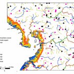
NASA Funding Helps Virginia Assess Oyster Loss From Recent Algae Bloom #satellitedata #earthobservation #aquaculture #oysters #harmfulalgalblooms
science.nasa.gov/blogs/scien…

USF combines AI-powered mapping and community outreach to fight dengue @USFNews #satellitedata #earthobservation #publichealth #dengue #mosquito
usf.edu/news/2026/usf-combin…

Connecting NOAA Satellite Data to the People Who Use It @NOAASatellites #satellitedata #earthobservation #operationalworkflows #decisionmaking
nesdis.noaa.gov/news/connect…

A City Doesn’t Grow at One Speed #satellitedata #earthobservation #landsat #sentinel2 #urbanization
science.nasa.gov/mission/lan…

Cities’ Infrastructure Grows More Slowly Than Their Populations Do @nyuniversity #satellitedata #earthobservation #urbangrowth
nyu.edu/about/news-publicati…

Supporting Long-Term Data Quality for the NCEO Airborne Earth Observatory #remotesensing #earthobservation #calibration
neodaas.ac.uk/news/supportin…

NASA, USDA Sign Agreement Advancing Earth Science, Agriculture #satellitedata #earthobservation #geospatial #agriculture
nasa.gov/news-release/nasa-u…

Researchers create new database to track origins of water from space @RiceUniversity #satellitedata #remotesensing #watercycle
news.rice.edu/news/2026/rese…

CU Boulder professor co-chairing major National Academies study for NASA @CUBoulder #satellitedata #earthobservation #earthscience
colorado.edu/aerospace/cu-bo…

How a Florida State University researcher uses AI to track hidden health risks from red tide @FloridaState #satellitedata #earthobservation #hyperspectral #redtide
news.fsu.edu/news/expert-pit…
