

Saskatchewan's independent and community-driven weather organization. Providing context to severe weather. Download our app: https://teapawt.net/t.co/4NLYRYIuv1
Saskatchewan, Canada
Joined July 2013
- Tweets16.5K
- Following103
- Followers4K
- Likes161


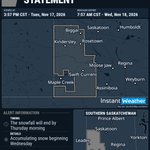


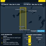
#skstorm 4:47a SNOWFALL WARNING (YELLOW LEVEL) UPDATED by Environment Canada
(Locations listed below description)
Snowfall, with total amounts of 10 to 15 cm is expected.
Snow at times heavy is expected over the Cypress Hills today. Total accumulations will approach 15 cm over the higher terrain. The snow will taper off overnight into Thursday.
Travel will likely be challenging. Road closures are possible.
Snowfall warnings are issued when significant impacts are expected due to snowfall accumulations.
Please continue to monitor alerts and forecasts issued by Environment Canada. To report severe weather, send an email to [email protected], call 1-800-239-0484 or post reports on social media using #SKStorm.
UPDATED:
- R.M. of Arlington including Dollard
- R.M. of Carmichael including Carmichael
- R.M. of Maple Creek including Cypress Hills Prov. Park
- R.M. of Maple Creek including Maple Creek
- R.M. of Piapot including Piapot
- R.M. of White Valley including Eastend and Ravenscrag

73
#skstorm 4:44a SPECIAL WEATHER STATEMENT ENDED by Environment Canada
ENDED:
- R.M. of Antelope Park including Loverna and Hoosier
- R.M. of Auvergne including Ponteix and Aneroid
- R.M. of Big Stick including Golden Prairie
- R.M. of Biggar including Biggar and Springwater
- R.M. of Bone Creek including Simmie and Scotsguard
- R.M. of Canaan including Lucky Lake
- R.M. of Chesterfield including Eatonia and Mantario
- R.M. of Clinworth including Sceptre Lemsford and Portreeve
- R.M. of Coulee including Neidpath and McMahon
- R.M. of Deer Forks including Burstall and Estuary
- R.M. of Enterprise including Richmound
- R.M. of Excelsior including Waldeck Rush Lake and Main Centre
- R.M. of Eye Hill including Macklin Denzil and Evesham
- R.M. of Fox Valley including Fox Valley
- R.M. of Frontier including Frontier and Claydon
- R.M. of Glen Bain including Glen Bain
- R.M. of Glen McPherson west of Mankota
- R.M. of Grandview including Handel and Kelfield
- R.M. of Grass Lake including Salvador and Reward
- R.M. of Grassy Creek including Shaunavon
- R.M. of Gull Lake including Gull Lake and Tompkins
- R.M. of Happyland including Leader Prelate and Mendham
- R.M. of Heart's Hill including Cactus Lake
- R.M. of Kindersley including Kindersley Brock and Flaxcombe
- R.M. of Lac Pelletier including Blumenhof
- R.M. of Lacadena including Kyle Tyner and Sanctuary
- R.M. of Lawtonia including Hodgeville
- R.M. of Lone Tree including Climax and Bracken
- R.M. of Mankota including Mankota and Ferland
- R.M. of Mariposa including Tramping Lake and Broadacres
- R.M. of Marriott south of Biggar
- R.M. of Milton including Alsask and Marengo
- R.M. of Miry Creek including Abbey Lancer and Shackleton
- R.M. of Monet including Elrose Wartime and Forgan
- R.M. of Morse including Herbert Morse Ernfold and Gouldtown
- R.M. of Mountain View including Herschel and Stranraer
- R.M. of Newcombe including Glidden and Madison
- R.M. of Oakdale including Coleville
- R.M. of Pinto Creek including Kincaid and Hazenmore
- R.M. of Pittville including Hazlet
- R.M. of Pleasant Valley including McGee and Fiske
- R.M. of Prairiedale including Major and Smiley
- R.M. of Progress including Kerrobert and Luseland
- R.M. of Reford including Wilkie Landis and Leipzig
- R.M. of Reno including Consul Robsart and Willow Creek
- R.M. of Riverside including Cabri Pennant and Success
- R.M. of Rosemount including Cando and Traynor
- R.M. of Saskatchewan Landing including Stewart Valley
- R.M. of Snipe Lake including Eston and Plato
- R.M. of St Andrews including Rosetown and Zealandia
- R.M. of Swift Current including Swift Current and Wymark
- R.M. of Tramping Lake including Scott and Revenue
- R.M. of Val Marie including Val Marie Orkney and Monchy
- R.M. of Victory including Beechy
- R.M. of Webb including Webb and Antelope lake
- R.M. of Whiska Creek including Vanguard Neville and Pambrun
- R.M. of Winslow including Dodsland and Plenty
- R.M. of Wise Creek including Cadillac and Admiral

76
#skstorm 3:57p SPECIAL WEATHER STATEMENT ENDED by Environment Canada
ENDED:
- R.M. of Arlington including Dollard
- R.M. of Carmichael including Carmichael
- R.M. of Maple Creek including Cypress Hills Prov. Park
- R.M. of Maple Creek including Maple Creek
- R.M. of Piapot including Piapot
- R.M. of White Valley including Eastend and Ravenscrag

184
#skstorm 3:57p SPECIAL WEATHER STATEMENT UPDATED by Environment Canada
(Locations listed below description)
Accumulating snow beginning Wednesday.
The first significant snowfall of the season is expected for southwest Saskatchewan.
A low-pressure system will bring an area of precipitation to southwestern Saskatchewan beginning this evening. The precipitation will likely begin as rain, but will slowly change over to snow or a rain/snow mix tonight as it spreads eastward. Total snowfall accumulations are expected to be in the 5 to 15 cm range for most areas. The snow will be heavy at times on Wednesday before slowly tapering off through Wednesday night.
The snowfall will end by Thursday morning.
Please continue to monitor alerts and forecasts issued by Environment Canada. To report severe weather, send an email to [email protected], call 1-800-239-0484 or post reports on social media using #SKStorm.
UPDATED:
- R.M. of Antelope Park including Loverna and Hoosier
- R.M. of Auvergne including Ponteix and Aneroid
- R.M. of Big Stick including Golden Prairie
- R.M. of Biggar including Biggar and Springwater
- R.M. of Bone Creek including Simmie and Scotsguard
- R.M. of Canaan including Lucky Lake
- R.M. of Chesterfield including Eatonia and Mantario
- R.M. of Clinworth including Sceptre Lemsford and Portreeve
- R.M. of Coulee including Neidpath and McMahon
- R.M. of Deer Forks including Burstall and Estuary
- R.M. of Enterprise including Richmound
- R.M. of Excelsior including Waldeck Rush Lake and Main Centre
- R.M. of Eye Hill including Macklin Denzil and Evesham
- R.M. of Fox Valley including Fox Valley
- R.M. of Frontier including Frontier and Claydon
- R.M. of Glen Bain including Glen Bain
- R.M. of Glen McPherson west of Mankota
- R.M. of Grandview including Handel and Kelfield
- R.M. of Grass Lake including Salvador and Reward
- R.M. of Grassy Creek including Shaunavon
- R.M. of Gull Lake including Gull Lake and Tompkins
- R.M. of Happyland including Leader Prelate and Mendham
- R.M. of Heart's Hill including Cactus Lake
- R.M. of Kindersley including Kindersley Brock and Flaxcombe
- R.M. of Lac Pelletier including Blumenhof
- R.M. of Lacadena including Kyle Tyner and Sanctuary
- R.M. of Lawtonia including Hodgeville
- R.M. of Lone Tree including Climax and Bracken
- R.M. of Mankota including Mankota and Ferland
- R.M. of Mariposa including Tramping Lake and Broadacres
- R.M. of Marriott south of Biggar
- R.M. of Milton including Alsask and Marengo
- R.M. of Miry Creek including Abbey Lancer and Shackleton
- R.M. of Monet including Elrose Wartime and Forgan
- R.M. of Morse including Herbert Morse Ernfold and Gouldtown
- R.M. of Mountain View including Herschel and Stranraer
- R.M. of Newcombe including Glidden and Madison
- R.M. of Oakdale including Coleville
- R.M. of Pinto Creek including Kincaid and Hazenmore
- R.M. of Pittville including Hazlet
- R.M. of Pleasant Valley including McGee and Fiske
- R.M. of Prairiedale including Major and Smiley
- R.M. of Progress including Kerrobert and Luseland
- R.M. of Reford including Wilkie Landis and Leipzig
- R.M. of Reno including Consul Robsart and Willow Creek
- R.M. of Riverside including Cabri Pennant and Success
- R.M. of Rosemount including Cando and Traynor
- R.M. of Saskatchewan Landing including Stewart Valley
- R.M. of Snipe Lake including Eston and Plato
- R.M. of St Andrews including Rosetown and Zealandia
- R.M. of Swift Current including Swift Current and Wymark
- R.M. of Tramping Lake including Scott and Revenue
- R.M. of Val Marie including Val Marie Orkney and Monchy
- R.M. of Victory including Beechy
- R.M. of Webb including Webb and Antelope lake
- R.M. of Whiska Creek including Vanguard Neville and Pambrun
- R.M. of Winslow including Dodsland and Plenty
- R.M. of Wise Creek including Cadillac and Admiral

173
#skstorm 3:54p SNOWFALL WARNING (YELLOW LEVEL) ISSUED by Environment Canada
(Locations listed below description)
Snowfall, with total amounts of 10 to 15 cm is expected.
Snow is expected to develop overnight tonight over the Cypress Hills, becoming heavy at times on Wednesday.
Time span: overnight until Wednesday night.
Remark: Precipitation may start as rain or a rain/snow mix before transitioning over to snow.
Travel will likely be challenging. Road closures are possible.
Snowfall warnings are issued when significant impacts are expected due to snowfall accumulations.
Please continue to monitor alerts and forecasts issued by Environment Canada. To report severe weather, send an email to [email protected], call 1-800-239-0484 or post reports on social media using #SKStorm.
NEW:
- R.M. of Arlington including Dollard
- R.M. of Carmichael including Carmichael
- R.M. of Maple Creek including Cypress Hills Prov. Park
- R.M. of Maple Creek including Maple Creek
- R.M. of Piapot including Piapot
- R.M. of White Valley including Eastend and Ravenscrag

231
#skstorm 8:46a SPECIAL WEATHER STATEMENT UPDATED by Environment Canada
(Locations listed below description)
Accumulating snow beginning Wednesday.
The first significant snowfall of the season is expected for southwest Saskatchewan.
A low-pressure system will bring an area of precipitation to southwestern Saskatchewan beginning this evening. The precipitation will likely begin as rain, but will slowly change over to snow or a rain/snow mix tonight as it spreads eastward. Total snowfall accumulations are expected to be in the 5 to 15 cm range for most areas. The Cypress Hills area may see higher amounts. The snow will be heavy at times on Wednesday before slowly tapering off through Wednesday night.
The snowfall will end by Thursday morning.
Please continue to monitor alerts and forecasts issued by Environment Canada. To report severe weather, send an email to [email protected], call 1-800-239-0484 or post reports on social media using #SKStorm.
UPDATED:
- R.M. of Antelope Park including Loverna and Hoosier
- R.M. of Arlington including Dollard
- R.M. of Auvergne including Ponteix and Aneroid
- R.M. of Big Stick including Golden Prairie
- R.M. of Biggar including Biggar and Springwater
- R.M. of Bone Creek including Simmie and Scotsguard
- R.M. of Canaan including Lucky Lake
- R.M. of Carmichael including Carmichael
- R.M. of Chesterfield including Eatonia and Mantario
- R.M. of Clinworth including Sceptre Lemsford and Portreeve
- R.M. of Coulee including Neidpath and McMahon
- R.M. of Deer Forks including Burstall and Estuary
- R.M. of Enterprise including Richmound
- R.M. of Excelsior including Waldeck Rush Lake and Main Centre
- R.M. of Eye Hill including Macklin Denzil and Evesham
- R.M. of Fox Valley including Fox Valley
- R.M. of Frontier including Frontier and Claydon
- R.M. of Glen Bain including Glen Bain
- R.M. of Glen McPherson west of Mankota
- R.M. of Grandview including Handel and Kelfield
- R.M. of Grass Lake including Salvador and Reward
- R.M. of Grassy Creek including Shaunavon
- R.M. of Gull Lake including Gull Lake and Tompkins
- R.M. of Happyland including Leader Prelate and Mendham
- R.M. of Heart's Hill including Cactus Lake
- R.M. of Kindersley including Kindersley Brock and Flaxcombe
- R.M. of Lac Pelletier including Blumenhof
- R.M. of Lacadena including Kyle Tyner and Sanctuary
- R.M. of Lawtonia including Hodgeville
- R.M. of Lone Tree including Climax and Bracken
- R.M. of Mankota including Mankota and Ferland
- R.M. of Maple Creek including Cypress Hills Prov. Park
- R.M. of Maple Creek including Maple Creek
- R.M. of Mariposa including Tramping Lake and Broadacres
- R.M. of Marriott south of Biggar
- R.M. of Milton including Alsask and Marengo
- R.M. of Miry Creek including Abbey Lancer and Shackleton
- R.M. of Monet including Elrose Wartime and Forgan
- R.M. of Morse including Herbert Morse Ernfold and Gouldtown
- R.M. of Mountain View including Herschel and Stranraer
- R.M. of Newcombe including Glidden and Madison
- R.M. of Oakdale including Coleville
- R.M. of Piapot including Piapot
- R.M. of Pinto Creek including Kincaid and Hazenmore
- R.M. of Pittville including Hazlet
- R.M. of Pleasant Valley including McGee and Fiske
- R.M. of Prairiedale including Major and Smiley
- R.M. of Progress including Kerrobert and Luseland
- R.M. of Reford including Wilkie Landis and Leipzig
- R.M. of Reno including Consul Robsart and Willow Creek
- R.M. of Riverside including Cabri Pennant and Success
- R.M. of Rosemount including Cando and Traynor
- R.M. of Saskatchewan Landing including Stewart Valley
- R.M. of Snipe Lake including Eston and Plato
- R.M. of St Andrews including Rosetown and Zealandia
- R.M. of Swift Current including Swift Current and Wymark
- R.M. of Tramping Lake including Scott and Revenue
- R.M. of Val Marie including Val Marie Orkney and Monchy
- R.M. of Victory including Beechy
- R.M. of Webb including Webb and Antelope lake
- R.M. of Whiska Creek including Vanguard Neville and Pambrun
- R.M. of White Valley including Eastend and Ravenscrag
- R.M. of Winslow including Dodsland and Plenty
- R.M. of Wise Creek including Cadillac and Admiral

385
#skstorm 4:54a SPECIAL WEATHER STATEMENT ISSUED by Environment Canada
(Locations listed below description)
Accumulating snow beginning Wednesday.
The first significant snowfall of the season is expected for southwest Saskatchewan.
A low-pressure system will bring an area of precipitation to southwestern Saskatchewan beginning Tuesday evening. This precipitation will likely begin as rain, but will slowly change over to snow or a rain/snow mix Tuesday night as it spreads eastward. Total snowfall accumulations are expected to be in the 5 to 15 cm range for most areas. The Cypress Hills area may see higher amounts. The snow will be heavy at times on Wednesday before slowly tapering off through Wednesday night.
The snowfall will end by Thursday morning.
Please continue to monitor alerts and forecasts issued by Environment Canada. To report severe weather, send an email to [email protected], call 1-800-239-0484 or post reports on social media using #SKStorm.
NEW:
- R.M. of Antelope Park including Loverna and Hoosier
- R.M. of Arlington including Dollard
- R.M. of Auvergne including Ponteix and Aneroid
- R.M. of Big Stick including Golden Prairie
- R.M. of Biggar including Biggar and Springwater
- R.M. of Bone Creek including Simmie and Scotsguard
- R.M. of Canaan including Lucky Lake
- R.M. of Carmichael including Carmichael
- R.M. of Chesterfield including Eatonia and Mantario
- R.M. of Clinworth including Sceptre Lemsford and Portreeve
- R.M. of Coulee including Neidpath and McMahon
- R.M. of Deer Forks including Burstall and Estuary
- R.M. of Enterprise including Richmound
- R.M. of Excelsior including Waldeck Rush Lake and Main Centre
- R.M. of Eye Hill including Macklin Denzil and Evesham
- R.M. of Fox Valley including Fox Valley
- R.M. of Frontier including Frontier and Claydon
- R.M. of Glen Bain including Glen Bain
- R.M. of Glen McPherson west of Mankota
- R.M. of Grandview including Handel and Kelfield
- R.M. of Grass Lake including Salvador and Reward
- R.M. of Grassy Creek including Shaunavon
- R.M. of Gull Lake including Gull Lake and Tompkins
- R.M. of Happyland including Leader Prelate and Mendham
- R.M. of Heart's Hill including Cactus Lake
- R.M. of Kindersley including Kindersley Brock and Flaxcombe
- R.M. of Lac Pelletier including Blumenhof
- R.M. of Lacadena including Kyle Tyner and Sanctuary
- R.M. of Lawtonia including Hodgeville
- R.M. of Lone Tree including Climax and Bracken
- R.M. of Mankota including Mankota and Ferland
- R.M. of Maple Creek including Cypress Hills Prov. Park
- R.M. of Maple Creek including Maple Creek
- R.M. of Mariposa including Tramping Lake and Broadacres
- R.M. of Marriott south of Biggar
- R.M. of Milton including Alsask and Marengo
- R.M. of Miry Creek including Abbey Lancer and Shackleton
- R.M. of Monet including Elrose Wartime and Forgan
- R.M. of Morse including Herbert Morse Ernfold and Gouldtown
- R.M. of Mountain View including Herschel and Stranraer
- R.M. of Newcombe including Glidden and Madison
- R.M. of Oakdale including Coleville
- R.M. of Piapot including Piapot
- R.M. of Pinto Creek including Kincaid and Hazenmore
- R.M. of Pittville including Hazlet
- R.M. of Pleasant Valley including McGee and Fiske
- R.M. of Prairiedale including Major and Smiley
- R.M. of Progress including Kerrobert and Luseland
- R.M. of Reford including Wilkie Landis and Leipzig
- R.M. of Reno including Consul Robsart and Willow Creek
- R.M. of Riverside including Cabri Pennant and Success
- R.M. of Rosemount including Cando and Traynor
- R.M. of Saskatchewan Landing including Stewart Valley
- R.M. of Snipe Lake including Eston and Plato
- R.M. of St Andrews including Rosetown and Zealandia
- R.M. of Swift Current including Swift Current and Wymark
- R.M. of Tramping Lake including Scott and Revenue
- R.M. of Val Marie including Val Marie Orkney and Monchy
- R.M. of Victory including Beechy
- R.M. of Webb including Webb and Antelope lake
- R.M. of Whiska Creek including Vanguard Neville and Pambrun
- R.M. of White Valley including Eastend and Ravenscrag
- R.M. of Winslow including Dodsland and Plenty
- R.M. of Wise Creek including Cadillac and Admiral

292
#skstorm 11:21a FOG ADVISORY (YELLOW LEVEL) ENDED by Environment Canada
ENDED:
- Camsell Portage
- Cluff Lake Mine
- La Loche and Clearwater River Prov. Park
- Uranium City

193
#skstorm 10:18a FOG ADVISORY (YELLOW LEVEL) UPDATED by Environment Canada
(Locations listed below description)
Near-zero visibility in fog continues over some areas.
Dense fog will persist until this afternoon.
Be prepared for areas of near-zero visibility and allow extra time to reach your destination. If driving, turn on your lights, slow down and maintain a safe following distance.
Please continue to monitor alerts and forecasts issued by Environment Canada. To report severe weather, send an email to [email protected], call 1-800-239-0484 or post reports on social media using #SKStorm.
UPDATED:
- Camsell Portage
- Cluff Lake Mine
- La Loche and Clearwater River Prov. Park
- Uranium City

197
#skstorm 4:35a FOG ADVISORY (YELLOW LEVEL) UPDATED by Environment Canada
(Locations listed below description)
Near-zero visibility in fog continues over some areas.
Dense fog will persist until later this morning.
Be prepared for areas of near-zero visibility and allow extra time to reach your destination. If driving, turn on your lights, slow down and maintain a safe following distance.
Please continue to monitor alerts and forecasts issued by Environment Canada. To report severe weather, send an email to [email protected], call 1-800-239-0484 or post reports on social media using #SKStorm.
UPDATED:
- Camsell Portage
- Cluff Lake Mine
- La Loche and Clearwater River Prov. Park
- Uranium City

244
#skstorm 12:30a FOG ADVISORY (YELLOW LEVEL) UPDATED by Environment Canada
(Locations listed below description)
Near-zero visibility in fog continues over some areas.
Dense fog is expected to persist into Monday morning in some places.
Be prepared for areas of near-zero visibility and allow extra time to reach your destination. If driving, turn on your lights, slow down and maintain a safe following distance.
Please continue to monitor alerts and forecasts issued by Environment Canada. To report severe weather, send an email to [email protected], call 1-800-239-0484 or post reports on social media using #SKStorm.
UPDATED:
- Camsell Portage
- Cluff Lake Mine
- La Loche and Clearwater River Prov. Park
- Uranium City

172
#skstorm 1:58p FOG ADVISORY (YELLOW LEVEL) ENDED by Environment Canada
ENDED:
- City of Lloydminster Alb., SK
- City of Lloydminster, SK
- Lloydminster
- Lloydminster Alb., SK
- Lloydminster, SK
- Provost, SK
- Vermilion
- Wainwright

251
#skstorm 6:57a FOG ADVISORY (YELLOW LEVEL) ENDED by Environment Canada
(Locations listed below description)
Poor visibility in fog is no longer expected.
ENDED:
- R.M. of Battle River including Sweet Grass Res. and Delmas
- R.M. of Britannia including Hillmond
- R.M. of Buffalo including Phippen
- R.M. of Cut Knife including Cut Knife
- R.M. of Douglas including Speers Richard and Alticane
- R.M. of Eldon including Maidstone and Waseca
- R.M. of Frenchman Butte including St. Walburg
- R.M. of Glenside north of Biggar
- R.M. of Hillsdale including Neilburg and Baldwinton
- R.M. of Manitou Lake including Marsden
- R.M. of Mayfield including Maymont Denholm and Fielding
- R.M. of Medstead including Medstead Belbutte and Birch Lake
- R.M. of Meota including Meota and The Battlefords Prov. Park
- R.M. of Mervin including Turtleford Mervin and Spruce Lake
- R.M. of North Battleford northwest of The Battlefords
- R.M. of Parkdale including Glaslyn and Fairholme
- R.M. of Paynton including Paynton
- R.M. of Round Hill including Rabbit Lake and Whitkow
- R.M. of Round Valley including Unity
- R.M. of Senlac including Senlac
- R.M. of Turtle River including Edam and Vawn
- R.M. of Wilton including Lashburn Marshall and Lone Rock
- The Battlefords

238
#skstorm 3:39a FOG ADVISORY (YELLOW LEVEL) UPDATED by Environment Canada
(Locations listed below description)
Near-zero visibility in fog continues.
Dense fog has developed over portions of western Saskatchewan.
Conditions are expected to improve later this morning.
Visibility will likely be suddenly reduced at times.
Fog advisories are issued when widespread poor visibility in fog is expected.
Please continue to monitor alerts and forecasts issued by Environment Canada. To report severe weather, send an email to [email protected], call 1-800-239-0484 or post reports on social media using #SKStorm.
UPDATED:
- R.M. of Battle River including Sweet Grass Res. and Delmas
- R.M. of Britannia including Hillmond
- R.M. of Buffalo including Phippen
- R.M. of Cut Knife including Cut Knife
- R.M. of Douglas including Speers Richard and Alticane
- R.M. of Eldon including Maidstone and Waseca
- R.M. of Frenchman Butte including St. Walburg
- R.M. of Glenside north of Biggar
- R.M. of Hillsdale including Neilburg and Baldwinton
- R.M. of Manitou Lake including Marsden
- R.M. of Mayfield including Maymont Denholm and Fielding
- R.M. of Medstead including Medstead Belbutte and Birch Lake
- R.M. of Meota including Meota and The Battlefords Prov. Park
- R.M. of Mervin including Turtleford Mervin and Spruce Lake
- R.M. of North Battleford northwest of The Battlefords
- R.M. of Parkdale including Glaslyn and Fairholme
- R.M. of Paynton including Paynton
- R.M. of Round Hill including Rabbit Lake and Whitkow
- R.M. of Round Valley including Unity
- R.M. of Senlac including Senlac
- R.M. of Turtle River including Edam and Vawn
- R.M. of Wilton including Lashburn Marshall and Lone Rock
- The Battlefords

208
#skstorm 3:39a FOG ADVISORY (YELLOW LEVEL) UPDATED by Environment Canada
(Locations listed below description)
Near-zero visibility in fog continues.
Visibility will likely be suddenly reduced at times.
Fog advisories are issued when widespread poor visibility in fog is expected.
Please continue to monitor alerts and forecasts issued by Environment Canada. To report severe weather, send an email to [email protected], call 1-800-239-0484 or post reports on social media using #SKStorm.
UPDATED:
- R.M. of Battle River including Sweet Grass Res. and Delmas
- R.M. of Britannia including Hillmond
- R.M. of Buffalo including Phippen
- R.M. of Cut Knife including Cut Knife
- R.M. of Douglas including Speers Richard and Alticane
- R.M. of Eldon including Maidstone and Waseca
- R.M. of Frenchman Butte including St. Walburg
- R.M. of Glenside north of Biggar
- R.M. of Hillsdale including Neilburg and Baldwinton
- R.M. of Manitou Lake including Marsden
- R.M. of Mayfield including Maymont Denholm and Fielding
- R.M. of Medstead including Medstead Belbutte and Birch Lake
- R.M. of Meota including Meota and The Battlefords Prov. Park
- R.M. of Mervin including Turtleford Mervin and Spruce Lake
- R.M. of North Battleford northwest of The Battlefords
- R.M. of Parkdale including Glaslyn and Fairholme
- R.M. of Paynton including Paynton
- R.M. of Round Hill including Rabbit Lake and Whitkow
- R.M. of Round Valley including Unity
- R.M. of Senlac including Senlac
- R.M. of Turtle River including Edam and Vawn
- R.M. of Wilton including Lashburn Marshall and Lone Rock
- The Battlefords

184
#skstorm 10:41p FOG ADVISORY (YELLOW LEVEL) ENDED by Environment Canada
(Locations listed below description)
Poor visibility in fog is no longer expected.
ENDED:
- Collins Bay
- Wollaston Lake

182
#skstorm 6:18p FOG ADVISORY (YELLOW LEVEL) UPDATED by Environment Canada
(Locations listed below description)
Near-zero visibility in fog continues.
Dense fog has developed over portions of western Saskatchewan.
Conditions are expected to improve by tomorrow morning.
Visibility will likely be suddenly reduced at times.
Fog advisories are issued when widespread poor visibility in fog is expected.
Please continue to monitor alerts and forecasts issued by Environment Canada. To report severe weather, send an email to [email protected], call 1-800-239-0484 or post reports on social media using #SKStorm.
UPDATED:
- R.M. of Battle River including Sweet Grass Res. and Delmas
- R.M. of Britannia including Hillmond
- R.M. of Buffalo including Phippen
- R.M. of Cut Knife including Cut Knife
- R.M. of Douglas including Speers Richard and Alticane
- R.M. of Eldon including Maidstone and Waseca
- R.M. of Frenchman Butte including St. Walburg
- R.M. of Glenside north of Biggar
- R.M. of Hillsdale including Neilburg and Baldwinton
- R.M. of Manitou Lake including Marsden
- R.M. of Mayfield including Maymont Denholm and Fielding
- R.M. of Medstead including Medstead Belbutte and Birch Lake
- R.M. of Meota including Meota and The Battlefords Prov. Park
- R.M. of Mervin including Turtleford Mervin and Spruce Lake
- R.M. of North Battleford northwest of The Battlefords
- R.M. of Parkdale including Glaslyn and Fairholme
- R.M. of Paynton including Paynton
- R.M. of Round Hill including Rabbit Lake and Whitkow
- R.M. of Round Valley including Unity
- R.M. of Senlac including Senlac
- R.M. of Turtle River including Edam and Vawn
- R.M. of Wilton including Lashburn Marshall and Lone Rock
- The Battlefords

230
#skstorm 4:39p FOG ADVISORY (YELLOW LEVEL) ISSUED by Environment Canada
(Locations listed below description)
Near-zero visibility in fog continues over some areas.
Poor visibility is expected to last through tonight into Sunday morning.
Travel will likely be hazardous in some locations. Visibility will likely be suddenly reduced at times.
Please continue to monitor alerts and forecasts issued by Environment Canada. To report severe weather, send an email to [email protected], call 1-800-239-0484 or post reports on social media using #SKStorm.
NEW:
- Collins Bay
- Wollaston Lake

168
#skstorm 3:28p FOG ADVISORY (YELLOW LEVEL) ENDED by Environment Canada
ENDED:
- R.M. of Antelope Park including Loverna and Hoosier
- R.M. of Biggar including Biggar and Springwater
- R.M. of Chesterfield including Eatonia and Mantario
- R.M. of Eye Hill including Macklin Denzil and Evesham
- R.M. of Grandview including Handel and Kelfield
- R.M. of Grass Lake including Salvador and Reward
- R.M. of Heart's Hill including Cactus Lake
- R.M. of Kindersley including Kindersley Brock and Flaxcombe
- R.M. of Mariposa including Tramping Lake and Broadacres
- R.M. of Marriott south of Biggar
- R.M. of Milton including Alsask and Marengo
- R.M. of Monet including Elrose Wartime and Forgan
- R.M. of Mountain View including Herschel and Stranraer
- R.M. of Newcombe including Glidden and Madison
- R.M. of Oakdale including Coleville
- R.M. of Pleasant Valley including McGee and Fiske
- R.M. of Prairiedale including Major and Smiley
- R.M. of Progress including Kerrobert and Luseland
- R.M. of Reford including Wilkie Landis and Leipzig
- R.M. of Rosemount including Cando and Traynor
- R.M. of Snipe Lake including Eston and Plato
- R.M. of St Andrews including Rosetown and Zealandia
- R.M. of Tramping Lake including Scott and Revenue
- R.M. of Winslow including Dodsland and Plenty

207
#skstorm 3:28p FOG ADVISORY (YELLOW LEVEL) UPDATED by Environment Canada
(Locations listed below description)
Near-zero visibility in fog continues.
Dense fog has developed over portions of western Saskatchewan.
Conditions are expected to improve later today.
Visibility will likely be suddenly reduced at times.
Fog advisories are issued when widespread poor visibility in fog is expected.
Please continue to monitor alerts and forecasts issued by Environment Canada. To report severe weather, send an email to [email protected], call 1-800-239-0484 or post reports on social media using #SKStorm.
UPDATED:
- R.M. of Battle River including Sweet Grass Res. and Delmas
- R.M. of Britannia including Hillmond
- R.M. of Buffalo including Phippen
- R.M. of Cut Knife including Cut Knife
- R.M. of Douglas including Speers Richard and Alticane
- R.M. of Eldon including Maidstone and Waseca
- R.M. of Frenchman Butte including St. Walburg
- R.M. of Glenside north of Biggar
- R.M. of Hillsdale including Neilburg and Baldwinton
- R.M. of Manitou Lake including Marsden
- R.M. of Mayfield including Maymont Denholm and Fielding
- R.M. of Medstead including Medstead Belbutte and Birch Lake
- R.M. of Meota including Meota and The Battlefords Prov. Park
- R.M. of Mervin including Turtleford Mervin and Spruce Lake
- R.M. of North Battleford northwest of The Battlefords
- R.M. of Parkdale including Glaslyn and Fairholme
- R.M. of Paynton including Paynton
- R.M. of Round Hill including Rabbit Lake and Whitkow
- R.M. of Round Valley including Unity
- R.M. of Senlac including Senlac
- R.M. of Turtle River including Edam and Vawn
- R.M. of Wilton including Lashburn Marshall and Lone Rock
- The Battlefords

479