Jeremy Buckles (@JeremyBuckles) header
Jeremy Buckles (@JeremyBuckles) profile picture

Meteorologist 🌪️⛈️❄️☀. Husband, Dad. Proverbs 3:5-6. Content about weather, fishing, sports, education policy. Opinions my own.

Knoxville, TN
Joined May 2009
Photo by Jeremy Buckles (@JeremyBuckles)Photo by Jeremy Buckles (@JeremyBuckles)Photo by Jeremy Buckles (@JeremyBuckles)Photo by Jeremy Buckles (@JeremyBuckles)Photo by Jeremy Buckles (@JeremyBuckles)Photo by Jeremy Buckles (@JeremyBuckles)Photo by Jeremy Buckles (@JeremyBuckles)Photo by Jeremy Buckles (@JeremyBuckles)Photo by Jeremy Buckles (@JeremyBuckles)Photo by Jeremy Buckles (@JeremyBuckles)
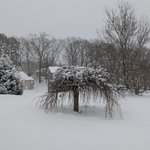
❄️It's the first snow of the season up on Mt. LeConte at 6593 feet elevation. The LeConte Lodge reached a low temperature of 27°F this morning with a snow measurement of 0.2". Credit to the LeConte Lodge for the photos!
7
113
18
707
78,402
⛈️The risk for a significant severe weather event across the Mid-South and Tennessee Valley continues to increase for Saturday. Damaging winds are the primary risk area-wide, but tornadoes and hail are also possible. Please follow forecast updates closely as we approach Saturday.
2
23
3
71
5,319
📉A significant pattern change is expected across much of the country as an Arctic Outbreak is forecast to spread from the Northern Plains to the south and east, leading to exceptionally high probabilities of below-normal temperatures expected across much of the East.🧵 ❗️The coldest air of the season to date and dangerous wind chills are likely across many areas of the Southeast. Below freezing temperatures are possible as far south as the Gulf Coast and much of the Florida Peninsula. Impacts to highly sensitive citrus crops are possible. 🚙Frozen precipitation is possible across the parts of the Southern Plains and Southeast with the potential for heavy snow extending northward to include much of Appalachians, Ohio Valley, Mid-Atlantic, Great Lakes, and Northeast, potentially leading to significant travel disruptions.
32
300
30
951
133,666
🥶An Arctic blast of cold air is becoming increasingly likely next week. Now is the time to prepare. Have a plan to protect pets and livestock by having proper shelter, and ensure pipes and crawl spaces are adequately insulated by winterizing your home or business.
17
29
3,648
ON A TENNESSEE SATURDAY NIGHT.
161
2,805
399
9,101
371,362
Active Region 3842 produces another (R3 - Strong) solar flare, an X9.0 at 1218 UTC on October 3rd, 2024. Stay Tuned to swpc.noaa.gov for the latest updates!
35
403
84
1,314
201,279
An X7.1 flare was observed from Region 3842. Stay tuned for updates!
19
323
54
1,246
118,137
🌡️🔥 Dangerous heat will continue through this weekend in the South-Central U.S. and expand into the East and parts of California next week. If you're planning outdoor July 4th activities, be sure to drink plenty of water and limit time outside during the peak of the heat.
31
1
46
12,772
THE TENNESSEE VOLUNTEERS ARE THE NATIONAL CHAMPIONS!
430
6,513
1,232
15,270
3,580,687
The historic geomagnetic storm continues...
35
884
104
3,305
690,512
HeatRisk can help people in the U.S. understand what forecasted heat means for them, their families, and their community. Visit the Interactive HeatRisk Viewer: wpc.ncep.noaa.gov/heatrisk/ You can provide feedback at surveymonkey.com/r/ExpNWSHea… #NIHHIS #HeatSafety
1
23
44
18,354
📅Mark your calendars! ⚡Saturday, September 28th, 10 AM to 2 PM Join us for our 2024 Open House! It's free and open to the public! Look for more details over the upcoming months. fb.me/e/6dDTdc9KA
4
7
1,030
Clouds have cleared & satellite is giving us a clear view of the remaining snow. It's amazing how tight the gradient was between the areas that received snow and those that only had rain. The areas in white show snow cover. The brown and green areas (vegetation) show no snow.
2
19
5
97
8,344
The morning observation from Mt. LeConte had a current temperature of 15°F with 2" of snow. 🥶 At Newfound Gap, the @GreatSmokyNPS webcam shows snow covering the ground this morning. You can check current Smokies roads info at @SmokiesRoadsNPS. #tnwx #ncwx #mrxwx
10
1
42
4,706
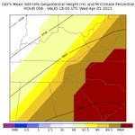
SPC & WFO forecasters evaluating probabilistic data designed for the Watch-to-Warning gap #HWT2023
1
6
2
73
7,441
Jeremy Buckles retweeted
Video of the tornado warned storm over Sullivan County, TN last night. On 11E near Piney Flats looking toward Bluff City and Bristol. From Lisa Johnson via Chime In. @natwxdesk
13
20
2,205
During heavy rain, water can accumulate on roads quicker than it can drain off. This creates a hydroplaning risk. When driving in heavy rain, use caution, slow down, and use headlights so other drivers can see you. Never drive into floodwaters. Turn around; don't drown! – at Morristown, TN
8
9
3,782
SWEET 16 VOLS
189
2,602
429
9,719
782,799
Widespread damaging wind gusts will impact the area Friday ahead of a line of showers and storms. 50-60 mph gusts are probable across the valley. with higher gusts of 70-80 across the higher elevations. Due to the recent rainfall, many down trees and powerlines are expected.
3
22
3
27
10,263
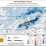
❄️Northwest Flow Storm Total Snowfall 1/13/23 - 1/14/23 Thank you for your snow reports and observations! Total snowfall was very dependent on elevation with Mount LeConte receiving 16 inches of snow and much of the valley only have a trace to a couple tenths of an inch. #mrxwx – at Morristown, TN
2
7
2
24
6,945