

The Kansas Data Access & Support Center (DASC) is the clearinghouse for GIS data for the State of Kansas.
Lawrence, KS
Joined October 2010
- Tweets367
- Following110
- Followers376
- Likes49


May the 4th is the Kansas Geoportal Hub's one-year anniversary! We've come a long way in using the @Esri @ArcGISHub platform to bring geospatial data to Kansas.
hub.kansasgis.org/
Work with a Kansas agency? Have #GIS data to share? Contact DASC for details: [email protected]
What's on your conference schedule for 2023? Is it @EsriUC? The Kansas Association of Mappers conference in October? The @URISA GIS Pro conference also in October?
Check out details on these and other events in 2023 on hub.kansasgis.org.
🌻2021 NG911 imagery release alert!🌻
Statewide aerial photography captured over the course of leaf-off conditions from 2/26/21 through 2/19/22, as requested by the State of Kansas, Department of Administration.
hub.kansasgis.org/datasets/2…
Are you an @ArcGISOnline administrator or content manager? Do you know that your content, groups, and user data can be backed up in case of an outage? Check out @GEOjobeGIS's suite of tools here: geo-jobe.com or @northpointgis Backup Manager: northpointgis.com
Happy National Geography Awareness week! Don't forget to check out your local #geospatial #GISDay events. The @UnivOfKansas will be hosting one on November 16th. Details here: kansasmappers.org/resources/…
Looking for Kansas @uscensusbureau TIGER shapefiles? The Kansas Geoportal @ArcGISHub now has downloadable layers for 2020 counties, Census tracts, metro and urban areas, cities, and more.
Come check out DASC at the Kansas Association of Mappers conference, October 12th-17th.
Check out the new @Esri case study with @kswateroffice staff member Katie Goff @GoffKatie10.
"State of Kansas Addresses Long-Term Water Supply Finance Needs with GIS"
esri.com/en-us/lg/industry/w…

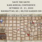
Come see the DASC team at the Kansas Association of Mappers conference, October 18-21, 2022. The DASC team will be presenting on the @ArcGISHub site, hub.kansasgis.org. Are you registered? #gis #KAM #geospatial

Kansas GIS retweeted

Our community forestry program supports both Tree Campus USA and Tree City USA programs in Kansas! Both programs have a huge impact on our communities across the state! #treecityusa #treecampususa #welovetrees

Looking for updated NG911 imagery for Kansas? The Data Access and Support Center has just released download links for the 2021 NG911 imagery. Check it out on DASC's Hub site: hub.kansasgis.org/apps/downl… #imagery #GIS @ArcGISHub #NG911 @Esri
KansasGIS has launched an @ArcGISHub Hub site. This will be updated with community events, GIS data contributions from state agencies, and more! @Esri #hub #GIS #data
hub.kansasgis.org/
You might be a GIS Developer if someone asks you to make a map and you're like... #geodev
Kansas GIS retweeted

Our short course instructors are hard at work creating amazing training for YOU Check them out. They're filling up FAST! #peer2peerlearning #networking #gis #mapmaking #locationservices #datadevelopment #magicgis2018 midamericagisconsortium.wild…
Fresh data- just got updated Kansas school districts. Available for download at- kansasgis.org/catalog/index.… or use in a web map or ArcGIS Online map from- services1.arcgis.com/q2Cglof…
GIS Job Hunters- there are quite a few GIS jobs open in Kansas posted at kansasmappers.org/Jobs
New and improved ORKA (Open Records for Kansas Appraisers) rolls out today. Check it out- kansasgis.org/orka/ #upgrade #itWillProbablyPrint
Kansas GIS retweeted

There’s no place like…Kansas!
Happy #KansasDay! 🌻 On this day in 1861, Kansas was admitted as the 34th state. The Sunflower State is home to five national park sites and several national trails. nps.gov/state/ks
NPS Image: Nicodemus NHS #FindYourPark

ALT Kansas sunset
Kansas 2017 MrSID NAIP is now available for download by county- kansasgis.org/catalog/index.…
Register for a Kansas LUCA workshop by December 15: Derby- data.kansasgis.org/requests/… Lawrence- data.kansasgis.org/requests/… Topeka- data.kansasgis.org/requests/…