

Chief Forecaster for Connor’s Weather Forecast | Tropical Weather Specialists @HighlandWX| Skywarn Spotter for @NWSGSP| part time storm chaser
Simpsonville, SC
Joined November 2022
- Tweets8.9K
- Following617
- Followers545
- Likes8.3K





Forecaster Connor Keely retweeted

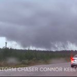
Supercell with #tornado possible tag and flash flood potential moving in to Roswell, New Mexico
Forecaster Connor Keely retweeted

It won't be noticed through the rest of October but all signs point to big changes as we move into November. These changes scream El Niño. Enjoy the slow period now.
Below is the EPS reflecting the change from dry (brown) to wet (green) as we move into November.
Forecaster Connor Keely retweeted

EL NIÑO is set to bring a major, significant, and possibly record setting winter of weather to Florida and the Gulf Coast this season.
The impacts probably start being felt regularly in the pattern the last 2 weeks of November.
Euro ensemble mean with a strong signal of suppressed storm track, higher than typical rain totals across Florida and the I-10 corridor. I expect somewhere in Florida to challenge a record for wettest winter on record. Whom that ends up being, no idea. But the table is set for that potential between Nov. 2026 and Mar. 2027.
The window of EL NIÑO impact in the weather pattern likely starts to settle in around a month from now.


Forecaster Connor Keely retweeted
Our super El Niño will begin to flex as we move deeper into November. You can already see the pattern evolving in the extended range.
The South will experience many storm systems, this is basically a lock. The big question is cold air. Can we continue the trend of deep shots of Arctic air like we have seen the last several years? Weakening & disruptions of the polar vortex will be something big to watch. Positioning teleconnections up in favorable positions.
Blue doesn't always mean snow. Please keep that in mind as we move closer to Winter.


Forecaster Connor Keely retweeted

Snowliage occuring on the Blue Ridge Parkway tonight! 🍁❄️🍂
📍Licklog Gap Overlook
Forecaster Connor Keely retweeted

It snowed back home on the mountain last night and early this morning…
(Video isn’t my own, credit to the feller who filmed it.)


Forecaster Connor Keely retweeted

WOW Lake Michigan is pounding the Michigan City lighthouse in front of Corey this afternoon
Video: Corey Gerken (@CoreyGerkenWX)
Forecaster Connor Keely retweeted

Drone video of the #tornado with CC drop near Russellville, Illinois moments ago. @WxWiseApp @ryanhallyall
Forecaster Connor Keely retweeted

Some guys have all the luck. A friend of mine was in Pensacola for the hurricane, and then Ft. Stockton, Texas, today for this
Forecaster Connor Keely retweeted
Wow... a massive correction in the models for this weekend. Energy trending more robust and closer to the Carolinas.
Euro trend since yesterday introduces now a full blown coastal storm Saturday night into Sunday. Enhanced winds, lots of rain, and cooler weather across the southeast and Florida. Something to watch into tomorrow in the model data. AI Euro agrees.
Forecaster Connor Keely retweeted

Intense winds from Ft. Walton Beach, Florida in the eyewall of Isaias. Storm Chaser helped protect me so I could get the video outside the truck.
Forecaster Connor Keely retweeted
Yeah, this YouTube video is gonna go HARD. Would’ve never guessed my best-documented tornado video of 2026 would come out of South Carolina, but here we are. Release date coming soon!
Forecaster Connor Keely retweeted
Finally got around to editing some shots from Saturday’s tornadoes in South Carolina, and WOW, I think this one is going on the wall!


Forecaster Connor Keely retweeted

The Barnwell, South Carolina tornado from October 10th has been UPGRADED to EF2 intensity, with winds of 115mph. The upgrade is based on significant damage to hardwood trees and power poles. This is the strongest tornado in Barnwell County since an EF3 on April 13th, 2020. #SCwx


CAE issues Damage Survey PNS (Max: EF2) at Oct 13, 9:06 AM EDT ...NWS Damage Survey for 10/10/26 Tornado Event... mesonet.agron.iastate.edu/p.…

Forecaster Connor Keely retweeted
One hurricane did all of this. 57 tornado warnings in three days, and the last ones were about 600 miles from where it came ashore.
Forecaster Connor Keely retweeted

Here's a look at the incredible number of tornado warnings, flash flood warnings, and special marine warnings issued across the Carolinas from #Isaias. Our endless appreciation to the National Weather Service and other emergency officials!

