

Providing information on tropical cyclones and severe weather events.
Main Development Region
Joined March 2012
- Tweets11.1K
- Following359
- Followers3.2K
- Likes44K




KeviShader retweeted

New feature for cyclonicwx.com/interactive/: you now have total freedom with colormaps! Choose from the many pre-existing ones, create your own with a new colormap editor, or upload a CPT file and instantly import its colormap. Want to use one elsewhere? Export it to a CPT file or use the automatically generated Python snippet to use it for your own plots. Check it out by looking through the layers in the bottom right and clicking on the product you want to change


KeviShader retweeted

🆕: Europe’s 1st geostationary sounder enters service today! 🛰️
The satellite - renamed as 'Meteosat-13' - will detect signs of atmospheric instability even before clouds form, helping forecasters see weather risks earlier.
Learn more: bit.ly/4zshitH
KeviShader retweeted

Terrifying footage of a violent tornado ripping through the city of Marsala in Sicily, Italy earlier this morning. Heavy damage reported in the area.
KeviShader retweeted

Video incredibile di Rosalba Pipitone, sempre da Marsala. Questo potrebbe essere il tornado siciliano più intenso da diversi decenni, ci sono auto scaraventate in giro. Seguiranno aggiornamenti
KeviShader retweeted

After further review together with ESSL and DWD, it's been concluded that IF3 level damage to vegetation occured just southwest of Ohrdruf (TH). The tornado from August 19th has subsequently been upgraded. 15 tornadoes have been confirmed from the outbreak in total.


KeviShader retweeted

🌩️ After months of work, it's here: iRadar v2 – my new modern weather-radar viewer.
Volumetric data from Europe & the US, composites, dual-pol, hail detection, 3D view, cross-sections, side views, weather stations, lightning & warnings, and more.
👉 iradar.app


KeviShader retweeted

¿Y si vemos los gráficos de olas de calor como si fueran olas reales rompiendo?
Esto es lo que he hecho aquí. Es una interpretación literal de la palabra que hemos usado durante décadas para este fenómeno — ola de calor — visualizada como el nombre que le da nombre.
Mientras el calor extremo vuelve a estar en Europa Occidental, podemos observar el comportamiento récord de este año hasta ahora:
Cada forma es un pulso de calor real — 3+ días consecutivos de aire anormalmente cálido (temperatura de 850 hPa; T850) por encima del percentil 90 local — representado como una onda rompiente. Se hincha a medida que aumenta el calor, alcanza su máxima intensidad y luego se curva en una ruptura abrupta cuando el patrón se derrumba. El tamaño y el color siguen el calor acumulado total del evento, el área por encima del umbral P90 integrada a lo largo de toda su duración. Ondas más grandes y oscuras significan más calor, que se mantiene durante más tiempo.
2026 destaca de inmediato, y su oleada más reciente es comparable en tamaño y oscuridad al histórico y catastrófico agosto de 2003.
Se puede ver directamente en los datos: nos enfrentamos más a olas rompientes que son eventos mayores, más oscuros —y más persistentes— en todo el registro de los últimos 24 años, varios acumulándose uno tras otro entre mayo y julio en lugar de parecer picos aislados.
Ese cambio de ondulaciones cortas, pálidas y aisladas en los 2000–2010 a formas extensas, saturadas y superpuestas en los últimos veranos es exactamente como aparece la "aceleración" en un registro de temperatura de la baja-media troposfera.

KeviShader retweeted

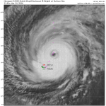
Initial view coming into Rota of the devastation from #Bavi @JordanHallWX


KeviShader retweeted

Absolutní rekord (pravděpodobně) překonán!
Stanice Doksany v Ústeckém kraji nečekala do zítřka, kdy má vlna veder vrcholit, a před malou chvílí naměřila teplotu 40,6 °C, čímž by překonala dosavadní rekord 40,4 °C naměřený v Dobřichovicích dne 20. srpna 2012. Teploty ještě mírně stoupají a nemusí se tak jednat o finální hodnotu.
Shrnutí dnešních nejvyšších teplot a dosažených teplotních rekordů budeme vydávat ve večerních hodinách.
Latest update has 41.3°C for Saarbrücken-Burbach, which would break the all-time record of 41.2°C recorded back in July 2019. DWD will surely check the station data again, since the station is running quite a bit higher than surrounding stations, but this could be a new record.


KeviShader retweeted

The death toll has now risen to 589, with 2,980 people injured and a large number still unaccounted for after twin earthquakes struck Venezuela.
KeviShader retweeted

OMG: The DWD station at Saarbrücken-Burbach has now according to mtwetter has once again broken its own record from earlier. Setting a new preliminary June record at 41.1°C, shattering the record from before today and bringing us within 0.1° of ALL-TIME.
Subject to review by DWD
BREAKING: The madness continues. At 3:40 pm local time the DWD synoptic station at Saarbrücken-Buurbach set yet another new preliminary June record at 40.9°C, just 0.3°C off all-time and shattering the old record of 39.6°C. 13 Stations are now above the old June record.
#EUwx

KeviShader retweeted

Likely violent #tornado (EF3+) destroyed multiple homes, twisted high tension power lines, and left significant ground scaring north of Kouts, Indiana.
@MyRadarWX #inwx – at Hebron, IN
KeviShader retweeted
Significant damage on the north side of Kouts, Indiana. This was a violent #tornado.
#inwx @MyRadarWX – at Hebron, IN


