

The Louisiana Office of State Climatology strives to improve the public's understanding of climate through services, research, and education.
LSU
Joined April 2014
- Tweets2.1K
- Following1.1K
- Followers623
- Likes1.1K
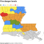



Despite some areas of the state receiving decent rain over the weekend, parish fire danger levels remain elevated for most of the state and most parishes still have burn bans in place.


LOSC retweeted

Just a locally crazy, unforeseen random event last night in Pearl River County in Mississippi. The forecast was for widely-scattered thunderstorms with a "marginal" flood risk. A tiny area got stuck beneath a downpour for HOURS, with up to 17 INCHES falling!

It has been almost completely dry across Louisiana the past three weeks, but there is hope on the horizon. A system is expected to move into the area on Halloween and provide some much-needed moisture. It won't be a drought buster, but every drop helps at this point.

Most of the state is mired in drought, but there may be some hope on the horizon. According to the Climate Prediction Center's outlook for November, chances are precipitation is going to be above-normal. Maybe not enough to end the drought, but it could certainly help.


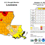
The current U.S. Drought Monitor depiction showed drought expansion from the previous week, not surprisingly. Most notably, an area of D4 'Exceptional' drought was added in north-central Louisiana. That is the first time there has been any D4 in the state since late-January 2024.


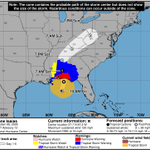
Isaias is now a major hurricane with estimated max sustained winds of 120 mph. It is experiencing shear, but the shear is aligned with its motion which is limiting its negative effect. Isaias is expected to be at or near major hurricane strength at landfall in FL this evening.


Isaias now has estimated max sustained winds of 100 mph and a central pressure of 975 mb. Intensity at landfall is questionable as the system is encountering extremely warm waters AND shear. However that plays out, Isaias will still be a dangerous storm when it makes landfall.


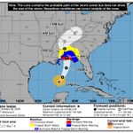
Isaias continues to intensify and has estimated maximum sustained winds of 85 mph. It is currently moving ENE at 10 mph and is expected to turn north and accelerate. Peak intensity will likely be over the Gulf with some weakening occurring prior to landfall near the AL/FL border.


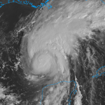
Isaias became a hurricane overnight and is moving through the Gulf. Hurricane Hunters are investigating the system and the next update from the NHC will be released later this morning.

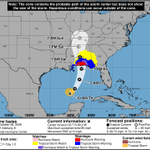
TS Isaias is organizing and is expected to strengthen rapidly and could approach major hurricane status. Forward speed is expected to increase as it moves towards the northern Gulf coast. Right now landfall looks to be in the Mobile area, but it is expected to be a large storm.


We are continuing to monitor the system in the southwest Gulf. While not yet a depression, it is likely to become one in the next day or two. After that, it is expected to drift towards the northern Gulf.


How is it already October? According the CPC monthly outlook, conditions are 'Leaning' towards being warmer-than-normal during the month. More importantly, precipitation is 'Likely' to be above normal, which should help improve our current drought.


After a dry stretch, a pattern change is on the way beginning today and especially over the weekend. Right now, the highest rain totals are likely over the southeastern portion of the state. There is a risk of 'Excessive' rainfall both Saturday and Sunday.


The new US Drought Monitor depiction was released today and showed degradations. Over 1/2 of the state is now in 'Severe' or 'Extreme' drought. A system forecast to move through the state later this week could potentially bring some beneficial rain, let's hope it does.


While this stretch of less humid weather is certainly pleasant and welcome after a long summer, one negative effect is that it's increasing fire danger, especially after recent dryness. Most parishes in central and northern Louisiana are under 'Burn Bans'.


LOSC retweeted

September 21, 2005:
Hurricane Rita peaked as an extremely intense Category 5. The storm's 895 millibar minimum central pressure and 180 mph winds made it the strongest Gulf of Mexico hurricane on record until being tied on both statistics by 2024's Hurricane Milton.
#wxhistory

LOSC retweeted

With less than 5% of the Southern Region remaining free from drought and dry conditions this week, much of the region continues to experience worsening drought conditions.
For local drought information, select your location on the map: droughtmonitor.unl.edu/Curre…

It may be the middle of September, but so far there's been no relief from summer heat. Temperatures have been significantly above normal and while there have been pockets of significant precipitation, for the most part conditions have been drier than normal.


