

Editor of @nwherald. Alum of @mujschool. Former reporter for @newssun, @saukvalley, @nwherald; intern @bistrib, @reuters.
- Tweets4.8K
- Following711
- Followers922
- Likes404








ALT Headline: Round of Snow Tonight into Saturday. Sub Headline: Prepare for slippery travel Saturday morning. What To Expect: Coating of Snow. Snow accumulations of 1 to 3” expected in addition to reduced visibility and slippery travel conditions. Location of impacts: Northeast IL and Northwest IN. Highest accumulations expected near the I-55 corridor. When: Midnight tonight through 10 AM Saturday, light snow showers/flurries will persist into Saturday evening. What you should do: Prepare for extra travel time. Slow down and increase following distance. Graphic Created: Friday, January 5, 2024 1:14 PM CST
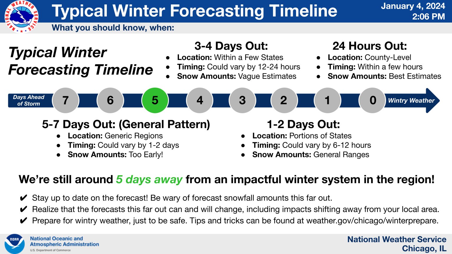
ALT -------------------- ALT TEXT Generated at: Thursday, January 4, 2024 1:56 PM CST. Your Previous Text is Above -------------------- Headline: Typical Winter Forecasting Timeline. What you should know, when: 5-7 Days Out: (General Pattern) Location: Generic Regions. Timing: Could vary by 1-2 days. Snow Amounts: Too Early! 3-4 Days Out: Location: Within a Few States. Timing: Could vary by 12-24 hours. Snow Amounts: Vague Estimates. 1-2 Days Out: Location: Portions of States Timing: Could vary by 6-12 hours. Snow Amounts: General Ranges. 24 Hours Out: Location: County-Level Timing: Within a few hours. Snow Amounts: Best Estimates We’re still around 5 days away from an impactful winter system in the region! Stay up to date on the forecast! Be wary of forecast snowfall amounts this far out. Realize that the forecasts this far out can and will change, including impacts shifting away from your local area. Prepare for wintry weather, just to be safe. Tips and tricks can be found at weather.gov


ALT This is a multiday forecast graphic for northern Illinois and northwest Indiana. Headline: Dangerous Heat/Humidity This Week. Sub Headline: Cold front to bring some relief towards weeks end. Visit weather.gov/Chicago for more forecast details for your location. Graphic Created: Tuesday, August 22, 2023 4:37 AM CDT.


ALT This graphic displays a tornado warning plotted on a map. The warning is in effect until 7:45 PM CDT. The warning includes Chicago IL, Cicero IL and Evanston IL. This warning is for Northeastern Cook County in northeastern Illinois. The threats associated with this warning are a radar indicated tornado and no hail is expected. There are 2,643,648 people in the warning along with 531 schools and 52 hospitals.


ALT Free online games and puzzles at shawlocal.com/games

ALT Staying warm when the power is out. Close blinds or curtains to keep in some heat. Close off rooms to avoid wasting heat. Wear layers of loose-fitting, lightweight, warm clothing. Eat and drink; food provides energy to warm the body; avoid caffeine and alcohol. Stuff towels or rags in cracks under doors.
