MWC Weather ⚡️ (@MWC_Weather) header
MWC Weather ⚡️ (@MWC_Weather) profile picture

Chasing storms in Ohio and beyond! Also providing updates on local and national weather events.

Cleveland, OH
Joined June 2020
Photo by MWC Weather ⚡️ (@MWC_Weather)Photo by MWC Weather ⚡️ (@MWC_Weather)Photo by MWC Weather ⚡️ (@MWC_Weather)Photo by MWC Weather ⚡️ (@MWC_Weather)Photo by MWC Weather ⚡️ (@MWC_Weather)Photo by MWC Weather ⚡️ (@MWC_Weather)Photo by MWC Weather ⚡️ (@MWC_Weather)Photo by MWC Weather ⚡️ (@MWC_Weather)Photo by MWC Weather ⚡️ (@MWC_Weather)Photo by MWC Weather ⚡️ (@MWC_Weather)
MWC Weather ⚡️ retweeted
Could have been a brief tornado near Avon, Ohio right after 6pm this evening #ohwx
At 6:00 PM EDT, Sheffield Lake [Lorain Co, OH] 911 Call Center reports Tstm Wnd Dmg. Reports of tree and property damage. #ohwx mesonet.agron.iastate.edu/ls…
3
4
29
3,015
MWC Weather ⚡️ retweeted
Waterspout off Lakeview Beach in Lorain. 5:34pm #ohwx @neoweather_us
28
84
20
656
62,871
MWC Weather ⚡️ retweeted
Severe Thunderstorm Warning including Brunswick OH, Medina OH and Wadsworth OH until 5:15 PM EDT
1
7
14
2,940
Willoughby, Ohio. 📸 #OHwx
5
30
394
Severe winds as seen from Sunset Park near Willoughby. The strongest gust, around 60 MPH, took down a medium-sized tree and caused a large tree to lean but not fully topple. #OHwx @nwscle
2
2
4
341
MWC Weather ⚡️ retweeted
Severe Thunderstorm Warning including Cleveland OH, Parma OH and Lakewood OH until 7:00 PM EDT. This destructive storm will contain wind gusts to 80 MPH!
3
26
3
81
8,800
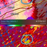
A tornado likely impacted eastern Detroit around 4:15 pm before moving across Belle Isle into Windsor. Wouldn’t be surprised to see a couple more spin-up tornadoes in Ontario, and possibly into Ohio as this line continues to chug along. #MIwx #ONwx
1
5
1,680
MWC Weather ⚡️ retweeted
Tornado warned storm moments ago! Somerset, New York #Nywx
7
25
1,289
MWC Weather ⚡️ retweeted
PLAINS mothership north of Elba, NY! #nywx
50
301
57
1,558
123,948
Severe-warned thunderstorm pushing into Brooklyn, OH this evening. #OHwx
1
1
8
364
Pea sized hail, estimated peak wind gusts of 50 MPH in Brooklyn, OH. @NWSCLE
1
1
96
Some larger hail on the back end of this, up to the size of pennies. @NWSCLE
1
50
MWC Weather ⚡️ retweeted
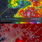
Tornado Warning including Elyria OH, Cleveland-Hopkins Airport OH and Strongsville OH until 5:30 PM EDT
2
14
5
62
14,213
Wouldn’t be surprised if there was a waterspout ongoing about a mile off the coast near Willowick. #OHwx
3
153
Measured a max wind gust of 51 MPH at Clearfork Reservoir, about 1.5 miles NW of Lexington. #OHwx @NWSCLE
2
8
1,268
This boater is racing to safety as a severe thunderstorm looms overhead. #OHwx
Severe storm rolling across Clear Fork Reservoir near Lexington. #OHwx
1
3
378
Severe storm rolling across Clear Fork Reservoir near Lexington. #OHwx
2
1
5
530
MWC Weather ⚡️ retweeted
Pray for Crooksville 🙏 Rescues are continuing and you can see this is one of the most damaging floods in recent memory. There has been almost 6” of rain in the last 24 hours with more expected today. Check on your Perry County friends and family especially those in the village. #ZanesViral
2
12
436
Widespread tree damage in the Pigeon Creek area of western Summit County. I didn’t see any whole trees toppled, but the top half of one large tree was taken down. Several other instances of large branches down. @NWSCLE
1
2
3
199
A few more pics from Pigeon Creek.
2
3
36