


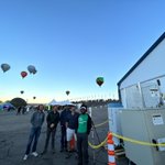




ALT Photograph of students in Argentina collecting cloud observations and temperature data to upload through the GLOBE Eclipse tool during the eclipse that crossed South America on July 2, 2019. Three students wearing eclipse glasses can be seen looking at the sky. They are sitting on a low hill and the sky is blue behind them. A tall scientific instrument next to them collects weather data. Credit: Pablo Cecchi


ALT Map of the Washington, Philadelphia and New York region. Colors indicate density of nitrogen dioxide as measured by the TEMPO satellite on Aug. 2, 2023 shortly after noon Eastern. Most of the area is blue, indicating low levels of the pollutant. There are dark purple and red blobs near Washington and New York, indicating higher pollution, as well as a line of higher pollution stretching between the cities along the I-95 corridor. Credits: Kel Elkins, Trent Schindler, and Cindy Starr/NASA's Scientific Visualization Studio


ALT Researcher Claudia Bernier walks a large white weather balloon out, held above her head. She is walking through an open meadow near a forested area. A TOLNet lidar, Pandora spectrometer, and ceilometer for studying clouds are in the background. Credits: NASA/Guillaume Gronoff

ALT NASA aircraft at the hangar. The DC-8, a large white plane with a blue stripe, on the left, is the largest flying science laboratory in the world. A smaller plane on the right is the Gulfstream-III. Credits: NASA/Jhony Zavaleta


