North MS Storm Chasers πͺπΊπΈ retweeted
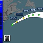
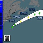
What an absolutly insane first hurricane chase I got to experience this weekend. Isaias did not disappoint, coming onto shore as a high end Category 2 Hurricane. My mind kept getting blown by this storm. It was unlike anything I had ever experienced up to that point!
North MS Storm Chasers πͺπΊπΈ retweeted
The very outer bands of convection from Isaias is creating one of the most beautiful sunsets I have ever experienced!
@NMSCAS
@willbrattonwx
@spann
@simpsonWVTM13 β at Evergreen, AL
North MS Storm Chasers πͺπΊπΈ retweeted
TOMORROW: Join us in Tupelo, MS for our next in person SKYWARN course. To view our full SKYWARN class schedule, please visit weather.gov/meg/skywarn
North MS Storm Chasers πͺπΊπΈ retweeted
21 years ago this morning, residents of southeast Louisiana and southern Mississippi received this bulletin from the National Weather Service.
North MS Storm Chasers πͺπΊπΈ retweeted
The partial lunar eclipse tonight, seen from the Noxubee Refuge in Mississippi. Photos 3 and 4 were several minute long super exposures
@NMSCAS
@willbrattonwx
@spann β at Starkville, MS
North MS Storm Chasers πͺπΊπΈ retweeted
Straight from the LightningCam app. Camera set in window while I ate dinner. 18:41 SW portion of Corinth, MS August 22, 2026 @WTVAWeather @spann @Weather_WREG3 @WCBIWEATHER @weatherchannel @tnvalleyweather @WBBJ7Weather @NMSCAS
North MS Storm Chasers πͺπΊπΈ retweeted
Didn't expect to zero meter a wet microsburst on campus today.
@matt_laubhan @NWSJacksonMS @spann @NMSCAS @willbrattonwx β at Starkville, MS
North MS Storm Chasers πͺπΊπΈ retweeted
.@NWSJacksonMS has upgraded the winds of the Monticello/Brookhaven long track tornado earlier this year 160mph, making it a strong EF-3 tornado.
In addition, based on additional analysis of aerial imagery, the maximum path width has been revised upward to 1.5 miles. #mswx
JAN issues Damage Survey PNS (Max: EF3) at Jul 28, 6:56 PM CDT ...NWS Damage Survey for 5/6/2026 Tornado Event - Update #4... mesonet.agron.iastate.edu/p.β¦
North MS Storm Chasers πͺπΊπΈ retweeted
Insane storm approaching @EchoParkSpdwy, in Georgia
@willbrattonwx
@spann
@NMSCAS β at Hampton, GA
North MS Storm Chasers πͺπΊπΈ retweeted
Slight reds of the aurora peeking through so far, south of Winchester TN. Cloud cover was wanting to ruin the party though sadly.
@NMSCAS
@willbrattonwx
North MS Storm Chasers πͺπΊπΈ retweeted
Brief tornado this afternoon caught on our @NMSCAS Skycam in Shelby.
North MS Storm Chasers πͺπΊπΈ retweeted
Here's the latest on the heavy rain: we are still forecasting potential widespread impacts from flash flooding. Not everyone will realize these numbers, the high end totals could in excess of 10 to 15". Please take any warnings seriously & avoid all unnecessary travel.

ALT Graphic reads: Significant Rainfall Totals - More Details on Location/Amounts. Hazards: Forecast Overview: Confidence continues to increase that significant impacts including widespread, life-threatening flash flooding may likely occur from training storms tonight into early Thursday. Noted on the right is a 24 hour forecast rainfall total 7PM Wed thru 7PM Thu - highlighting the areas most likely to see extreme high-end totals of 10-15" and potentially 20+" in some isolated areas. Be weather aware & have a reliable way to receive warnings should they become required! Confidence - High confidence in storm coverage/intensity
North MS Storm Chasers πͺπΊπΈ retweeted
Something that is catching my eye today is that the synoptics feel misplaced. With a curved jet, lift is found over the entire exit with suppression on the backside. Notice the zone of lift is given a glancing blow to our supercells across NE Kansas and SE Nebraska.
The overall pattern is sliding along the edge of the risk area rather than arcing into the warm sector. Feels like a partial failure mode today playing out. Still, a robust environment remains regardless, and we are still far from being over today. The day is still young.
North MS Storm Chasers πͺπΊπΈ retweeted
Tracking a storm near Minneapolis, Kansas.
#kewx
North MS Storm Chasers πͺπΊπΈ retweeted
Additional ground surveys and analysis of aerial imagery have revealed the starting point of the May 6th South Mississippi long track EF3 tornado was further west than originally believed, in far southwestern Adams County. The revised tornado track is over 81 miles long.
North MS Storm Chasers πͺπΊπΈ retweeted
Caught the end of the Monticello, Ms tornado early via drone as it occluded a few miles northwest of Bassfield. 8:54 p.m.
God bless the people we lost tonight.
Praying for their families and friends.
@NWSJacksonMS
@matt_laubhan
@NMSCAS
North MS Storm Chasers πͺπΊπΈ retweeted
Power flashes recorded earlier in Greenville, Ms at 10:08 from about 10 miles south of town.
@NWSJacksonMS @NMSCAS @MaxVelocityWX