Tim Reith (@NTVsTimReith) header
Tim Reith (@NTVsTimReith) profile picture

Chief meteorologist at KHGI-NTV and KFXL. [email protected]. Love weather, sports, and being outdoors.

Minden, NE
Joined January 2012
Photo by Tim Reith (@NTVsTimReith)Photo by Tim Reith (@NTVsTimReith)Photo by Tim Reith (@NTVsTimReith)Photo by Tim Reith (@NTVsTimReith)Photo by Tim Reith (@NTVsTimReith)Photo by Tim Reith (@NTVsTimReith)Photo by Tim Reith (@NTVsTimReith)Photo by Tim Reith (@NTVsTimReith)Photo by Tim Reith (@NTVsTimReith)Photo by Tim Reith (@NTVsTimReith)
Tim Reith retweeted
This has already been the 3rd-WETTEST "METEOROLOGICAL FALL" (SEPT - NOV) ON RECORD at Hastings Municipal Airport (HSI): Even though we still have most of November to go to finish out the season, meteorological fall 2026 already ranks 3rd-wettest on record at Hastings! #NEwx
3
6
678
Tim Reith retweeted
Flood Warning for several of our northeast counties until 3 PM Wed (parts of it might need extended beyond?). A few gauges "making a run" toward flood stage...including along the West Fork Big Blue River and Silver Creek. Latest river data here: water.noaa.gov/wfo/gid #NEwx
1
3
778
11/3/26 6:27 pm A few rainfall reports from last night into today.
1
191
Temperatures tonight will be chilly with lows in the 20s across most of western and north central Nebraska tonight. Highs tomorrow will also be cold with highs only in the upper 40s to low 50s. #NEwx
2
1
414
Tuesday evening forecast. Rai moving out and warmer temps will be moving in especially by the weekend.
1
157
Tim Reith retweeted
New rainfall records were set at both Grand Island and Hastings today. #NEwx
1
3
687
11/3/26 4:25 PM Due to locally heavy rainfall, flood warnings have been issued for parts of Hamilton, Fillmore, Clay, Merrick, Nance, Polk and York counties until 3 PM on Wednesday.
1
209
Here's some news you've all been waiting for: The last political ad on @NTVNEWS aired at 1:30 p.m. Over on our FOX station, KFXL, the final political ad will air at 6:44 p.m.
3
2
13
1,201
11/3/26 2:11 PM Rain continues to fall but also continues to diminish in overall coverage area. Locally heavy rain in excess of 4" has been observed leading to flood advisories in portions of Merrick, Hamilton, Polk and Nance counties.
1
194
11/2/26 9:12 PM Our severe weaher threat seems very diminished but the rain continues to fall. There have been some spots with well over an inch of rain already tonight.
3
233
Tim Reith retweeted
A special weather statement has been issued for Red Cloud NE, Campbell NE and Bladen NE until 7:30 PM CST
1
1
710
11/2/26 Not the most pleasant of election days tomorrow but don't let that stop you from getting out to vote! Not only cool and damp at times, also expect NW winds gusting over 35 mph.
132
College basketball is official back 🏀 Le Moyne at Nebraska to tip off the regular season at PBA!
1
3
539
Tim Reith retweeted
Pride of the Minutemen Marching Band wraps up successful 2026 marching season dlvr.​it/TW97BP
1
3
419
11/2/26 6:24 PM Would expect some very heavy rain in Franklin along with small hail potential. Could see hail approaching quarter size just to the northeast of town. These storms have been strengthening but are just below severe levels currently.
144
Monday evening forecast. A windy and potentially damp night ahead.
133
Tim Reith retweeted
A special weather statement has been issued for Phillipsburg KS, Stockton KS and Kensington KS until 5:45 PM CST
1
2
2
1,143
11/2/26 5:12 PM Hastings you have some t-storm activity heading your way. Nothing severe but some lightning and heavy rain possible.
110
11/2/26 4:48 PM Storm pulsing up in intensity just east of Doniphan. Be on the lookout for some small hail and gusty winds.
131
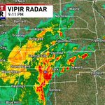
11/2/26 4:37 pM Line of non severe thunderstorms continue to develop along a cold front moving through the region. Here is the view as the storms approach in Aurora on our NTV Viaero Wireless Camera Network.
1
183