

Official account for the National Weather Service Aviation Weather Center. Details: https://xitter.cf/t.co/HPaHRzC8Oi
- Tweets7.5K
- Following288
- Followers12K
- Likes1K





ALT An informational infographic titled "Monitoring Dense Fog on AviationWeather.gov" showcasing five key tools available on the website for tracking visibility and fog forecasts. Under the header text, five labeled screenshot panels illustrate these features: Prog Charts displaying a map where yellow shading indicates fog; TAF map showing station model format data on an interactive map with a timeline slider; Current observations (METARS) and IFR G-AIRMETs showing customizable weather plots and purple-shaded advisory areas; Ceiling and Visibility Dashboard featuring interactive dropdowns and color-coded flight category timelines for selected airports; and Gridded visibility Forecasts displaying map-based forecast grids for visibility, ceiling, or flight categories.


ALT Key Messages: 1. Isaias is expected to strengthen and be a strong hurricane when it approaches the northern Gulf Coast on Friday. A life-threatening storm surge is expected along a portion of the northern Gulf Coast, and a Storm Surge Warning remains in effect from the Mouth of the Mississippi River to Steinhatchee, Florida. Residents in the warning area should follow advice given by local officials and evacuate if told to do so. 2. Damaging hurricane force-winds are expected over portions of the Florida Panhandle, southern Alabama, and southern Mississippi, and a Hurricane Warning remains in effect from Ocean Springs, Mississippi to the Bay/Gulf County Line, Florida. Residents in these areas should prepare for the possibility of long-duration power outages. 3. Isaias will bring areas of heavy rainfall to the central U. S. Gulf coast and much of the Southeast Friday into the weekend. Flash and urban flooding, along with isolated river flooding, will be possible.

ALT Mensajes clave: 1. Se espera que Isaias se fortalezca y se convierta en un fuerte huracán cuando se acerque a la costa norte del Golfo el viernes. Se espera una marejada ciclónica que amenaza la vida a lo largo de una porción de la costa norte del Golfo, y un Aviso de Marejada Ciclónica permanece en efecto desde la Boca del Río Mississippi a Steinhatchee, Florida. Los residentes en el área de aviso deben seguir los consejos dados por los funcionarios locales y evacuar si se les dice. 2. Se esperan vientos con fuerza de huracán dañinos sobre porciones de Florida Panhandle, sur de Alabama y sur de Mississippi, y un Aviso de Huracán permanece en efecto desde Ocean Springs, Mississippi hasta Bay County Line, Florida. Los residentes de estas áreas deben prepararse para la posibilidad de cortes del suministro eléctrico de larga duración.


ALT High-resolution satellite image from GOES-19 showing a large, organized tropical cyclone (Hurricane Isaias) filling the northern Gulf of Mexico. Dense, swirling cloud cover spans across coastal Louisiana, Mississippi, Alabama, and the Florida Panhandle, with extensive outer rainbands stretching inland over the Southeastern United States.

ALT Forecast map showing the projected track cone curving north-northeast from the Gulf of Mexico through the Southeastern U.S. toward the Ohio Valley. Forecast Track & Positions:7 AM Fri: Major Hurricane ('M') in the central Gulf of Mexico. 1 AM Sat: Hurricane ('H') near coastal Mississippi/Alabama border. 1 PM Sat: Tropical Storm ('S') inland over central Alabama. 1 AM Sun: Tropical Depression ('D') inland over middle Tennessee. Watches & Warnings:Red (Hurricane Warning): Coastal Louisiana, Mississippi, Alabama, and Florida Panhandle. Blue (Tropical Storm Warning): Coastal Louisiana and Florida Panhandle. Yellow (Tropical Storm Watch): Inland Mississippi, Alabama, and Georgia.

ALT Key Messages: 1. A life-threatening storm surge is expected from the Mouth of the Mississippi River to Suwannee, Florida. Residents under evacuation orders should leave immediately and follow advice from local officials. 2. Extremely dangerous and damaging hurricane force-winds are expected over portions of the Florida Panhandle, southern Alabama, and southern Mississippi where a Hurricane Warning is in effect. Residents in these areas should have a safe room to ride out the storm and prepare for long-duration power outages. 3. Damaging wind gusts are likely over a large portion of the southeastern United States from western and northern Georgia westward over much of central and northern Alabama, southern middle Tennessee, and Mississippi, especially in areas of higher terrain. Residents should secure loose outdoor items, avoid driving high-profile vehicles, prepare for power outages, and be aware of the potential for falling trees.

ALT Mensajes clave: 1. Se espera una marejada ciclónica que amenaza la vida desde la Boca del Río Mississippi a Suwannee, Florida. Los residentes bajo órdenes de evacuación deben irse de inmediato y seguir los consejos de los funcionarios locales. 2. Se esperan vientos de fuerza de huracán extremadamente peligrosos y dañinos sobre porciones de Florida Panhandle, sur de Alabama y sur de Mississippi, donde un Aviso de Huracán está en efecto. Los residentes de estas áreas deben tener una habitación segura para superar la tormenta y prepararse para cortes del suministro eléctrico de larga duración.

ALT A weather forecast image titled Non Convective Turbulence Potential Tomorrow, valid from Saturday September 12th 15Z to Sunday September 13th 12Z, displaying G-AIRMET and SIGMET status along with regional turbulence descriptions including LLWS across the southern plains, turbulence impacts from an upper low in the PAC NW, and low-level turbulence across the west with enhanced potential over the Sierras and parts of the Rockies. The product is experimental.

ALT A weather forecast image titled Non Convective Icing Potential Tomorrow, valid from Saturday September 12th 15Z to Sunday September 13th 12Z. A legend shows the colors for G-AIRMETs being likely and possible as well as for when SIGMETs are possible. G-AIRMET issuance possible between FL200 and 10,000ft across the northern plains and G-AIRMET issuance likely from FL200 to 8,000ft due to an upper low moving in across the Pacific Northwest with enhancement from the mountains. The product is experimental.

ALT A weather forecast image titled IFR Potential Tomorrow, valid from Saturday September 12th 15Z to Sunday September 13th 12Z. A legend shows G-AIRMETs are likely and possible, and SIGMETs are possible with associated colors. IFR conditions associated with a storm system possible across the PAC NW with mountain obscurations. IFR will linger into the early afternoon hours along the CA Pacific coast. Early morning IFR development possible Sunday across parts of CO and KS. Widespread IFR across much of the east with best chances in highlighted areas across the mid Atlantic Saturday night into Sunday. This product is experimental.


ALT National Weather Service graphic for Tropical Storm Edouard showing a forecast track map and key stats as of 11:27 AM on September 1, 2026. Max sustained winds are 50 mph, moving NW at 8 mph toward the upper Texas coast. A Tropical Storm Warning is highlighted in blue for Chambers County, southern Liberty County, and adjacent waters, with the primary threat being heavy rainfall, flash flooding, and tropical storm-force winds

ALT NWS Houston/Galveston graphic showing a Tropical Storm Warning in effect on September 1, 2026, for Chambers County, Bolivar Peninsula, southern Liberty County, and adjacent Gulf waters (shaded red on the map). Forecast details list inland sustained winds of 20–30 mph with gusts up to 40 mph, and offshore winds of 20–30 knots with gusts up to 45 knots and 3–5 foot seas. Text advises completing preparations to protect life and property.


ALT This slide, titled 'Day 2 Aviation Thunderstorm Outlook' for 18Z Tuesday, August 11 to 12Z Wednesday, August 12, displays a map of the United States highlighting thunderstorm hazard areas and Core 30 airports. Three main convective hazard regions are indicated: A red region over the Northeast and Great Lakes: Signifies scattered strong to severe storms during the afternoon into the overnight/early morning hours with tops above FL450. An orange region covering the Southwest and West: Indicates isolated to scattered storms during the afternoon into the overnight/early morning with tops to FL400 and isolated tops above FL450. A peach-shaded region over the Southeast: Indicates scattered storms during the afternoon and evening with tops to FL400 and isolated tops above FL450. The bottom of the slide features a hazard impact legend (Minor, Moderate, Major, Extreme) alongside NOAA and AviationWeather.gov logos.

ALT An image titled 'Day 2 Aviation Icing Outlook' displaying the icing forecast for the Core 30 Airports valid from 18Z Tuesday, August 11 to 12Z Wednesday, August 12. The background features a gray map of the United States showing the locations of the CORE 30 airports as black dots. A bright green rectangular textbox positioned over the north-central U.S. displays the message: 'No Significant Icing Outside of Convection Expected.' At the bottom-left, an impact legend displays three color-coded categories: 'Minor Impacts' (light green), 'Moderate Impacts' (teal), and 'Major Impacts' (dark purple). The slide's header is black, featuring the National Weather Service Aviation Weather Center (AWC) logo on the left. The black footer contains the AWC website address (AviationWeather.gov) and social media handle (@NWSAWC).

ALT An image titled 'Day 2 Aviation Turbulence Outlook' displaying the turbulence forecast for the Core 30 Airports, valid from 18Z Tuesday, August 11 to 12Z Wednesday, August 12. The background features a gray map of the United States with the locations of the airports marked as black dots. A text box summarizes the forecast: moderate turbulence possible Tuesday during the late afternoon and evening hours between FL360 and FL240 in the northeast; thermally induced low turbulence below 15,000 feet across parts of WY, ID, and UT; and low-level wind shear expected late Tuesday night into Wednesday morning across the southern plains. At the bottom-left, an impact legend displays four color-coded categories: 'Minor Impacts' (light green), 'Moderate Impacts' (teal), 'Major Impacts' (dark purple), and 'Extreme Impacts' (red). The slide's black header features the National Weather Service Aviation Weather Center (AWC) logo on the left. The black footer contains the AWC website address.

ALT Slide 14: Day 2 Aviation Ceiling and Visibility Outlook for 18Z Tuesday, August 11 through 12Z Wednesday, August 12. This slide presents a map of the United States identifying Core 30 airports and regions with varying ceiling and visibility impacts, categorized by Minor, Moderate, and Major levels. The forecast details include: Dense wildfire smoke causing localized MVFR/IFR conditions and reduced slantwise visibility across the northwestern US and Northern Rockies. An IFR marine layer along the West Coast intensifying during the overnight hours. Development of IFR/LIFR conditions with mist and fog overnight along and near the Gulf of America coast. IFR conditions expected to develop overnight into the morning from Iowa east through the Great Lakes region.

ALT Day 2 Ceiling and Visibilities Outlook main aviation impacts in the Northeast, Northwest and Southern U.S.

ALT Day 2 Turbulence Outlook only minor aviation impacts across the U.S.

ALT Day 2 Icing Outlook no aviation impacts across the U.S.

ALT Day 2 Convection Outlook major aviation impacts across the Great Lakes into the Central Plains.

ALT Map showing the Day 2 Aviation Thunderstorm Outlook for August 9 through August 10. Major impacts are highlighted in the Upper Midwest for isolated strong to severe storms during the afternoon into the early morning hours with tops above flight level 450. Moderate impacts are highlighted in the Southwest, the Southeast and Gulf Coast, and along the East Coast, all indicating isolated to scattered afternoon storms with tops generally reaching flight level 40,000 feet to above 45,000 feet.

ALT Map showing the Day 2 Aviation Icing Outlook for August 9 through August 10. Minor impacts are highlighted in a single area over the Northern Plains, specifically North Dakota and northern Minnesota, indicating occasional moderate icing early Monday between flight levels 23,000 feet and 12,000 feet.

ALT Map showing the Day 2 Aviation Turbulence Outlook for August 9 through August 10. Minor impacts are highlighted in three areas: off the coast of Northern California for surface winds of 30 knots or greater; over the Midwest for Low-Level Wind Shear Sunday night into Monday morning; and over the Mid-Atlantic region for occasional moderate turbulence between flight levels 40,000 feet and 24,000 feet during Sunday afternoon and evening.

ALT Map showing the Day 2 Aviation Ceiling and Visibility Outlook for August 9 through August 10. Moderate impacts are highlighted in three main areas: the Pacific Northwest and Rockies due to dense wildfire smoke causing localized MVFR and IFR conditions; the West Coast due to an intensifying IFR marine layer overnight; and the Southeast and Gulf Coast regions due to developing areas of IFR and LIFR fog overnight. Minor impacts are shown surrounding these moderate regions and extending into the Northeast.

ALT Smoke will remain large impact over Pacific Northwest. Low ceilings with Pacific Marine layer and in the northeast.

ALT Low turbulence impact over Arkansas into Kentucky area. Low impact threat of LLWS over KS/NE.

ALT No icing impacts.

ALT Scattered thunderstorms over Arizona and southeast into east central US. Wide spread thunderstorms will persist off southeast coast through period. A chance of severe high top thunderstorms overnight into the morning over upper plains.

ALT Day 2 Aviation Icing Outlook for the Core 30 Airports, valid from 18Z Friday, August 7, through 12Z Saturday, August 8 (Friday afternoon through Saturday morning). The image displays categories for Minor, Moderate, and Major Impacts. A summary note indicates that no significant icing is expected outside of convection.

ALT Day 2 Aviation Turbulence Outlook for the Core 30 Airports, valid from 18Z Friday, August 7, through 12Z Saturday, August 8 (Friday afternoon through Saturday morning). The image displays categories for Minor, Moderate, Major, and Extreme Impacts. A summary note indicates that no significant turbulence is expected outside of convection.

ALT Day 2 Aviation Thunderstorm Outlook for the Core 30 Airports, valid from 18Z Friday, August 7, through 12Z Saturday, August 8 (Friday afternoon through Saturday morning). The image displays categories for Minor, Moderate, Major, and Extreme Impacts. It includes forecasts for multiple rounds of storms with tops above FL450 across parts of the Ozarks, as well as details on scattered, isolated, and potentially severe storms (mainly over the Great Lakes and mid Atlantic region) across various regions including the southeast, TN valley into the mid Atlantic, parts of the midwest, and the southwest.

ALT Day 2 Aviation Ceiling and Visibility Outlook for the Core 30 Airports, valid from 18Z Friday, August 7, through 12Z Saturday, August 8 (Friday afternoon through Saturday morning). The image displays categories for Minor, Moderate, and Major Impacts. It highlights an IFR marine layer moving onshore overnight across parts of the west coast, dense wildfire smoke causing localized MVFR/IFR conditions and reduced slantwise visibility across the northwest and inner mountain west, and expected developments of IFR/LIFR fog throughout the overnight period across parts of the east, midwest, and great lakes.

ALT Day 2 Aviation Icing Outlook for the period 18Z Thursday, August 6 to 12Z Friday, August 7. This view covers the Core 30 Airports. The forecast indicates no significant icing is expected outside of convection. The image includes legend categories for Moderate, Minor, and Major impacts.

ALT Day 2 Aviation Turbulence Outlook for the period 18Z Thursday, August 6 to 12Z Friday, August 7. This view covers the Core 30 Airports. The forecast indicates no significant turbulence is expected outside of convection. The image includes legend categories for Moderate, Minor, Major, and Extreme impacts.

ALT Day 2 Aviation Ceiling and Visibility Outlook for the period 18Z Thursday, August 6 to 12Z Friday, August 7. This view covers the Core 30 Airports. The forecast highlights prolonged IFR conditions across parts of the west coast, dense wildfire smoke causing localized MVFR/IFR conditions and reduced slantwise visibility across the northwest, and IFR/LIFR conditions developing late Thursday night into Friday morning across parts of the midwest and east coast. The image includes legend categories for Moderate, Minor, and Major impacts.

ALT Day 2 Aviation Thunderstorm Outlook for the period 18Z Thursday, August 6 to 12Z Friday, August 7. This view covers the Core 30 Airports. The forecast indicates a large cluster of storms overnight across the central plains, widespread storms in the afternoon across parts of the Appalachians, scattered storms with tops to FL400-FL450+ in the southwest, and isolated strong to severe storms across parts of the mid Atlantic and lower New England. The image includes legend categories for Moderate, Minor, Major, and Extreme impacts.


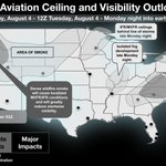
ALT Day 2 Aviation Ceiling and Visibility Outlook for the Core 30 Airports, valid from 00Z Tuesday, August 4 to 12Z Tuesday, August 4, covering Monday night into early Tuesday. The slide outlines potential ceiling and visibility impacts: IFR conditions developing after 03Z along parts of the California coast; dense wildfire smoke across the northwest causing localized MVFR/IFR conditions and reduced slantwise visibility; IFR/MVFR ceilings occurring behind the line of storms late Monday nigh in the upper midwest; isolated fog development late Monday night across parts of the midwest and New England; and further IFR (with possible LIFR) conditions developing late Monday into Tuesday morning across parts of the mid Atlantic.

ALT Day 2 Aviation Ceiling and Visibility Outlook for the Core 30 Airports, valid from 12Z Monday, August 3 to 00Z Tuesday, August 4, covering Monday morning and afternoon. The slide outlines the forecast for ceiling and visibility impacts: IFR conditions are expected until mid-morning across parts of the California coast; dense wildfire smoke across the northwest will cause localized MVFR/IFR conditions and significantly reduce slantwise visibility; and there is a forecast for a prolonged period of LIFR/IFR conditions throughout the day on Monday across the east and northeast.

ALT Day 2 Aviation Turbulence Outlook for the Core 30 Airports, valid from 12Z Monday, August 3 to 12Z Tuesday, August 4. The slide covers non-convective turbulence and notes potential moderate impacts, including: afternoon thermally induced isolated moderate turbulence from FL210 to the surface across the front range; a shear area moving eastward with moderate turbulence possible between FL350 and FL180 along the border of Canada and the US during the afternoon and evening; and moderate turbulence overnight Monday into Tuesday morning behind the line of storms across the northeast between FL400 and FL180, with low moderate turbulence also possible below 6,000 feet.

ALT Day 2 Aviation Thunderstorm Outlook (12Z Monday, August 3 to 12Z Tuesday, August 4) for the Core 30 Airports. The slide presents impact categories (Moderate, Minor, Extreme, Major) and specific forecast details: isolated storms Monday morning with tops to FL350; a line of potentially strong or severe storms after 02Z Monday evening, with cloud tops to FL420, isolated tops above FL450, and large hail aloft; and multiple rounds of storms throughout the day, with tops exceeding FL450.

ALT Day 2 Aviation Icing Outlook for the Core 30 Airports, valid from 12Z Monday, August 3 to 12Z Tuesday, August 4. The slide outlines the forecast for non-convective icing, categorized by impact levels: Moderate, Minor, and Major. It specifically notes moderate icing potential throughout the day on Monday across Montana at flight levels FL240 and FL140.