


Major coastal flooding for South Florida due to King Tides and persistent onshore wind.
Virginia Key near Miami recorded its 3rd highest water level on record and Port Everglades recorded its highest on record.
#KingTides #BrowardCounty #MiamiDade #CoastalFlooding #Florida
BREAKING: Virginia Key just crested at major flood stage, at 2.56’ above MHHW.
This is the second highest water level on record for this gauge, surpassing that of Hurricane Irene from 1999 with a crest of 2.53’ and Hurricane Wilma in 2005 with a crest of 2.55’. #Miami #kingtides @CBSMiami

CORRECTION: This will be the THIRD highest crest on record with an official height of 2.54’ above MHHW.
The issue stems a rounding error in the automated metric conversion and will be corrected down from 2.56 (now shows 2.55) down to 2.54 ft.
This means today’s water level is the third highest on record (since 1994) behind Hurricane Irma and Wilma.

BREAKING: Virginia Key just crested at major flood stage, at 2.56’ above MHHW.
This is the second highest water level on record for this gauge, surpassing that of Hurricane Irene from 1999 with a crest of 2.53’ and Hurricane Wilma in 2005 with a crest of 2.55’. #Miami #kingtides @CBSMiami
Water coming over the sea wall at times during high tide in Miami (Bayshore Drive / Margarate Pace Park).

⚠️Preliminary magnitude 8.0 earthquake has been revised down to 7.6 strikes Panama. Multiple aftershocks reported. Tsunami hazard being reviewed per Tsunami Warning Center

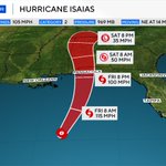
Update: Hurricane #Isaias has intensified into a major hurricane with peak sustained winds of 120 mph and higher gusts.
Movement: NNE at 15 mph
Hurricane #ISAIAS likely becomes a major hurricane tonight. Satellite imagery shows the inner core trying to develop an eye. The window for this storm to run for major hurricane is narrow.

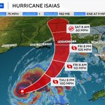
Special Update: We now have #HurricaneIsaias in the Gulf.
This comes after dropsonde data from the hurricane hunters suggest the storm has intensified with winds of 75 mph, which classifies as a category 1 hurricane.


The anticipated spin over the western Gulf is now Tropical Depression Nine. We expect this to become Isaias soon and further develop into a hurricane by Thursday.

A tropical depression will likely form in the western Gulf by the middle to end of the week as an area of low pressure meanders in the Bay of Campeche.
Next 2 days: 30%
Next 7 days: 70%


Key West: A 52 mph wind gust measured at Key West International.
Strong storms also producing another round of street flooding.
A Flood Advisory continues through 11:30am.
Funny you mention DoorDash. Mine said delivered. Never arrived. Last seen heading into that “puddle

Yeah...okay. So...the @nickmerionos terminology defines "Significant street flooding" as Nissan Ultima gets the Door Dash through.
Significant street flooding in Miami (this is Bayshore and 21st by Margaret Pace Park. Combination of King Tides and torrential rains.
Minor to moderate coastal flooding with the King Tides happening now, especially in Broward County.
If you are in an area taking on water right now and worried it may get worse...we just reached the peak of high tide for Broward and Miami-Dade.


