

Washington+Oregon #Wildfire data. NOT FOR SAFETY/EMERGENCY/EVACUATION PURPOSES; not affiliated w/ govt. RT/fav/follow!=endorse. Open source. See @FireUnofficial
- Tweets993
- Following10
- Followers182
- Likes0
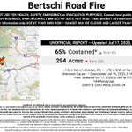
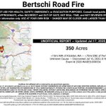




ALT 2020-WASES-000334 - #BertschiRoadFire 🔥 unofficial, automated update. ~10mi NW of Klickitat, WA. ⚠️ DO NOT USE FOR SAFETY PURPOSES - See officials instead. May be incorrect; disclaimers in images.

ALT 2020-WASES-000334 - Perimeter map

ALT 2020-WASES-000334 - #BertschiRoadFire 🔥 unofficial, automated update. ~10mi NW of Klickitat, WA. ⚠️ DO NOT USE FOR SAFETY PURPOSES - See officials instead. May be incorrect; disclaimers in images.

ALT 2020-WASES-000334 - Perimeter map

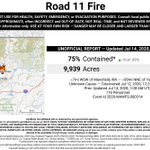
ALT 2020-WAWFS-000314 - #Road11Fire 🔥 unofficial, automated update. ~7mi WSW of Mansfield, WA. ⚠️ DO NOT USE FOR SAFETY PURPOSES - See officials instead. May be incorrect; disclaimers in images.

ALT 2020-WAWFS-000314 - Perimeter map

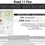
ALT 2020-WAWFS-000314 - #Road11Fire 🔥 unofficial, automated update. ~7mi WSW of Mansfield, WA. ⚠️ DO NOT USE FOR SAFETY PURPOSES - See officials instead. May be incorrect; disclaimers in images.

ALT 2020-WAWFS-000314 - Perimeter map

ALT 2020-WAWFS-000314 - #Road11Fire 🔥 unofficial, automated update. ~7mi WSW of Mansfield, WA. ⚠️ DO NOT USE FOR SAFETY PURPOSES - See officials instead. May be incorrect; disclaimers in images.

ALT 2020-WAWFS-000314 - Perimeter map

ALT 2020-WAWFS-000314 - #Road11Fire 🔥 unofficial, automated update. ~7mi WSW of Mansfield, WA. ⚠️ DO NOT USE FOR SAFETY PURPOSES - See officials instead. May be incorrect; disclaimers in images.

ALT 2020-WAWFS-000314 - Perimeter map

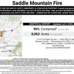
ALT 2020-WAMCR-000291 - #SaddleMountainFire 🔥 unofficial, automated update. ~11mi S of Royal City, WA. ⚠️ DO NOT USE FOR SAFETY PURPOSES - See officials instead. May be incorrect; disclaimers in images.

ALT 2020-WAMCR-000291 - Perimeter map

ALT 2020-WACOA-200084 - #PotholeFire 🔥 unofficial, automated update. At North Omak, WA. ⚠️ DO NOT USE FOR SAFETY PURPOSES - See officials instead. May be incorrect; disclaimers in images.

ALT 2020-WACOA-200084 - Perimeter map

ALT 2020-WACOA-200084 - #PotholeFire 🔥 unofficial, automated update. At North Omak, WA. ⚠️ DO NOT USE FOR SAFETY PURPOSES - See officials instead. May be incorrect; disclaimers in images.

ALT 2020-WACOA-200084 - Perimeter map

ALT 2020-WAMCR-000291 - #SaddleMountainFire 🔥 unofficial, automated update. ~11mi S of Royal City, WA. ⚠️ DO NOT USE FOR SAFETY PURPOSES - See officials instead. May be incorrect; disclaimers in images.

ALT 2020-WAMCR-000291 - Perimeter map

ALT 2019-ORUMF-019341 - #341SkookumCreekFire 🔥 unofficial, automated update. ~18mi N of Monument, OR. ⚠️ DO NOT USE FOR SAFETY PURPOSES - See officials instead. May be incorrect; disclaimers in images.

ALT 2019-ORUMF-019341 - Perimeter map


ALT 2019-WASPD-000645 - #Milepost20Fire 🔥 unofficial, automated update. ~8mi W of Quincy, WA. ⚠️ DO NOT USE FOR SAFETY PURPOSES - See officials instead. May be incorrect; disclaimers in images.

ALT 2019-WASPD-000645 - Perimeter map

ALT 2019-WASPD-000625 - #MatsonFire 🔥 unofficial, automated update. At Mesa, WA. ⚠️ DO NOT USE FOR SAFETY PURPOSES - See officials instead. May be incorrect; disclaimers in images.

ALT 2019-WASPD-000625 - Perimeter map

ALT 2019-WASPD-000625 - #MatsonFire 🔥 unofficial, automated update. At Mesa, WA. ⚠️ DO NOT USE FOR SAFETY PURPOSES - See officials instead. May be incorrect; disclaimers in images.

ALT 2019-WASPD-000625 - Perimeter map

ALT 2019-WAOWF-000320 - #SouthForkCreekFire 🔥 unofficial, automated update. ~10mi WNW of Leavenworth, WA. ⚠️ DO NOT USE FOR SAFETY PURPOSES - See officials instead. May be incorrect; disclaimers in images.

ALT 2019-WAOWF-000320 - Perimeter map

ALT 2019-ORRSF-000434 - #GopherFire 🔥 unofficial, automated update. ~10mi ESE of Prospect, OR. ⚠️ DO NOT USE FOR SAFETY PURPOSES - See officials instead. May be incorrect; disclaimers in images.

ALT 2019-ORRSF-000434 - Perimeter map

ALT 2019-ORRSF-000434 - #GopherFire 🔥 unofficial, automated update. ~10mi ESE of Prospect, OR. ⚠️ DO NOT USE FOR SAFETY PURPOSES - See officials instead. May be incorrect; disclaimers in images.

ALT 2019-ORRSF-000434 - Perimeter map

ALT 2019-ORRSF-000434 - #GopherFire 🔥 unofficial, automated update. ~10mi ESE of Prospect, OR. ⚠️ DO NOT USE FOR SAFETY PURPOSES - See officials instead. May be incorrect; disclaimers in images.

ALT 2019-ORRSF-000434 - Perimeter map