

Bringing you the latest weather information for the Philadelphia area. Sometimes talk about other stuff. Check my site! https://teapawt.net/t.co/bLYuIbNAhq
- Tweets9.6K
- Following489
- Followers1.4K
- Likes7.9K


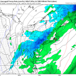
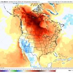

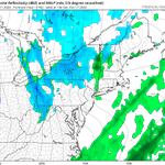

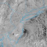


ALT The 6-10 day temperature outlook for November 21-25.


ALT This graphic displays a severe thunderstorm warning plotted on a map. The warning is in effect until 4:00 PM EST. The warning includes Philadelphia PA, Camden NJ and Collingswood NJ. This warning is for Northwestern Camden County in southern New Jersey, Northern Gloucester County in southern New Jersey, Northwestern Burlington County in southern New Jersey, Southeastern Bucks County in southeastern Pennsylvania and Central Philadelphia County in southeastern Pennsylvania. The threats associated with this warning are wind gusts up to 60 MPH and quarter sized hail. There are 1,716,600 people in the warning along with 417 schools and 37 hospitals.


ALT This graphic displays Tornado Watch watch number 705 plotted on a map. The watch is in effect until 7:00 PM EST. The watch includes parts of Delaware, New Jersey and Pennsylvania. The threats associated with this watch are a few tornadoes possible, scattered hail up to ping pong size possible and isolated gusts up to 70 mph possible. There are 10,380,513 people in the watch along with 2517 schools and 180 hospitals.


ALT WHAT WE KNOW: A wave of low pressure is likely to develop across the Ohio Valley late Wednesday and then track eastward to off the Mid-Atlantic coast Friday while strengthening. This low pressure will cause expanding precipitation, with rain and high elevation snowfall possible. Much cooler than normal temperatures will accompany this system Friday and through next weekend. WHAT WE DON’T KNOW: The exact placement of the storm — small shifts in the track will greatly change impacts. The amount of snow that may occur, and whether lower elevations will receive any accumulation. The impacts to coastal regions due to gusty winds and onshore flow. BOTTOM LINE: Confidence in storm development is higher than confidence in specific impacts. Forecast details will change over the next several days. Keep up to date with the latest at weather.gov

ALT El Niño description.

ALT Summary and historical analysis of data during very strong El Niño winters for Philadelphia.

ALT Temperature and precipitation outlook for Winter 2026-2027.

ALT Favored El Niño impacts during the upcoming Winter 2026-2027.


