

Official X/Twitter page of Pinal County Development Services and Pinal County Office of Emergency Management.
- Tweets3.2K
- Following67
- Followers620
- Likes41








ALT Graphic showing 3 maps generated by the Storm Prediction Center (SPC). On the left shows the severe hail outlook, in the middle is the severe winds outlook, and on the right is the tornado outlook. Below the images are sliding bars showing the highest risk associated with each risk, and a brief description of what to expect.


ALT Graphic shows where slight risk is expected for severe weather for southern Arizona. For Wednesday eastern Pinal, Graham, and Greenlee county is in slight risk. Thursday, the risk extends to eastern Pima county and northern Cochise county. Hazards expected are strong winds (50-60+ mph), localized flash flooding, large hail (1-2+ inches), and a low confidence for a tornado.



ALT This graphic displays a severe thunderstorm warning plotted on a map. The warning is in effect until 1:00 PM MST. The warning includes Pinal County, AZ. This warning is for Central Pinal County. The threats associated with this warning are wind gusts up to 60 MPH and pea sized hail. There are 0 people in the warning along with 0 schools and 0 hospitals.

ALT This graphic displays a flash flood warning plotted on a map. The warning is in effect until 4:30 PM MST. The warning includes Apache Junction AZ and Rio Verde AZ. This warning is for Maricopa County in south central Arizona and Pinal County in southeastern Arizona. Avoid walking or driving through flood waters! Move immediately to higher ground! There are 165,565 people in the warning along with 41 schools and 1 hospital.


ALT Image of Flash Flood Watch for southeast Arizona for Monday, September 14, 2026.

ALT Image of the Day 1 Excessive Rainfall Outlook issued by the Weather Prediction Center for Monday, September 14, 2026.


ALT Map of westbound I-10 detour in the Wild Horse Pass Corridor near Gila River bridge (Mile Post 173-171)

ALT This graphic displays Severe Thunderstorm watch number 601 plotted on a map. The watch is in effect until 11:00 PM MST. The watch includes parts of Arizona. The threats associated with this watch are no tornadoes expected, isolated hail up to half inch size possible and scattered gusts up to 70 mph possible. There are 6,180,058 people in the watch along with 1901 schools and 88 hospitals.

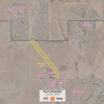
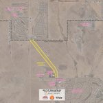
ALT A map of a project area

ALT Map identifying I-10 eastbound and westbound lane restrictions between Nelson Road and SR 387.


ALT Map showing road closures and detours in Arizona. U.S. 60 is closed between Miami and Superior, with a detour route marked in green passing through Hayden and Winkelman on State Route 77. Local traffic is permitted between Queen Valley and Superior. The map features landmarks like Superstition Mountains and Pinal Peak.

ALT A map graphic shows a highlighted project area along Highway 79 between mileposts 140 and 148, with directions to Florence and Superior, and a legend for project area and milepost markers.


ALT A map of a project location