
Christ follower 1st. Met with 20+ years of experience forecasting and modeling BS/MS from NC State Husband to Jennifer Father of 5. https://xitter.cf/t.co/aMKO4rG3EI
- Tweets28.5K
- Following171
- Followers17.8K
- Likes2.1K







ALT Tropical Weather Outlook NWS National Hurricane Center Miami FL 200 PM EDT Sat Oct 17 2026 For the North Atlantic...Caribbean Sea and the Gulf of America: 1. Off the East Coast of the United States: A strong non-tropical low pressure area is expected to form during the next day or two off of the eastern coast of the United States. This low is likely to move slowly and erratically through the middle of next week, and some subtropical development is possible during this time. Regardless of whether subtropical development occurs, this system will cause high winds, coastal flooding, and dangerous surf along portions of the U.S. East Coast. Please consult statements and warnings from local National Weather Service offices and the Weather Prediction Center for more information, along with High Seas Forecasts issued by the National Weather Service. * Formation chance through 48 hours...low...near 0 percent. * Formation chance through 7 days...low...20 percent.


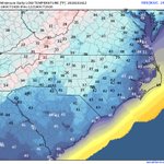
ALT National Weather Service forecast map from Greenville-Spartanburg, SC showing low temperatures Saturday, October 17 across the western Carolinas and northeast Georgia. Lows Saturday night will range from the upper 30s to mid 40s east of the mountains and lower to mid 30s across the mountains. Frost is possible, mainly across the North Carolina mountains.


ALT NWS Raleigh preliminary survey table for October 11, 2026, listing 9 tornadoes: Candor (EF-2, 115 mph), Fayetteville (EF-2, 115 mph), Jordan Lake (EF-1, 107 mph), Linden (EF-1, 105 mph), Carpenter (EF-1, 110 mph), Clayton (EF-0, 85 mph), Perry Creek (EF-1, 107 mph), Harrells (EF-0, 75 mph), and Louisburg (EF-1, 100 mph).

ALT A tornado touched down in the Stone Ridge neighborhood, just south of 540, and traveled northward into the Neuse Crossing neighborhood. A discontinuous path of tree and structural damage consistent with that of an EF-1 tornado was observed, with peak winds of approximately 100-110 mph. The tornado lifted near Mitchell Mill Rd. Special thanks to members of the Wake County Emergency Management team for their assistance with this survey.


ALT This graphic displays a tornado warning plotted on a map. The warning is in effect until 2:00 PM EDT. The warning includes Wake Forest NC, Knightdale NC and Rolesville NC. This warning is for Northeastern Wake County in central North Carolina and Southwestern Franklin County in central North Carolina. The threats associated with this warning are a radar indicated tornado and pea sized hail. There are 463,913 people in the warning along with 79 schools and 4 hospitals.

ALT This graphic displays a severe thunderstorm warning plotted on a map. The warning is in effect until 1:45 PM EDT. The warning includes Raleigh NC, Cary NC and Wake Forest NC. This warning is for Vance County in central North Carolina, Western Warren County in central North Carolina, Granville County in central North Carolina, Wake County in central North Carolina, North central Johnston County in central North Carolina, Southeastern Durham County in central North Carolina and Franklin County in central North Carolina. The threats associated with this warning are wind gusts up to 60 MPH and pea sized hail. There are 1,123,611 people in the warning along with 217 schools and 12 hospitals.