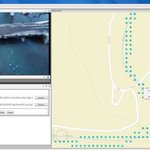
Aerial, Drone & Mobile Geospatial Video Mapping Software & Video Recorders for Critical Infrastructure Inspections
Fort Collins, CO, USA
Joined October 2012
- Tweets111
- Following56
- Followers111
- Likes19
Aerial, Drone & Mobile Geospatial Video Mapping Software & Video Recorders for Critical Infrastructure Inspections