








Zack Riel retweeted

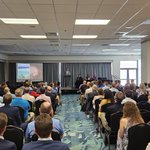
Today is the last day of #AMS7WxComm! We have some great presentations lined up. Thanks to everyone sticking around on the last day of the conference!

Great start to the #wx7comm here in Myrtle Beach. I'm very excited to be a Co-Chair for the first time with this conference. @AMS_Soc_Impacts


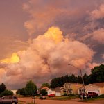
Hail at 2:18 pm in Madison, WI 53704 near corner of highway 151 and highway 113. #wiwx @NWSMilwaukee – at Wisconsin, USA

Zack Riel retweeted
A tornado watch has been issued for parts of Illinois and Wisconsin until 8 PM CDT – at Illinois, USA

ALT This graphic displays Tornado Watch watch number 163 plotted on a map. The watch is in effect until 8:00 PM CDT. The watch includes parts of Illinois and Wisconsin. The threats associated with this watch are a few tornadoes likely, scattered hail up to ping pong size likely and scattered gusts up to 70 mph possible. There are 6,243,330 people in the watch along with 2385 schools and 113 hospitals.
Pea size hail at the intersection of I-94 and County highway A in Lake Mills, WI, approximately 11:25 am. @NWSMilwaukee #wiwx – at Lake Mills, WI


I'm looking forward to presenting Thursday morning then listening to other people talk about their incredible work being done. #HazRM #preparedness


Light to moderate snow will likely affect the Tuesday morning commute, bringing reduced visibilities and slippery roads.
Highest amounts west where a Winter Weather Advisory is in effect, with lower amounts toward Lake Michigan. #wiwx


Straight from the National Weather Service – at Waukesha, WI


Zack Riel retweeted
A severe thunderstorm watch has been issued for parts of Illinois, Indiana, Iowa and Wisconsin until 7 PM CDT – at Illinois, USA

Zack Riel retweeted
Severe Thunderstorm Warning including DeKalb IL, Sycamore IL, Cortland IL until 1:45 PM CDT – at Illinois, USA

Time to PREPARE if you're in the SEVERE THUNDERSTORM WATCH till 11 pm #preparedness #wiwx #ilwx – at Waukesha, WI


Zack Riel retweeted

The dawn of a new era of spaceflight has begun with the launch of @AstroBehnken and @Astro_Doug to the @Space_Station at 3:22 p.m. ET.
WATCH LIVE: nasa.gov/live

Remember TURN AROUND DON'T DROWN #ilwx – at DeKalb, IL
