

Shawnee County Emergency Management Department Our Social Media Policy can be found at https://xitter.cf/t.co/7s7coLlHMr
- Tweets4K
- Following520
- Followers2.9K
- Likes1.2K









ALT Right image of the sun with grass in the foreground. Left side depicts a timeline graph showing high temperatures (orange), heat indices (red), and normal high temperatures for the Topeka area today through Friday.

ALT 4 Day forecast showing a hot sunny day. Hot weather is the main threat, with strong storms possible.

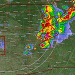
ALT This graphic displays a severe thunderstorm warning plotted on a map. The warning is in effect until 10:30 PM CDT. The warning includes Holton KS, Hiawatha KS and Sabetha KS. This warning is for Northeastern Pottawatomie, Nemaha, Jackson, Brown and Southeastern Marshall Counties. The threats associated with this warning are wind gusts up to 70 MPH and pea sized hail. There are 23,408 people in the warning along with 24 schools and 5 hospitals.

ALT This graphic displays a severe thunderstorm warning plotted on a map. The warning is in effect until 8:00 PM CDT. The warning includes Holton KS, Silver Lake KS and Auburn KS. This warning is for Central Shawnee County in east central Kansas and Southern Jackson County in northeastern Kansas. The threats associated with this warning are wind gusts up to 60 MPH and ping pong sized hail. There are 114,401 people in the warning along with 44 schools and 8 hospitals.




ALT This graphic displays Tornado Watch watch number 294 plotted on a map. The watch is in effect until 1:00 AM CDT. The watch includes parts of Iowa, Kansas, Missouri and Nebraska. The threats associated with this watch are a couple tornadoes possible, scattered hail up to apple size likely and scattered gusts up to 75 mph possible. There are 3,812,758 people in the watch along with 1684 schools and 143 hospitals.


