

U.S. Forest Service-Southern California, Fire Information
Your SoCal National Forests
Joined April 2009
- Tweets19.7K
- Following2.4K
- Followers77.1K
- Likes5.4K



USFS Fire and Aviation-Southern California retweeted

This isn’t just any prescribed burn.
Over the past few days, more than 70 of our firefighters and personnel, alongside our @forestservice partners, have been conducting a prescribed burn at @SequoiaKingsNPS.
The 482-acre Grant Grove Prescribed Burn continues a long tradition of proactive fire management in one of the world’s most historic giant sequoia groves.
Home to the General Grant Tree, the world’s second largest sequoia tree by volume, the grove benefits from reducing dead and down fuels that can feed wildfires. Previous prescribed burns have helped stop the spread of 2015 Rough Fire and the 2021 KNP Complex from damaging this important area.
Yet this prescribed burn not only protects this grove from wildfire but creates the ideal conditions for these magnificent trees to release their seeds and grow the next generation of trees.

ALT Prescribed burn blazing through a forest at night under a bright moon and starry sky.

ALT Group of wildland fire personnel gathered in a wooded area surrounded by tall trees and parked vehicles during daylight.

ALT Tall sequoia trees towering against a clear sky in a dense forest setting at dusk.
USFS Fire and Aviation-Southern California retweeted

Wind from the Northeast have decreased over the Angeles National Forest and will transition to winds from the southwest later in the afternoon. However, temperatures and relative humidity will remain warm and dry into Monday.
In addition to our excellent partners at the Los Angeles office of the National Weather Service, we also want to highlight another source of valuable weather and fire intelligence information.
At the Southern California Geographic Coordination Center (OSCC) in Riverside, the Predictive Services group studies the weather, fuel (grass brush, trees) conditions and provides additional wildfire risk analysis to fire agencies. The information they provide is relevant to help firefighters at all levels develop strategic and tactical fire behavior information, predict fire growth, and interpret potential fire characteristics.
OSCC produces a short webcast that offers a quick summary of fire weather conditions throughout the area. Matt Shameson narrates today’s webcast, Matt is a Forest Service Meteorologist with predictive services.
Watch the webcast: gacc.nifc.gov/oscc/predictiv…
@SoCalUSFS_Fire @NWSLosAngeles


USFS Fire and Aviation-Southern California retweeted
#ForestServiceAircraft
The Angeles National Forest has pre-positioned two Forest Service contracted Bombardier CL-415’s at Fox Field.
The CL-415’s can carry up 1,621 gallons, fly at 207 mph and are amphibious aircraft that skim the surface of a water body, scoop water into the plane’s onboard tank, before dropping water on the fire.
The planes (260 & 262) will augment the Forest Service firefighting fixed wing and rotor aircraft assigned to Fox Field. The base is located at General William J. Fox Airfield in Lancaster.
@SoCalUSFS_Fire


USFS Fire and Aviation-Southern California retweeted
#HendersonFire - Camp Pendleton
Angeles’ Fox Field has launched Forest Service Cessna Citation II Intel 52K to the 1404-acre brush fire on USMC Camp Pendleton.
Intel 52k is a twin jet aircraft that provides real-time video and infrared mapping to fire command on the ground.
@USMC @MCIWPendletonCA @SoCalUSFS_Fire


USFS Fire and Aviation-Southern California retweeted
#RedFlagWarning
Strong Santa Ana winds continue gust up to 58mph over the Angeles National Forest.
Today a series of fires broke out over the southland today demonstrating how dry conditions are, even with the recent hurricane related storm.
Forest visitors and area residents please report any flames, smoke to 911.
Are you prepared? ready.lacounty.gov/
Weather information: weather.gov/lox/
@ReadyLACounty @SoCalUSFS_Fire @NWSLosAngeles


USFS Fire and Aviation-Southern California retweeted
#RedFlagWarning #SantaAnaWinds
The Angeles National Forest has moved into high state of readiness ahead of the Red Flag and Santa Ana wind conditions expected tomorrow through Saturday.
We augmented available resources to include a strike team of engines from the Eldorado National Forest and two additional dozers.
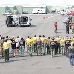
In addition, the Southern California’s Geographic Coordination Center has prepositioned firefighters throughout the southern half of the state; ready to respond in the event of a wildfire.
In addition to the “First Alarm” response by ground resources (Engine, Crews, Dozers, etc.) our initial response includes a full compliment of aircraft. Today’s photo highlights the aircraft’s available for a “first alarm” response from Angeles’ Fox Field in Lancaster.
Weather Forecast: weather.gov/lox/
@SoCalUSFS_Fire @NWSLosAngeles @ReadyLACounty


USFS Fire and Aviation-Southern California retweeted

🛫 Aircraft in the air. Resources on the move. She helps coordinate it all.
For Michelle, being a Communications Operator (Fire/EMS Dispatcher) means working in a high-pressure environment where she helps coordinate aircraft as incidents unfold and gets resources moving when people need help.
It’s a job that comes with a lot of pressure and responsibility. For Michelle, knowing she can play a part in helping others is what makes the work worth it.
USFS Fire and Aviation-Southern California retweeted
#JuniperFire - s/o Apple Valley 9/25/26
Angeles’ Valeyrmo Engine 336 was sent to “cover” San Bernardino NF’s Mormon Rocks station in Cajon Pass. During the assignment, E-336 responded to assist @CALFIREBDU with a 65 acre wind-driven brush fire located north of Lake Arrowhead and south of Apple Valley.
Our firefighters mobilize and battle wildfires locally and nationally.
@CALFIREBDU @USWFS @SanBernardinoNF @SoCalUSFS_Fire
🤖 Made with AI


USFS Fire and Aviation-Southern California retweeted
Today marks 25 years since the tragic events that took place on September 11, 2001.
Firefighters from the Angeles National Forest joined the Los Angeles Fire Department and many partner agencies at Los Angeles City Hall this morning.
We honored the lives lost, the heroes that rushed into danger and all those forever changed by the events of that day.
We will never forget 🇺🇸
#September11 #NeverForget #NationalFallenFirefighters


USFS Fire and Aviation-Southern California retweeted

As of today, 09/09, the National Preparedness Level has decreased to 3 (PL3). This decrease is due to continued improving fire weather conditions across multiple geographic areas, increasing availability of all nationally shared resource types and light ordering through the NICC.

ALT Wildland firefighters on a ridge overlooking a smoky mountain landscape.
USFS Fire and Aviation-Southern California retweeted
The Southern California Geographic Area Coordination Center is the focal point for coordinating the mobilization of resources to support existing wildfires and prepositioning firefighters when there is a probability of large fires.
Angeles National Forest Engine 331 mobilized to the Inyo National Forest to provide added firefighting capacity due to “Very High” fire danger in the Owens Valley.
During their assignment, the commercial vehicle fire on State Route 395 north of Bishop, was one of the fires the crew battled.
Swift,decisive actions by Engine 331 and CAL FIRE engines averted a large wildfire.
We are hiring firefighters: fs.usda.gov/r05/angeles/fire…
@SoCalUSFS_Fire @Inyo_NF @CALFIREBDU


USFS Fire and Aviation-Southern California retweeted
Fire activity at a national level has decreased enough to move to National Preparedness Level 4 this morning. However, there are still thousands of firefighters working to suppress challenging fires across the country.
This Labor Day weekend, support our wildland firefighters by doing your part: be safe with fire. Know the conditions, follow local restrictions and make sure your campfire is completely out before you leave.

National Fire News 9/4/26. The National Preparedness Level decreased to four (PL 4), effective September 4 at 7:30 a.m. MDT, after 48 consecutive days at national PL 5. More NFN: nifc.gov/fire-information/nf… 📷Little Giant Fire (Donovan Smith), InciWeb

USFS Fire and Aviation-Southern California retweeted
#GibbyFire – Orange County
Angeles National Forest Engine Strike Team 1607C is heading to assist the Orange County Fire Authority with the 217-acre Gibby Fire is located east of San Juan Capistrano.
An ANF Engine Strike Team consists of a strike team leader and five type 3 Forest Service wildland engines.
More information onOCFA’s Facebook: fb.watch/Jpo25TPGLW/?
@OCFireAuthority @SoCalUSFS_Fire
🤖 Made with AI


USFS Fire and Aviation-Southern California retweeted

Final Incident Update:
Forward progress of the #GibbyFire has been stopped at approximately 250 acres. Crews will remain on scene for mop-up and patrol.
All shelter-in-place orders have been lifted. Ortega Highway will remain closed from Gateway to Grand in Riverside County.
USFS Fire and Aviation-Southern California retweeted

A large airtanker performs a precision drop on the Timber Fire in Southern California. The Timber fire is located on the @LosPadresNF, and it is approximately 18,000 acres and is 27% contained. Footage was captured by trained professionals, please do not attempt this yourself.
USFS Fire and Aviation-Southern California retweeted
#RedFlagWarning
The National Weather Service Los Angeles Office has issued a RED FLAG WARNING until 3PM on Friday.
The Angeles National Forest has moved into an augmented staffing pattern that includes an additional US Forest Service Engine Strike Team prepositioned ready to respond to reported wildfires.
If you see something, say something. Report any sign of smoke or fire immediately by dialing 9-1-1. If you dial 9-1-1 from your cell phone, be sure to know your location.
@ReadyLACounty @LAFD @LACOFD @NWSLosAngeles


USFS Fire and Aviation-Southern California retweeted
Rappel Crews are wildland firefighters who drop directly from hovering helicopters on ropes — often descending into areas that are not easily accessible. Their primary mission is quick initial attack on remote wildfires where traditional firefighting methods are impractical.
USFS Fire and Aviation-Southern California retweeted
Yesterday, 174 new fires were reported nationwide, including 12 new large fires. Firefighters are currently working to contain 86 large fires, with 22,085 firefighters & support personnel working nationwide. Extreme fire behavior is reported in multiple geographic areas.

USFS Fire and Aviation-Southern California retweeted

@CALFIREBDU is assisting @SanBernardinoNF with the #Amber vegetation fire on Hwy 330 x 1N09 in the City Creek area. Fire is currently 10 acres, slow rate of spread with a potential for 15 acres. Follow @SanBernardinoNF for further updates – at Yucaipa, CA

ALT Fire staff commanding fire with visible smoke on a hillside in the distance.
USFS Fire and Aviation-Southern California retweeted
The Forest Service can mobilize more than 400 aircraft—airtankers, helicopters & water-scoopers—including 29 large & very large airtankers ready to respond nationwide. They support missions for the Forest Service, the Department of the Interior & the states.

ALT Airtanker drops retardant. (Forest Service photo.)